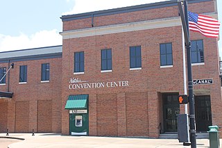
Natchez is the county seat and only city of Adams County, Mississippi, United States. Natchez has a total population of 15,792. Located on the Mississippi River across from Vidalia in Concordia Parish, Louisiana, Natchez was a prominent city in the antebellum years, a center of cotton planters and Mississippi River trade.
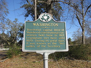
Washington is an unincorporated community in Adams County, Mississippi, United States. Located along the lower Mississippi, 6 miles (9.7 km) east of Natchez, it was the second and longest-serving capital of the Mississippi Territory.
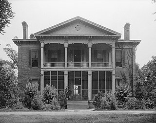
Glen Aubin, also known as the Rounds Plantation, is a Greek Revival house on Hutchins Landing Road, off Highway 61 South, near Natchez, Mississippi in the United States. It has been listed on the National Register of Historic Places in Mississippi since 1985. The nearby port was called Hutchins Landing.
Wayside is an unincorporated community in Washington County, Mississippi, United States.

Foster's Mound is a Plaquemine culture archaeological site located in Adams County, Mississippi northeast of Natchez off US 61. It is the type site for the Foster Phase of the Natchez Bluffs Plaquemine culture chronology. It was added to the NRHP on September 2, 1982 as NRIS number 82003091. The mounds are listed on the Mississippi Mound Trail.
Red Lick is an unincorporated community located in Jefferson County, Mississippi. Red Lick is approximately 5 miles (8.0 km) southeast of Lorman on Mississippi Highway 552.
Kirkville is a census-designated place and unincorporated community in Itawamba County, Mississippi, United States.
Sibley is an unincorporated community in Adams County, Mississippi, United States. There is a post office located on U.S. Route 61 in Sibley, ZIP code 39165.

Pine Ridge is an unincorporated community in Adams County, Mississippi, United States.
Eutaw is a ghost town in Bolivar County, Mississippi, United States. The settlement had a port on the Mississippi River called "Eutaw Landing."
Kienstra is a ghost town located in Adams County, Mississippi, United States. South of the town was Kienstra Landing, located on the Mississippi River.
Artonish is a ghost town located in Wilkinson County, Mississippi, United States. South of the town was Artonish Landing, located on a stretch of the Mississippi River known as the "Homochitto Cutoff".
Uniontown is a ghost town in Jefferson County, Mississippi, United States.
Clarksville is a ghost town in Wilkinson County, Mississippi, United States.

Ellis Cliffs is a ghost town in Adams County, Mississippi, United States.
Leota is a ghost town located in Washington County, Mississippi, United States. The settlement, along with its river port Leota Landing, were at one time located directly on the Mississippi River.
Loch Leven is a ghost town in Wilkinson County, Mississippi, United States.
Refuge is an unincorporated community located in Washington County, Mississippi, United States.
Mound Landing is a ghost town in Bolivar County, Mississippi, United States.
Cannonsburg is an unincorporated community in Jefferson County, Mississippi, United States.

