Hurstbourne is a home rule-class city in Jefferson County, Kentucky, United States. The population was 4,216 at the 2010 census, up from 3,884 at the time of the 2000 U.S. census. It is part of the Louisville Metro Government.

Burcott is a hamlet in the civil parish of Wing, in Buckinghamshire, England. Burcott is a common place name in the English language. The place name is Old English and refers to a fortified cottage.
Botolph Claydon is a hamlet in the civil parish of East Claydon, in Buckinghamshire, England. It is situated about 9 miles (14 km) east of Bicester in Oxfordshire, and 7 miles (11 km) north west of Aylesbury.

Wooburn is a large village in Buckinghamshire, England. It is located off the A4094 road between Wooburn Green and Bourne End in the very south of the county near the River Thames, about two miles south west of Beaconsfield and four miles east of Marlow. Wooburn is one of the two principal settlements within Wooburn, a civil parish in Wycombe district.

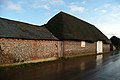
Tarrant Gunville is a village and civil parish in north Dorset, England, situated at the head of the Tarrant Valley on Cranborne Chase five miles northeast of Blandford Forum. The parish covers 3,469 acres at an elevation of 70 to 170 metres. In the 2011 census the parish—which includes the settlement of Stubhampton to the north—had 119 dwellings, 108 households and a population of 233.

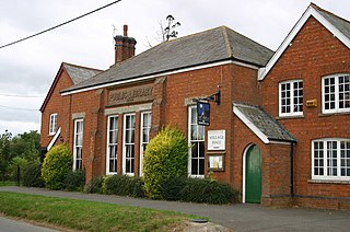
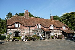
Tarrant Monkton is a village and civil parish in north Dorset, England, situated in the Tarrant Valley about four miles east-northeast of Blandford Forum. Within the parish boundary, 1+1⁄2 miles over hills to the west, lies the major part of Blandford Camp army base. In the 2011 census the parish—including the army base—had a population of 1,986. The village is centred on the All Saints Parish Church, opposite which is the Langton Arms, a public house and restaurant.
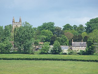
Canons Ashby is a small village and civil parish in West Northamptonshire, England. The population of the village is included in the civil parish of Preston Capes.

Brafferton is a village and civil parish in County Durham, England. It is administered as part of the borough of Darlington. The population of Brafferton Parish taken at the 2011 census was 154. It is situated between Darlington and Newton Aycliffe, a short distance from Coatham Mundeville.

The Test Way is a 44-mile (71 km) long-distance footpath in England from Walbury Hill in West Berkshire to Eling in Hampshire, which follows much of the course of the River Test.
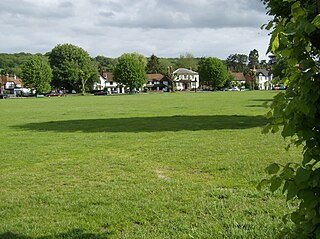
Vernham Dean, sometimes known as Vernhams Dean, is a village and civil parish in the Test Valley district of Hampshire, England, just east of the Wiltshire border and south of the Berkshire border. The village is about 9 miles (14 km) north of Andover and 9 miles (14 km) miles south of Hungerford in Berkshire.

Kingswood is a village in the Maidstone District of Kent, England and forms part of the civil parish of Broomfield and Kingswood.
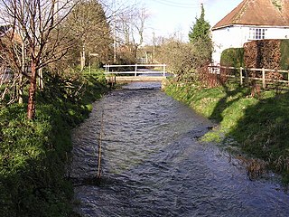
The Bourne Rivulet is a river in the English county of Hampshire. It is a tributary of the River Test.
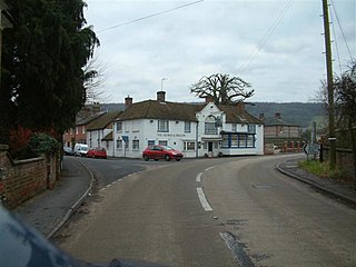
Hurstbourne Tarrant is a village and civil parish in Hampshire, England. It lies to the north of the county in the Test Valley.
Wooburn Green is a village in the civil parish of Wooburn, Buckinghamshire, England.

Chart Sutton is a civil parish and small village on the edge of the Weald of Kent, England. It lies approximately 5 miles (8 km) to the south of Maidstone.

Hunsdon is a village and civil parish in Hertfordshire, England. It is around 5.5 miles (9 km) east of Ware and 5 miles (8 km) north-west of Harlow. The population of the village taken at the 2011 Census was 1,080.

Ashley is a hamlet located in the parish of Sutton, some five miles (8 km) north of Dover on the summit of Gaggs Hill in Kent, England. Ashley runs almost seamlessly into the neighbouring village of Studdal. The A256 road passes to the west of Ashley. The population of the hamlet is included in the civil parish of Tilmanstone.

Westmarsh is a village in the Ash civil parish of East Kent, England. It is situated 8 miles (13 km) east of Canterbury and 7 miles (11 km) west of Ramsgate.

Chilton Moor is a village in Tyne and Wear, England. The village is located between Houghton le Spring and Fence Houses on the Tyne and Wear/County Durham county boundary.
Stoke is a small village in northwest Hampshire. At the 2011 Census the population of the village was included in the civil parish of St Mary Bourne. It lies in the valley of the Bourne Rivulet, a tributary of the River Test 5 miles (8.0 km) northeast of the town of Andover.