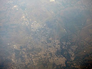
Harda is a city and a municipality in Harda district in the Indian state of Madhya Pradesh. Harda is the administrative headquarters of Harda.
Kurwai is a town and a Nagar Panchayat in Vidisha district in the Indian state of Madhya Pradesh. its also tehsil headquarter and assembly constituency.

Sehore is a city and a municipality in Sehore district in the Indian state of Madhya Pradesh. It is the district headquarters of Sehore District and is located on the Bhopal-Sehore-Indore highway, 38 km from Bhopal.

Bhopal District is a district of Madhya Pradesh state in central India. The city of Bhopal serves as its administrative headquarters. The district is part of Bhopal Division.

Sehore District is a district of Madhya Pradesh state in central India. The town of Sehore is the district headquarters. The district is part of Bhopal Division.
Sironj is a town and a municipality in Vidisha district in the Indian state of Madhya Pradesh. Its also a Tehsil Headquarter.

Budhni, also spelled Budni or Budhani, is a town and a Nagar Palika in Sehore district in the state of Madhya Pradesh, India. It is situated on Bhopal to Narmadapuram road at a distance of 7 km from Narmadapuram in north direction on the banks of Narmada River.It is also famous for Tractor testing i.e. CFMTTI (Institute under central government or Tractor Nagar.
Ashta is a city and a municipality in Sehore district in the state of Madhya Pradesh, India. The nearest airport is in the city of Bhopal.
Bhander is a town and a nagar panchayat in Datia district in the state of Madhya Pradesh.

Hindoria is a town and a nagar panchayat in Damoh district in the Indian state of Madhya Pradesh.
Jirapur is a town and a nagar panchayat in Rajgarh district in the Indian state of Madhya Pradesh. In 2022 Janpad Panchayat election held across Madhya Pradesh, Congress won the election and secure position as a Janpad Adhyaksh under the leadership of Khilchipur vidhayak Shri Priyavrat Singh Ji. He put all the efforts to win this election and doing great work for Khilchipur constituency. He won 2018 assembly election of Madhya Pradesh with huge margin of 30,000+ votes by defeating Kunwar Hajarilal Dangi of Bharatiya Janata Party (BJP) candidate.
Nasrullaganj, also known as Bherunda or Bhairunda, is a nagar panchayat in Sehore district in the Indian state of Madhya Pradesh. The nearest airport is in Bhopal.
Rajakhera is a city and a municipality situated near the banks of the Chambal River in Dholpur district in the Eastern part of the Indian state of Rajasthan. Its part of Braj region and the local language has Braj Bhasha dialect. The culture is fused with Rajasthan and its border states.
Rehti is a city municipality in Sehore District in the Indian state of Madhya Pradesh. Rehti is divided into 15 wards for which elections are held every 5 years.
Satwas is a town and a Nagar Panchayat in Dewas district in the Indian state of Madhya Pradesh. Satwas is around 136.8 km (85.0 mi) from Dewas.
Shujalpur is a city and a municipality in Shajapur district in the Indian state of Madhya Pradesh. Ranoji Rao Shinde, father of Mahadji Shinde (Scindia), died in 1745 at Shujalpur, where his cenotaph (chattri) stands which houses a Shiv temple. It is known as Ranoganj.
Udaipura is a town and a nagar panchayat in Raisen district in the Indian state of Madhya Pradesh. Udaipura has an average elevation of 321 metres (1,053 feet).
Kalapipal Mandi or Pankhedi is a City in Shajapur district of Madhya Pradesh, India. It is located on Western railways Bhopal - Ujjain section and is connected by railway to some major city's of Madhya Pradesh like Bhopal, Indore and Ujjain. Nearest airport Bhopal.

Ichhawar Assembly constituency is one of the 230 Vidhan Sabha constituencies of Madhya Pradesh state in central India.

Tonk Khurd is a city in Dewas district, in the state of Madhya Pradesh, India. It is the headquarters of Tonk Khurd tehsil and lies 28 km (17 mi) north-east of the district headquarters of Dewas and 172 km (107 mi) west of the state capital, Bhopal.


