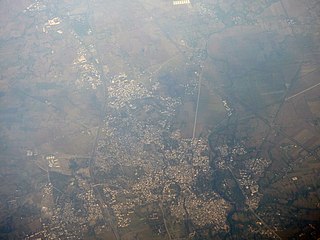
Kurwai is a town and a Nagar Panchayat in Vidisha district in the Indian state of Madhya Pradesh. its also tehsil headquarter and assembly constituency.

Sehore is a city and a municipality in Sehore district in the Indian state of Madhya Pradesh. It is the district headquarters of Sehore District and is located on the Bhopal-Sehore-Indore highway, 38 km from Bhopal.

Bhopal State was founded by Maharaja of Parmar Rajputs. In the beginning of 18th-century, Bhopal State was converted into an Islamic principality, in the invasion of the Afghan Mughal noble Dost Muhammad Khan. It was a tributary state within the Maratha Confederacy during 18th century (1737-1818), a princely salute state with 19-gun salute in a subsidiary alliance with British India from 1818 to 1947, and an independent state from 1947 to 1949. Islamnagar was founded and served as the State's first capital, which was later shifted to the city of Bhopal.

Bhopal District is a district of Madhya Pradesh state in central India. The city of Bhopal serves as its administrative headquarters. The district is part of Bhopal Division.

Raisen is a town and a municipality in Raisen district in the Indian state of Madhya Pradesh. It is the administrative headquarters of Raisen District.
Sironj is a town and a municipality in Vidisha district in the Indian state of Madhya Pradesh. Its also a Tehsil Headquarter.
Ashta is a city and a municipality in Sehore district in the state of Madhya Pradesh, India.
Badarwas is a town and a nagar panchayat in Shivpuri district in the state of Madhya Pradesh, India. Badarwas is also known as Jacket Capital of India.
Bhainsdehi is a city and a Nagar Parishad in Betul district in the state of Madhya Pradesh, India. Kukru is the second highest point of Mahadeo hills. Bhainsdehi is the originating place of the river Purna. It is predominantly a tribal tehsil. Bhainsdehi is surrounded by the mountain ranges of Satpura. Prachin Shiv mandir one of the most beautiful place in Bhainsdehi city
Ichhawar is a town, and a Municipal Council in Sehore district in the Indian state of Madhya Pradesh. Ichhawar is near Bhopal state capital. Nearest railway station sehore. Nearest airport Bhopal.
Kolaras is a town and a nagar parishad in Shivpuri district in the Indian state of Madhya Pradesh. Kolaras is located on NH3 presently called NH46. It is religious city and famous with name mini vrindavan.
Bagh is a census town in Dhar district in the state of Madhya Pradesh, India. It is known for the Bagh Caves, which are late 4th- to 6th-century Buddhist rock-cut chambers with murals. The name of the town stems from the caves - according to local legend there were living tigers in these abandoned Buddhist caves.

Narsinghgarh is a town and a municipality, near Rajgarh city in Rajgarh district in the Indian state of Madhya Pradesh.

Jagdishpur is a panchayat village in the Bhopal district of Madhya Pradesh, India. It is located in the Huzur tehsil and the Phanda block.
Mangalgarh is a panchayat village in the Berasia tehsil of Bhopal district, Madhya Pradesh, India.

Dost Mohammad Khan was the founder of Bhopal State in central India. He founded the modern city of Bhopal, the capital of the modern day Madhya Pradesh state.
Parason is a township located in Bhopal district of Madhya Pradesh, India.
Patalpur is a village in the Bhopal district of Madhya Pradesh, India. It is located in the Berasia tehsil, on the north-east border of the Berasia town. It is situated along the Madhya Pradesh State Highway 23, just north of the Berasia town.
Patalpur is a village in the Bhopal district of Madhya Pradesh, India. It is located in the Berasia tehsil, near Keetai Dewapura and Patalpani.

Berasia is one of the 230 constituencies in the Madhya Pradesh Legislative Assembly of Madhya Pradesh, a central state of India. Berasia is also part of the Bhopal Lok Sabha constituency. It is a reserved seat for the Scheduled Caste (SC).


