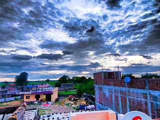
Barwani or Badwani is a municipal town in Barwani district of Madhya Pradesh, India, that is situated near the left bank of the Narmada River. It is the administrative headquarters of Barwani district and has also served as the capital of the former princely state of Barwani. Barwani is only accessible by road.
Ashta is a city and a municipality in Sehore district in the state of Madhya Pradesh, India.
Erandol is a town and a taluka in Jalgaon district in the Indian state of Maharashtra state. It is situated on the banks of the Anjani River. The vehicle registration is changed now it's MH-54.
Lahar is a city and a Nagar Palika in Bhind district in the Indian state of Madhya Pradesh.
Mhowgaon is a Nagar Panchayat under Sub Division Dr. Ambedkar Nagar (Mhow) in Indore district in the Indian state of Madhya Pradesh. The total geographical area of Mhowgaon nagar panchayat is 13.5 km2 and it is the smallest city by area in the sub district. The population density of the city is 2309 persons per km2. Mhowgaon is divided into 15 wards for which elections are held every 5 years. Among them, Mhowgaon Ward No. 2 is the most populous ward with a population of 3440 and Mhowgaon Ward No. 15 is the least populous ward with a population of 957. Mhowgaon Nagar Panchayat has total administration over 6,373 houses to which it supplies basic amenities like water and sewerage. It is also authorized to build roads within Nagar Panchayat limits and impose taxes on properties coming under its jurisdiction.
Nasrullaganj, also known as Bherunda or Bhairunda, is a nagar panchayat in Sehore district in the Indian state of Madhya Pradesh. The nearest airport is in Bhopal.
Palda is a census town in Indore district in the Indian state of Madhya Pradesh.
Petlawad is a town and a Nagar Panchayat in the Jhabua district in the Indian state of Madhya Pradesh, formerly the Central Provinces. The town received nationwide media coverage on 12 September 2015 when an explosion killed approximately 100 people and injured over 150 people in the Petlawad explosion.
Rajakhera is a city and a municipality situated near the banks of the Chambal River in Dholpur district in the Eastern part of the Indian state of Rajasthan. Its part of Braj region and the local language has Braj Bhasha dialect. The culture is fused with Rajasthan and its border states.
Rehti is a city municipality in Sehore District in the Indian state of Madhya Pradesh. Rehti is divided into 15 wards for which elections are held every 5 years.
Sanawad is an Indian town in Khargone district in the Indian state of Madhya Pradesh. It is a popular center for the trade of cotton and wheat. Nearby cities include Khargone, Khandwa, Barwaha and Indore.
Sarangpur is a city and tehsil in Rajgarh district in the Indian state of Madhya Pradesh. It is situated at the bank of the river Kali Sindh.
Satwas is a town and a Nagar Panchayat in Dewas district in the Indian state of Madhya Pradesh. Satwas is around 136.8 km (85.0 mi) from Dewas.
Unhel is a city in ujjain district in the Indian state of Madhya Pradesh.Unhel is a tehsil of Ujjain district. It is in the Malwa region of western Madhya Pradesh.
Shahpur is a town and a Nagar panchayat in Burhanpur district in the Indian state of Madhya Pradesh.

Nemawar is a small town in Dewas District, Madhya Pradesh, India. Nemawar is located on the left bank of the Narmada river opposite to Handia. However, it belongs to Khategaon block and tehsil of the Dewas district
Berchha is a Gram Panchayat in Shajapur tehsil of Shajapur District, Madhya Pradesh, India. According to the 2011 census it has a population of 8157 living in 1587 households.
Piparwani village is located in Kurai Tehsil of Seoni district in Madhya Pradesh, India. It is situated 27 km away from sub-district headquarter Kurai and 60 km away from district headquarter Seoni. As per 2009 statistics, Peeparwani is the gram panchayat of the Piparwani village. The total geographical area of the village is 607.94 hectares.

Khadotiya is a village in Depalpur tehsil in Indore district of Madhya Pradesh State, India. The village is located 36 km away from district headquarters Indore, 17 km from Depalpur and 212 km from state capital Bhopal.
Surhan is a village in Martinganj Block in Azamgarh district of Uttar Pradesh State, India. It belongs to Azamgarh Division. It is located 44 km west of the District headquarters Azamgarh. 1 km from Martinganj. 249 km from State capital Lucknow.


