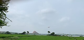
Ashta is a city and a municipality in Sehore district in the state of Madhya Pradesh, India. The nearest airport is in the city of Bhopal.
Badarwas is a town and a nagar panchayat in Shivpuri district in the state of Madhya Pradesh, India. Badarwas is also known as Jacket Capital of India.
Begumganj is a town and a municipality in Raisen district in the state of Madhya Pradesh, India. and is located on the Bhopal - Sagar National Highway 120 km away from Bhopal. It is one of the five divisions of the Raisen district.
Dhariawad is a census town in Pratapgarh district (Rajasthan) in the state of Rajasthan, India. It is the administrative headquarters for Dhariawad Tehsil.
Gogapur is a census town in tehsil Mehidpur City and Ujjain district in the Indian state of Madhya Pradesh.This town is commonly known as Mehidpur Road and Mehidpur Mandi.
Gurh is a town and a nagar panchayat in Rewa district in the Indian state of Madhya Pradesh. It is 23 kilometres (14 mi) from Rewa city. It is also famous for the Bhairav Baba statue. Approx 20 kilometres (12 mi) eastward, a village, Tamara Desh, is located which is the end point of the Gurh nagar panchayat. The village is at a triangle of Gurh, Mauganj and Sidhi district. It's Nearest Towns are Manikwar 37Km and Mangawan 25km And Rewa District 23km
Jhumpura is a census town and a block in Kendujhar district in the Indian state of Odisha.
Kachhwa is a town and a nagar panchayat in Mirzapur district in the Indian state of Uttar Pradesh.

Lingasugur is a municipal town in Raichur district in the Indian state of Karnataka. There are many Temples, hills and forts (Quila). The festivals of Muharram and Maha Shivaratri are important here. Mudgal in Lingasugur taluk has a very ancient fort. It has often been mentioned in the autobiography of Philip Meadows Taylor. Lingasugur, then known as Chavani was the site of a major British cantonment in the region.
Mangawan is a town and a nagar panchayat in Rewa district in the Indian state of Madhya Pradesh. It is 30 km (19 mi) from the District headquarters of Rewa. NH 7 and NH 27 goes through Mangawan. Allahabad is 96 km (60 mi) on NH 27 and Varanasi is 220 km (140 mi) on NH 7 and Manikwar is 15 km (9.3 mi)
Nasrullaganj is a nagar panchayat in Sehore district in the Indian state of Madhya Pradesh. The nearest airport is in Bhopal.
Rehti is a city municipality in Sehore District in the Indian state of Madhya Pradesh. Rehti is divided into 15 wards for which elections are held every 5 years.
Sarangpur is a city and tehsil in Rajgarh district in the Indian state of Madhya Pradesh. It is situated at the bank of the river Kali Sindh.
Sonkatch is a town and a Nagar panchayat in Dewas district in the Indian state of Madhya Pradesh.
Susner is a town and a nagar panchayat and Sub division in Agar Malwa district in the Indian state of Madhya Pradesh.
Unhel is a city in Ujjain district in the Indian state of Madhya Pradesh. It is in the Malwa region of western Madhya Pradesh.

Upleta is a city and tehsil in the Rajkot district of the state of Gujarat, India. It contains within it two towns and 49 villages.
Utran is a census town in Surat district in the Indian state of Gujarat. Utran Nearest airport Surat. Nearest railway station Utran railway station.
Shirahatti is a panchayat town in Gadag district in the Indian state of Karnataka.
Khujner is a town and a nagar panchayat in Rajgarh district in the Indian state of Madhya Pradesh.


