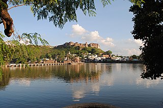
Kurwai is a town and a Nagar Panchayat in Vidisha district in the Indian state of Madhya Pradesh. its also tehsil headquarter and assembly constituency.

Guna District is one of the 52 districts of Madhya Pradesh in central India. Its administrative headquarters is Guna. The district has a population of 1,241,519. It has an area of 6390 km², and is bounded on the northeast by Shivpuri District, on the east by Ashoknagar District, on the southeast by Vidisha District, on the southwest by Rajgarh District, on the west and northwest by Jhalawar and Baran districts of Rajasthan state. The Sindh River flows northward along the eastern edge of the district, forming part of the boundary with Ashoknagar District, and the Parvati River flows northwestward through the southern portion of the district, forming part of the boundary with Baran District before flowing into Rajasthan.
Khilchipur is a town and a nagar panchayat in Rajgarh district in the Indian state of Madhya Pradesh. In 2022 Janpad Panchayat election held in which BJP emerged as a winner and make their candidate Janpad Adhyaksh and up-adhyaksh under the leadership of Kunwar Hajarilal Dangi.

Rajgarh District is a district of Madhya Pradesh in central India. The city of Rajgarh is the administrative headquarters of the district. The old name of Rajgarh was Jhanjhanipur. Rajgarh in Madhya Pradesh is one of the aspirational districts selected by Government of India. The district has an area of 6,154 km² and the population is 1,545,814. The district lies on the northern edge of the Malwa plateau, and the Parbati River forms the eastern boundary of the district, while the Kali Sindh River forms the western boundary. The district has seven tehsils, Rajgarh, Khilchipur, Jirapur, Biaora, Narsinghgarh, Sarangpur and Pachore. The district is bounded by Rajasthan state to the north, and by the districts of Guna to the northeast, Bhopal to the east, Sehore to the southeast, and Shajapur to the south and west. It is part of Bhopal Division. There are 1728 villages in Rajgarh.
Bhander is a town and a nagar panchayat in Datia district in the state of Madhya Pradesh.
Gairatganj is a City and Nagar Panchayat in Raisen district in the state of Madhya Pradesh, India. It's also a Tehsil Headquarter.
Mahroni is a town and a nagar panchayat in Lalitpur district in the Indian state of Uttar Pradesh. It is one of the tehsils of Lalitpur District also a legislative assembly constituency Mehroni Assembly constituency and is situated 37 km away from Lalitpur. It is very close to Madhya Pradesh and Uttar Pradesh border. Twitter
Nasrullaganj, also known as Bherunda or Bhairunda, is a nagar panchayat in Sehore district in the Indian state of Madhya Pradesh. The nearest airport is in Bhopal.
Pachore is a Tahsil Place and a nagar panchayat in Rajgarh district of Madhya Pradesh in India. It is situated on Agra-Bombay Road - NH 52 at the bank of the river Nevaj. Pachore Mandi is the biggest Mandi of Rajgarh District.
Rehti is a city municipality in Sehore District in the Indian state of Madhya Pradesh. Rehti is divided into 15 wards for which elections are held every 5 years.
Sarangpur is a city and tehsil in Rajgarh district in the Indian state of Madhya Pradesh. It is situated at the bank of the river Kali Sindh.
Satwas is a town and a Nagar Panchayat in Dewas district in the Indian state of Madhya Pradesh. Satwas is around 136.8 km (85.0 mi) from Dewas.

Sonkatch is a town and a Nagar panchayat in Dewas district in the Indian state of Madhya Pradesh. It's also a Tehsil headquarter of District.

Unchehara is a town and a nagar panchayat in Satna district in the Indian state of Madhya Pradesh. It is a block and one of six tehsils of Satna district. The town lies in the vicinity of Vindhya Range in Central India.
Unhel is a city in ujjain district in the Indian state of Madhya Pradesh.Unhel is a tehsil of Ujjain district. It is in the Malwa region of western Madhya Pradesh.

Narsinghgarh is a town and a municipality, near Rajgarh city in Rajgarh district in the Indian state of Madhya Pradesh.

Hanumana is a town and a nagar panchayat in Mauganj district in the Indian state of Madhya Pradesh and some Neighbouring Towns are Manikwar, Mauganj And Mangawan. Hanumana is also a Tehsil Headquarter.
Khujner is a town and a nagar panchayat in Rajgarh district in the Indian state of Madhya Pradesh. Khujner also called Khatu of Malwa. 465687 is Pin Code of Khujner.
Harana is a village in Rajgarh district in the state of Madhya Pradesh in India. It belongs to Bhopal Division.
Chhapiheda is a Nagar Panchayat city in Rajgarh district of Madhya Pradesh, India. It belongs to Khilchipur Tehsil.


