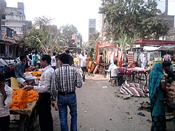
Shujalpur

Last updated

Shujalpur
Shoojahwulpoor
city
Madhya Pradesh location map.svg
Red pog.svg
Shujalpur
Location in Madhya Pradesh, India
India location map 3.png
Red pog.svg
Shujalpur
Shujalpur (India)
Coordinates: 23°24′N76°43′E / 23.4°N 76.72°E / 23.4; 76.72
CountryFlag of India.svg  India
State Madhya Pradesh
District Shajapur
Elevation
448 m (1,470 ft)
Population
 (2011)
  Total112,000
Languages
  Official Hindi, Malvi
Time zone UTC+5:30 (IST)
ISO 3166 code IN-MP
Vehicle registration MP 42

Shujalpur is a city and a municipality in Shajapur district in the Indian state of Madhya Pradesh. Ranoji Rao Shinde, father of Mahadji Shinde (Scindia), died in 1745 at Shujalpur, where his cenotaph ( chattri ) stands which houses a Shiv temple. It is known as Ranoganj.

Contents

Geography

Its a city located in Madhya Pradesh, near Indore. Shujalpur is located at 23°23′N76°43′E / 23.38°N 76.71°E / 23.38; 76.71 It has an average elevation of 448 metres (1,469 feet). The city falls in the Malwa region. Two rivers, the Nevaj and the Jamdad, flow through the city.

Railways

Shujalpur Railway Station SJPUR.JPG
Shujalpur Railway Station

Shujalpur lies on the Ujjain-Sehore-Bhopal Branch Line. There are regular trains plying to Delhi, Kolkata, Chennai, Ahmedabad, Bangalore, Jaipur, Kanpur, Patna, Trivandrum, Coimbatore, Cochin, Nagpur, Jammu, Puri, Allahabad and other major cities.

Dhanbad howrah double decker train.jpg

Now the railway station is very beautiful.

Demographics

[ needs update ] As of the 2011 Census of India, [1] Shujalpur had a population of 71,225. Males constitute 52% of the population and females 48%. Shujalpur has an average literacy rate of 69%: male literacy is 76%, and female literacy is 61%. In Shujalpur, 16% of the population is under 6 years of age. People speak Malvi (a local dialect of Hindi) and Hindi. Shujalpur is a legislative assembly constituency and a tehsil .

History

The city also has a rich political history. First Prime-Minister (as then it was called) of Madhya Bharat the late Pandit Liladhar Joshi belonged to this city. The city is also known for its temple of Shiva known as Jatashankar. Every year, on the occasion of Maha shivratri, a fair is organised near the cenotaph of ranoji rao sindhia and in the Jatashankar temple.

Special bazaar of diwali.jpg

Culture and economy

It is surrounded by more than fifty villages, which are connected via roads. Water supply of the city is mainly dependent on three dams. Jatashankar dam (built on river Jamdhad), Nandasura dam (built on river Nevaj) and Bamanghat dam (built on river Jamdhad). The city has one Government PG College named JNS (Jawaharlal Nehru Smriti).

Related Research Articles

<span class="mw-page-title-main">Chhatarpur</span> City in Madhya Pradesh, India

Chhatarpur is a city and a municipality in Chhatarpur district in the state of Madhya Pradesh, India. It is the administrative headquarters of Chhatarpur District. Chhatarpur is a city and a municipality in Chhatarpur district in the state of Madhya Pradesh, India. It is the administrative headquarters of Chhatarpur District.

Barwani or Badwani is a municipal town in Barwani district of Madhya Pradesh, India, that is situated near the left bank of the Narmada River. It is the administrative headquarters of Barwani district and has also served as the capital of the former princely state of Barwani. Barwani is only accessible by road.

Harda is a town and a municipality in Harda district in the Indian state of Madhya Pradesh. Harda is the administrative headquarters of Harda.

<span class="mw-page-title-main">Amarkantak</span> Hill station in Madhya Pradesh, India

Amarkantak is a pilgrim town and a Nagar Panchayat in Anuppur, Madhya Pradesh, India. The Amarkantak region is a unique natural heritage area and is the meeting point of the Vindhya and the Satpura Ranges, with the Maikal Hills being the fulcrum. This is where the Narmada River, the Son River and Johilla River originate.

<span class="mw-page-title-main">Guna district</span> District of Madhya Pradesh in India

Guna district is one of the 52 districts of Madhya Pradesh in central India. Its administrative headquarters is Guna. The district has a population of 1,241,519. It has an area of 6390 km², and is bounded on the northeast by Shivpuri District, on the east by Ashoknagar District, on the southeast by Vidisha District, on the southwest by Rajgarh District, on the west and northwest by Jhalawar and Baran districts of Rajasthan state. The Sindh River flows northward along the eastern edge of the district, forming part of the boundary with Ashoknagar District, and the Parvati River flows northwestward through the southern portion of the district, forming part of the boundary with Baran District before flowing into Rajasthan.

<span class="mw-page-title-main">Damoh district</span> District of Madhya Pradesh in India

Damoh District is a district of Madhya Pradesh state in central India. The town of Damoh is the district headquarters. The district is part of the Sagar Division.

<span class="mw-page-title-main">Indore district</span> District of Madhya Pradesh, India

The Indore District is a district of Madhya Pradesh state in central India. It is believed that the city is named after its Indreshwar Mahadev Temple, Where Indra is the presiding deity. The Gupta inscriptions name Indore as "Indrapura". It is also called the administrative capital. This district forms part of the Indore Division.

Bijawar is a city the state of Madhya Pradesh, India. It is the administrative headquarters of Bijawar Taluk, and was formerly the capital of a princely state of British India of the same name. The people of Bijawar are demanding the district status from their state government. It is the 53rd proposed district of Madhya Pradesh

<span class="mw-page-title-main">Bhitarwar</span> City in Madhya Pradesh, India India

Bhitarwar is a city and a Municipality in Gwalior district in the state of Madhya Pradesh, India. The town is surrounded by a river called Parbati.

Garoth is a town in Madhya Pradesh state in central India. It is one of the tehsil of Mandsaur District.It shares boundary with Jhalawar district of Rajasthan.The local Language or dialect spoken here is a mixture of Mewari, Harauti and Malwi Languages.Latitude and longitude coordinates are: 24.328077, 75.649902.

Pipri is a town and a nagar panchayat in Sonbhadra district in the Indian state of Uttar Pradesh.

<span class="mw-page-title-main">Renukoot</span> City in Uttar Pradesh, India

Renukoot is a city and a nagar panchayat in Sonbhadra district in the Indian state of Uttar Pradesh. It is 68 km south from the district headquarters Robertsganj.

Sabalgarh is a municipality in Morena district in the Indian state of Madhya Pradesh.

Sarangpur is a city and tehsil in Rajgarh district in the Indian state of Madhya Pradesh. It is situated at the bank of the river Kali Sindh.

<span class="mw-page-title-main">Sinnar</span> Town in Maharashtra, India

Sinnar is a city and a municipal council in Sinnar taluka of Nashik district in the Indian state of Maharashtra. Sinnar is the third largest city in Nashik district after Nashik and Malegaon.

Talen is a town in Madhya Pradesh, India.

Bagli is a town and a nagar panchayat in the Malwa region of Dewas district in the state of Madhya Pradesh, India. Bagli is around 66 km (41 mi) from Dewas.

Shahpura is Tehsil in Dindori district in the Indian state of Madhya Pradesh. Shahpura the PIN code is 481990.

Boda is a town and a Nagar Parishad in Rajgarh district in the state of Madhya Pradesh, India.

<span class="mw-page-title-main">Nemawar</span> Village in Madhya Pradesh, India

Nemawar is a small town in Dewas District, Madhya Pradesh, India. Nemawar is located on the left bank of the Narmada river opposite to Handia. However, it belongs to Khategaon block and tehsil of the Dewas district

References

[2]

  1. "Census of India 2001: Data from the 2001 Census, including cities, villages and towns (Provisional)". Census Commission of India. Archived from the original on 16 June 2004. Retrieved 1 November 2008.
  2. Sadhna Sharma (1995). States Politics in India. Mittal Publications. ISBN   978-81-7099-619-4.