Jaora is a city and a municipality in Ratlam district in the Indian state of Madhya Pradesh. Jaora is located in the Malwa region, between Ratlam and Mandsaur. It was the capital of the Jaora princely state of Jaora before Independence. During the Mourning of Muharram, thousands of people from all over the world visit the shrine of Hussain Tekri. Jains visit Jaora as a place that the Jain ascetic Rajendrasuri practiced tapasya.
Sitamau is a town and a nagar panchayat in Mandsaur district in the Indian state of Madhya Pradesh. It is in the Mandsaur district of Malwa region of Madhya Pradesh.

Mandsaur district is a District of Madhya Pradesh state in central India. The town of Mandsaur is the administrative headquarters of the district.The ancient Pashupatinath temple is situated in Mandsaur. Large quantities of opium are produced in Mandsaur district.
Bhawani Mandi is a town and a municipality in Jhalawar district in the state of Rajasthan, India.
Dhariawad is a census town in Pratapgarh district in the state of Rajasthan, India. It is the administrative headquarters for Dhariawad Tehsil.
Garoth is a town in Madhya Pradesh state in central India. It is one of the tehsil of Mandsaur District.It shares boundary with Jhalawar district of Rajasthan.The local Language or dialect spoken here is a mixture of Mewari, Harauti and Malwi Languages.Latitude and longitude coordinates are: 24.328077, 75.649902.

Gummidipoondi is an industrial town in Chennai Metropolitan Region of Thiruvallur district in the Indian state of Tamil Nadu. Notably, it is the northernmost assembly constituency and settlement in the state of Tamil Nadu.

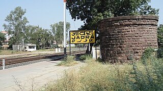
Jeeran is a town and a nagar panchayat in Neemuch district in the Indian state of Madhya Pradesh. It is located at 21 km south of the Neemuch.
Kiraoli is a town and a nagar panchayat in Agra district in the Indian state of Uttar Pradesh.
Lauthaha is a city and a notified area in Purvi Champaran district in the Indian state of Bihar.
Lohian Khas is a town and a nagar panchayat in Jalandhar district in the Indian state of Punjab. There was 11 wards in this town recently two more wards are constituted now currently 13 wards represent this lohian town. A bus stand and railway station also situated here. As per the Rail Department's terminology, Lohian station comes under the category of "rail junction", this type of terminology used where three or more rail tracks joins together and this important to mention here that historical city Patiala from railway point of view not comes under the category of junction By train people go to Makhu, Ferozpur, Sultanpur Lodhi, Kapurthala, Nakodar, Jalandhar and Ludhiana. There are schools for computer education and Ielts academies also here.

Manapakkam is a suburb of Chennai in the Indian state of Tamil Nadu. A census town, Manapakkam is located along the Mount-Poonamallee Road in Chennai. It is now a home to many IT companies like DLF Cybercity Chennai and Larsen & Toubro. Manappakam has beautiful and scenic Adyar River Bank Trail suitable for morning walkers and joggers, it is a 3-km stretch extended till Chennai Airport's secondary Runway Bridge.
Meghnagar is a census town, near Jhabua town in Jhabua district in the Indian state of Madhya Pradesh.
Piplia Mandi is a town and a Nagar Parishad in Mandsaur district in the Indian state of Madhya Pradesh. It is15 km away from the city of Mandsaur on state highway 31.
Ramchandrapur is a census town in Sankrail CD Block of Howrah Sadar subdivision in Howrah district in the Indian state of West Bengal. It is a part of Kolkata Urban Agglomeration.
Shamgarh is a town and a nagar panchayat in Mandsaur district in the Indian state of Madhya Pradesh. Shamgarh is located at 24.18°N 75.63°E.

Singaperumal Koil is a census town located between Chengalpattu and Maraimalai Nagar in Chengalpattu district in the Indian state of Tamil Nadu.
Jafarabad is a town and nagar panchayat in Jaunpur district in the Indian state of Uttar Pradesh.
Narayangarh is a nagar panchayat city in district of Mandsaur, Madhya Pradesh. The city is divided into 15 wards for which elections are held every 5 years. The Narayangarh Nagar Panchayat has population of 10,191 of which 5,168 are males while 5,023 are females as per report released by Census India 2011.
Manasa is a town with nagar palika in Neemuch district in the Indian state of Madhya Pradesh. It was under the princely state of Holker before Indian independence.

