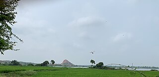
Harda is a town and a municipality in Harda district in the Indian state of Madhya Pradesh. Harda is the administrative headquarters of Harda. Betul city is 125 km far from main city.

Sardarpur is a town and a nagar panchayat in Dhar district in the Indian state of Madhya Pradesh. It is a town on Mahi river on the Malwa plateau. There is an ancient Shivalinga situated at the bank of Mahi river at a place called Shree Jhineshwar Dham; Shri Mohankheda Jain Thirth and Bhopawar Jain Tirth are located nearby.

Arookutty is a census town in Alappuzha district in the state of Kerala, India.

Badarwas is a town and a nagar panchayat in Shivpuri district in the state of Madhya Pradesh, India.

Chanpatia is a city Nagar Panchayat situated on the bank of the Burhi Gandak River is the administrative headquarter of Chanpatia block in Paschim Champaran district near the Indo-Nepal border, 18 KM from District headquarter Bettiah, 242 KM north-west of capital city Patna in the state of Bihar, India. Chanpatia is famous for tasty Marcha Ka chura, Basmati rice and the famous Handi kabab. PIN code=845449. Majority of population depends on agriculture. There are many small scale industries is present. Chanpatia is now growing at very high speed. New startup zone called Chanpatia startup zone was initiated during lockdown providing employment to many needy persons. Readymade clothes from this startup zones are highly demanding world wide.

Kannod is a town situated in Malwa region of Madhya Pradesh, India. It is surrounded by the Vindhya Range from three sides. It is well connected with Indore, Harda, Khandwa and Bhopal. Area code 07273

Karera is a municipality or Nagar Palika in the Shivpuri district of the Indian state of Madhya Pradesh.

Karnawad is a town and a nagar panchayat in Dewas district in the Indian state of Madhya Pradesh.

Karuppur is a panchayat town in Salem District in the Indian state of Tamil Nadu. It is located on the National Highway 7 between Salem and Bangalore. The Periyar University, with which many Salem colleges are affiliated, is located here. Government College of Engineering, referred as GCE-Salem is also located here. It is a railway station on the Chennai-Shoranur railway line.

Kumbhraj is a town in Guna district in the Indian state of Madhya Pradesh. Kumbhraj is one of the largest producer of coriander seeds in the world. Many multinational companies like Tata procure coriander seeds from Kumbhraj. Kumbhraj name is given by Rana Kumbha.

Lingasugur is a municipal town in Raichur district in the Indian state of Karnataka. There are many Temples, hills and forts (Quila). The festivals of Muharram and Maha Shivaratri are important here. Mudgal in Lingasugur taluk has a very ancient fort. It has often been mentioned in the autobiography of Philip Meadows Taylor. Lingasugur, then known as Chavani was the site of a major British cantonment in the region.

Manapakkam is a census town and part of the Chennai Metro city, in the Indian state of Tamil Nadu. Manapakkam is located along the Mount-Poonamallee Road in Chennai. It is now a home to many IT companies and L&T. Manappakam has beautiful and scenic Adyar River Bank Trail suitable for morning walkers and joggers, it's a 3 Kms stretch extended till Chennai Airport's secondary Runway Bridge.

Mhowgaon is a Nagar Panchayat under Sub Division Dr. Ambedkar Nagar (Mhow) in Indore district in the Indian state of Madhya Pradesh. The total geographical area of Mhowgaon nagar panchayat is 13.5 km2 and it is the smallest city by area in the sub district. The population density of the city is 2309 persons per km2. Mhowgaon is divided into 15 wards for which elections are held every 5 years. Among them, Mhowgaon Ward No. 2 is the most populous ward with a population of 3440 and Mhowgaon Ward No. 15 is the least populous ward with a population of 957. Mhowgaon Nagar Panchayat has total administration over 6,373 houses to which it supplies basic amenities like water and sewerage. It is also authorized to build roads within Nagar Panchayat limits and impose taxes on properties coming under its jurisdiction.

Motipur is a town and a notified area in Muzaffarpur district in the Indian state of Bihar.

Nasrullaganj is a nagar panchayat in Sehore district in the Indian state of Madhya Pradesh. The nearest airport is in Bhopal.

Rau is a suburb and a nagar panchayat in Indore district in the Indian state of Madhya Pradesh. It is a part of the Indore Metropolitan Region.

Sanwer is a Nagar panchayat in Indore district in the Indian state of Madhya Pradesh. It is situated between two major cities of Madhya Pradesh- Indore and Ujjain.

Talen is a town in Madhya Pradesh, India.

Thandla is a town in Thandla Tehsil in Jhabua District of Madhya Pradesh, India. It belongs to Indore Division. It is located 30 km north of the District headquarters of Jhabua. It is a Tehsil headquarter.

Lavkushnagar, formerly known as Laundi, is a town/city/tehshil and a nagar panchayat in Chhatarpur district in the Indian state of Madhya Pradesh. It is about 55 km (34 mi) away from Chhatarpur and 37 km (23 mi) from the temple town Khajuraho. The Urmil and Kail Rivers flow through this town. The Civil Airport Khajuraho and Dumra, Harpalpur, and Khajuraho Railway Station are located nearby, and links it to some major towns and cities of Madhya Pradesh. It also has a Civil Court, a Sub Jail, and a police station.


