
Mandsaur is a city and a municipality in Mandsaur district located on Border of Mewar and Malwa region of Madhya Pradesh, state of central India. It is the administrative headquarters of Mandsaur District. The ancient Pashupatinath Temple is located in Mandsaur.
Jaora is a city and a municipality in Ratlam district in the Indian state of Madhya Pradesh. Jaora is located in the Malwa region, between Ratlam and Mandsaur. It was the capital of the Jaora princely state of Jaora before Independence. During the Mourning of Muharram, thousands of people from all over the world visit the shrine of Hussain Tekri. Jains visit Jaora as a place that the Jain ascetic Rajendrasuri practiced tapasya.

Mandsaur district is a District of Madhya Pradesh state in central India. The town of Mandsaur is the administrative headquarters of the district.The ancient Pashupatinath temple is situated in Mandsaur. Large quantities of opium are produced in Mandsaur district.

Ratlam District is a district of Madhya Pradesh state in central India. The town of Ratlam is administrative headquarters of the district.

Neemuch district is one of the 51 districts of Madhya Pradesh state in central India. The town of Neemuch is the administrative headquarters of the district.
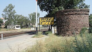
Piploda is a town and a Nagar Parishad in Ratlam district in the Indian state of Madhya Pradesh.
Tal is a town and a nagar parishad in Ratlam District of the Indian state of Madhya Pradesh. Raja Tariya Bhil established Tal in 1243 AD.
Jobat is a city and a nagar parishad municipality in Alirajpur district in the Indian state of Madhya Pradesh.
Bhanpura is a town and a nagar panchayat in Mandsaur district, located in the state of Madhya Pradesh, India. Bhanpura was discovered by King Bhanu bhil. It was also ruled by the Chandrawats of Mewar during the times of Rana Sanga's rule. The town is home to a number of historic places such as the Daraki-Chattan region, which is one of the world's oldest rock arts, Chaturbhujnath Nala rock art shelters, and the Hinglajgarh Fort. Bhanpura also has a museum that displays the popular arts of Mandsaur, including art from the Gupta era until the time of Pratiharas and Parmaras.
Bhawani Mandi is a town and a municipality in Jhalawar district in the state of Rajasthan, India.
Diken is a town and a nagar panchayat in Neemuch district in the state of Madhya Pradesh, India.
Garoth is a town in Madhya Pradesh state in central India. It is one of the tehsil of Mandsaur District.It shares boundary with Jhalawar district of Rajasthan.The local Language or dialect spoken here is a mixture of Mewari, Harauti and Malwi Languages.Latitude and longitude coordinates are: 24.328077, 75.649902.
Harpalpur is a town and a nagar panchayat in Chhatarpur District in the Indian state of Madhya Pradesh.
Malhargarh is a town and a tehsil in Mandsaur district in the Indian state of Madhya Pradesh. It is located between Neemuch and Mandsaur on the Ratlam- Chittaurgarh Section of Indian railway. Malhargarh is rich in agriculture and part of the Malwa region.
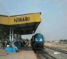
Niwari is a town and a nagar panchayat in Niwari district in Indian state of Madhya Pradesh. It is administrative headquarter of Niwari district. It is adjacent to the Jhansi and Mahoba districts of Uttar Pradesh.
Piplia Mandi is a town and a Nagar Parishad in Mandsaur district in the Indian state of Madhya Pradesh. It is15 km away from the city of Mandsaur on state highway 31.
Sendhwa is a city with a municipal government in Barwani district in the Indian state of Madhya Pradesh. It is the headquarters for Sendhwa Tehsil.
Shamgarh is a city and a nagar parishad in Mandsaur district in the Indian state of Madhya Pradesh. Shamgarh is located at 24.18°N 75.63°E.
Narayangarh is a nagar panchayat city in district of Mandsaur, Madhya Pradesh. The city is divided into 15 wards for which elections are held every 5 years. The Narayangarh Nagar Panchayat has population of 10,191 of which 5,168 are males while 5,023 are females as per report released by Census India 2011.
Manasa is a town with nagar palika in Neemuch district in the Indian state of Madhya Pradesh. It was under the princely state of Holker before Indian independence.

