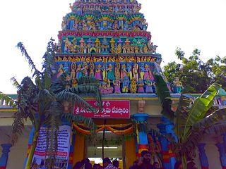
Perungudi is a neighbourhood of Chennai in the state of Tamil Nadu, India. It is situated about 10 kilometres (6.2 mi) south of Adyar. It is bordered on two sides by the Old Mahabalipuram Road and the Perungudi lake. It is situated on the Old Mahabalipuram IT Expressway right in middle of an Information Technology (IT) Estate. It is between Taramani and Thoraipakkam and parallel to Kottivakkam and Palavakkam in the East Coast Road.
Kemri is a town and nagar panchayat in Rampur district in the Indian state of Uttar Pradesh.
Bajna is a town and a nagar panchayat in Mathura district in the state of Uttar Pradesh, India.
Bhagwant Nagar is a town, Vidhan Sabha seat and a nagar panchayat in Unnao district in the state of Uttar Pradesh, India.
Bharatganj is a Nagar Panchayat city in district of Prayagraj, Uttar Pradesh.
Devendranagar is a town and a nagar panchayat in Panna district in the state of Madhya Pradesh, India. Earlier before the merger it was part of Erstwhile Princely State of Ajaigarh.
Pharenda, or Anandnagar, is a city in the Maharajganj district of the province of Uttar Pradesh in northern India. It is located approximately 44 kilometres north of Gorakhpur near the border with Nepal. District of Pharenda is Maharajganj. This is situated on the Buddhist Circuit which is built from Sarnath to Lumbini. It lies on NH-24 and near NH 29. It is about 45 km from Gorakhpur, 40 km from Siddharthnagar, 30 km from Maharajganj and 55 km from Sonauli Indo-Nepal border. This place is named after Seth Anandram Jaypuriya. There is closed sugar Mill which was started in about 1935 and closed in 1995. Near Anand Nagar there is a temple is Durga devi mandir, popularly known as Lehara Devi mandir.
Gunnaur is a town and a nagar panchayat in Sambhal district in the Indian state of Uttar Pradesh. Gunnaur is located at 28.25°N 78.43°E. It has an average elevation of 170 metres (557 feet).
Kursath is a town and a nagar panchayat in Hardoi district in the Indian state of Uttar Pradesh. It has ten wards named: Jawahar Nagar, Azad Nagar, Gauri Nagar, Pant Nagar, Rajendra Nagar, Patel Nagar, Gandhi Nagar, Subhash Nagar, Ram Nagar and Ashok Nagar.
Lahar is a city and a Nagar Palika in Bhind district in the Indian state of Madhya Pradesh.
Lal Gopalganj Nindaura is a town and a nagar panchayat in Prayagraj district in Indian state of Uttar Pradesh.
Lalganj is an important town and Nearest City, (60 kilometres Morden Old City Mehsi), and river port situated in Vaishali district, Bihar.

Meerpet–Jillelguda is a satellite city of Hyderabad and a municipal corporation in Rangareddy district of the Indian state of Telangana. The municipal corporation was formed after merging municipality of Meerpet and Jillelguda.
Mhowgaon is a Nagar Panchayat under Sub Division Dr. Ambedkar Nagar (Mhow) in Indore district in the Indian state of Madhya Pradesh. The total geographical area of Mhowgaon nagar panchayat is 13.5 km2 and it is the smallest city by area in the sub district. The population density of the city is 2309 persons per km2. Mhowgaon is divided into 15 wards for which elections are held every 5 years. Among them, Mhowgaon Ward No. 2 is the most populous ward with a population of 3440 and Mhowgaon Ward No. 15 is the least populous ward with a population of 957. Mhowgaon Nagar Panchayat has total administration over 6,373 houses to which it supplies basic amenities like water and sewerage. It is also authorized to build roads within Nagar Panchayat limits and impose taxes on properties coming under its jurisdiction.
Mundera Bazar is a town and a nagar panchayat in Gorakhpur district in the Indian state of Uttar Pradesh. MRs. Sunita Gupta, is the chairman of this nagar panchayat.
Sarai Mir is a town and a nagar panchayat in Azamgarh district in the Indian state of Uttar Pradesh.
Sewalkhas is a town and a Nagar Panchayat in Meerut district in the Indian state of Uttar Pradesh.
Tikait Nagar is a town and a nagar panchayat in Barabanki district in the Indian state of Uttar Pradesh.
Tarana is a town and a nagar parishad in Ujjain district in the Indian state of Madhya Pradesh. Tarana is a tehsil in Ujjain and the distance to Ujjain is 34 km. Tarana was part of Holkar estate. The current M.L.A of Tarana constituency is Mahesh Parmar (INC).
Narayangarh is a nagar panchayat city in district of Mandsaur, Madhya Pradesh. The city is divided into 15 wards for which elections are held every 5 years. The Narayangarh Nagar Panchayat has population of 10,191 of which 5,168 are males while 5,023 are females as per report released by Census India 2011.


