
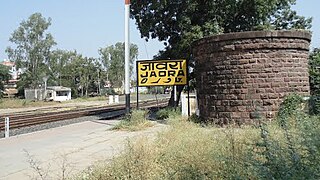
Jhabua is a town and a municipality in Jhabua district in the Indian state of Madhya Pradesh. It is the administrative headquarters of Jhabua District.
Ratlam is a city in the northwestern part of the Malwa region in Madhya Pradesh state of India. The city of Ratlam lies 480 metres (1,570 ft)above sea level. It is the administrative headquarters of Ratlam district, which was created in 1947 after the independence of India. It is located 294 kilometres west of the state capital Bhopal.
Jaora is a city and a municipality in Ratlam district in the Indian state of Madhya Pradesh. Jaora is located in the Malwa region, between Ratlam and Mandsaur. It was the capital of the Jaora princely state of Jaora before Independence. During the Mourning of Muharram, thousands of people from all over the world visit the shrine of Hussain Tekri. Jains visit Jaora as a place that the Jain ascetic Rajendrasuri practiced tapasya.

Dewas District is a district in the Indian state of Madhya Pradesh. The town of Dewas is the district headquarters.

Sailana is a town in the Malwa region of the Indian state of Madhya Pradesh. Sailana is 25 km (16 mi) from Ratlam city and 50 km (31 mi) away from Banswara district of the neighboring state of Rajasthan.
Sailana was once the capital of the Sailana State before it merged into India. A fort belonging to the former royal family still stands tall in Sailana. The Kedareshwar temple, situated 4 km (2.5 mi) from Sailana is a notable shrine.

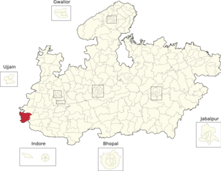
Rajgarh district is a district of Madhya Pradesh in central India. The city of Rajgarh is the administrative headquarters of the district. The old name of Rajgarh was Jhanjhanipur, and was ruled by the Bhils up to 1645. Rajgarh in Madhya Pradesh is one of the aspirational districts selected by Government of India. The district has an area of 6,154 km² and the population is 1,545,814. The district lies on the northern edge of the Malwa plateau, and the Parbati River forms the eastern boundary of the district, while the Kali Sindh River forms the western boundary. The district has seven tehsils, Rajgarh, Khilchipur, Jirapur, Biaora, Narsinghgarh, Sarangpur and Pachore. The district is bounded by Rajasthan state to the north, and by the districts of Guna to the northeast, Bhopal to the east, Sehore to the southeast, and Shajapur to the south and west. It is part of Bhopal Division. There are 1728 villages in Rajgarh.
Bijawar is a city the state of Madhya Pradesh, India. It is the administrative headquarters of Bijawar Taluk, and was formerly the capital of a princely state of British India of the same name. The people of Bijawar are demanding the district status from their state government. It is the 53rd proposed district of Madhya Pradesh
Malwa Agency was an administrative section of British India's Central India Agency. The headquarters of the political agent was at Mandsaur (Mandasor) / Neemuch (Nimach). The other chief towns of the region were : Ratlam and Jaora.
Badnawar (or Badnavar) is a Town, former pargana and a Nagar Parishad of the Dhar district in the state of Madhya Pradesh, India. This is a tehsil place having 170 villages. Badnawar is around 95 km from Indore - the business capital of Madhya Pradesh.
Raghogarh-Ruthiyai or Raghogarh-Vijaypur is a town and municipality in Guna district in the Indian state of Madhya Pradesh.

Ratlam State was a 13 gun salute princely state in India, part of the Malwa Agency of Central India during the British Raj.

Sailana State was an 11 gun salute princely state in India, part of the Malwa Agency of Central India during the British Raj. The state enjoyed an estimated revenue of Rs.5,00,000.
Alirajpur Assembly constituency is one of the 230 Vidhan Sabha constituencies of Madhya Pradesh state in central India. This constituency came into existence in 1951, as one of the 79 Vidhan Sabha constituencies of the erstwhile Madhya Bharat state. This constituency is reserved for the candidates belonging to the Scheduled tribes since its inception.

Jobat Assembly constituency is one of the 230 Vidhan Sabha constituencies of Madhya Pradesh state in central India. This constituency came into existence in 1951, as one of the 79 Vidhan Sabha constituencies of the erstwhile Madhya Bharat state. This constituency is reserved for the candidates belonging to the Scheduled tribes since its inception.
Peepal Khoont mainly known as Pipalkhunt is a Tehsil headquarter and Panchayat Samiti of the Pratapgarh district of Rajasthan state. It is a sub-division among the 5 sub-divisions of the Pratapgarh district. The main market is called Sadar Bajar. It is situated on National Highway 113. Pipalkhunt is a town located on the Banswara - Jaipur Expressway surrounded by the hills, plants and trees. The town is situated on the bank of the Mahi River.
Sarvan is a village in Sailana Tehsil in Ratlam district of Madhya Pradesh, India. It belongs to Ujjain division. It is located 32 km north of District headquarters Ratlam and 298 km from State capital Bhopal. Sarvan Pin code is 457550 and postal head office is Sailana.

Bijawar State was a princely state of colonial India, located in modern Chhatarpur district of Madhya Pradesh.

Jhabua State was one of the princely states of India during the period of the British Raj. It had its capital in Jhabua town. Most of the territory of the princely state was inhabited by the Bhil people, who constituted a majority of the population. The revenue of the state in 1901 was Rs.1,10,000.

Raghogarh State, also known as Raghugarh and as Khichiwara, was a princely state of the Gwalior Residency, under the Central India Agency of the British Raj. It was a Thikana state of about 109 km2 with a population of 19,446 inhabitants in 1901. The Parbati River marked the western border of the state. The capital was at Raghogarh in present-day Guna district of Madhya Pradesh.
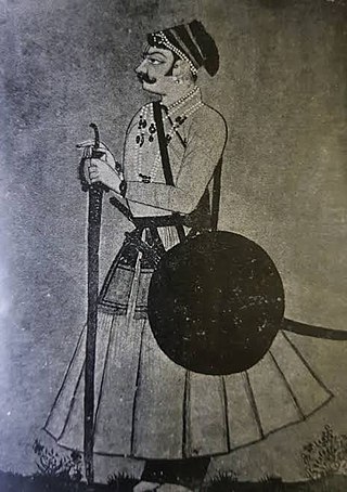
Ratan Singh Rathore was the founder of Ratlam, governor of 16 parganas in northern Malwa and a renowned warrior of his time. He gained fame under the patronage of the Mughal emperor Shah Jahan.

