
Barwani or Badwani is a municipal town in Barwani district of Madhya Pradesh, India, that is situated near the left bank of the Narmada River. It is the administrative headquarters of Barwani district and has also served as the capital of the former princely state of Barwani. Barwani is only accessible by road.
Ratlampronunciation (help·info) known historically as Ratnapuri is a city in the northwestern part of the Malwa region in Madhya Pradesh state of India. The city of Ratlam lies 480 metres above sea level. It is the administrative headquarters of Ratlam district, which was created in 1947 after the independence of India.
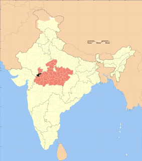
Ratlam District is a district of Madhya Pradesh state in central India. The town of Ratlam is administrative headquarters of the district.
Mahidpur City is a town and a municipality in Ujjain district in the Indian state of Madhya Pradesh. The modern town of Mahidpur is situated on the bank of river Shipra. It is located in the Malwa region. At present, the town is a tehsil place of Ujjain district.
Piploda is a town and a Nagar Parishad in Ratlam district in the Indian state of Madhya Pradesh.
Tal is a town and a nagar parishad in Ratlam District of the Indian state of Madhya Pradesh. It is a tehsil of Ratlam district and situated near Chambal river. Before Indian independence, Tal was part of the princely state of Jaora.

Partapur is a municipality in Banswara district in the Indian state of Rajasthan.it is a fastest growing town in vagad reigeon and second largest town in banswara district
Bina Railway Colony is a census town in Sagar District of state of Madhya Pradesh in India.
Gogapur is a census town in tehsil Mehidpur City and Ujjain district in the Indian state of Madhya Pradesh.This town is commonly known as Mehidpur Road and Mehidpur Mandi.

Kanaipur is a census town in Sreerampur Uttarpara CD Block in Srirampore subdivision of Hooghly district in the Indian state of West Bengal. It is a part of Kolkata Urban Agglomeration.
Kulihanda is a census town in Chinsurah Mogra CD Block in Chinsurah subdivision of Hooghly district in the Indian state of West Bengal. It is a part of Kolkata Urban Agglomeration.

Lumding Railway Colony is a census town in Hojai district in the Indian state of Assam.
Malhargarh is a town and a tehsil in Mandsaur district in the Indian state of Madhya Pradesh. It is located between Neemuch and Mandsaur on the Ratlam- Chittaurgarh Section of Indian railway. Malhargarh is rich in agriculture and part of the Malwa region.
Mhowgaon is a Nagar Panchayat under Sub Division Dr. Ambedkar Nagar (Mhow) in Indore district in the Indian state of Madhya Pradesh. The total geographical area of Mhowgaon nagar panchayat is 13.5 km2 and it is the smallest city by area in the sub district. The population density of the city is 2309 persons per km2. Mhowgaon is divided into 15 wards for which elections are held every 5 years. Among them, Mhowgaon Ward No. 2 is the most populous ward with a population of 3440 and Mhowgaon Ward No. 15 is the least populous ward with a population of 957. Mhowgaon Nagar Panchayat has total administration over 6,373 houses to which it supplies basic amenities like water and sewerage. It is also authorized to build roads within Nagar Panchayat limits and impose taxes on properties coming under its jurisdiction.
Nabagram Colony is a census town in Sreerampur Uttarpara CD Block in Srirampore subdivision of Hooghly district in the Indian state of West Bengal. It is a part of Kolkata Urban Agglomeration.
Namli is a town and a nagar parishad in Ratlam district in the Indian state of Madhya Pradesh.
New Bongaigaon Railway Colony is a census town in Bongaigaon district in the Indian state of Assam.
Northern Railway Colony is a census town in Kanpur Nagar district in the Indian state of Uttar Pradesh.

Tundla Railway Colony is a census town in Firozabad district, in the Indian state of Uttar Pradesh.

Budgam is a town and a notified area committee in Budgam district in the union territory of Jammu and Kashmir, India.

