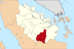
Indragiri Hulu (Upper Indragiri) is a landlocked regency (kabupaten) of Riau, Indonesia. It is located on the island of Sumatra. The original regency was split in two on 4 October 1999, with the western half being created as a separate Kuantan Singingi Regency. The regency now has an area of 8,198.71km2 and had a population of 363,442 at the 2010 census,[2] and 444,548 at the 2020 census;[3] the official estimate as at mid 2024 was 487,039 (comprising 249,632 males and 237,407 females).[1] The administrative seat of the regency is located at the town of Rengat.
Administrative districts
The regency is divided into fourteen districts (kecamatan), listed below with their areas and their populations at the 2010 census[2] and the 2020 census,[3] together with the official estimates as at mid 2024.[1] The table also includes the locations of the district administrative centres, the number of administrative villages in each district (totaling 178 rural desa and 16 urban kelurahan), and its post code.
Kode Wilayag
Name of District (kecamatan)
Area in km2
Pop'n census 2010
Pop'n census 2020
Pop'n estimate mid 2024
Admin centre
No. of villages
Post code
14.02.05
Peranap
1,700.98
28,231
35,161
39,231
Peranap
12 (a)
29357
14.02.14
Batang Peranap
(b)
8,980
13,252
15,233
Selunak
10
29354
14.02.06
Seberida
960.29
46,155
56,571
61,446
Pangkalan Kasai
11 (c)
29371
14.02.07
Batang Cenaku
970.00
28,393
40,736
50,799
Aur Cina
20
29355
14.02.08
Batang Gansal
950.00
26,890
33,272
36,453
Seberida
10
29356
14.02.03
Kelayang
879.84
21,288
24,542
26,979
Simpang Kelayang
17 (c)
29352
14.02.13
Rakit Kulim
(b)
19,833
23,836
26,159
Petonggan
19
29359
14.02.04
Pasir Penyu
372.50
31,116
36,234
37,868
Air Molek
13 (d)
29358
14.02.09
Lirik
233.60
23,418
27,624
28,762
Lirik Area
17
29353
14.02.11
Sungai Lala
(b)
12,938
16,608
18,315
Kelawat
12
29363
14.02.12
Lubuk Batu Jaya
(b)
18,560
22,981
24,045
Lubuk Batu Tinggal
9
29350
14.02.02
Rengat Barat (West Rengat)
921.00
39,819
48,573
52,942
Permatang Reba
18 (c)
29351 (e)
14.02.01
Rengat
1,210.50
46,049
50,603
52,999
Rengat
16 (f)
29311 - 29319
14.02.10
Kuala Cenaku
(b)
11,772
14,555
15,808
Kuala Cenaku
10
29335
Totals
8,198.71
363,442
444,548
487,039
Rengat
194
Notes: (a) including 2 kelurahan - Baturijal Hilir and Peranap. (b) the area of this district is still included in the figures for the district from which it was cut out. (c) including one kelurahan - the admin centre. (d) including 5 kelurahan - Air Molek I, Kembang Harum, Sekar Mawar, Tanah Merah and Tanjung Gading. (e) except the village of Rantau Bakung, which has a post code of 29345. (f) including 6 kelurahan - Kampung Besar Kota, Kampung Besar Seberang, Kampung Dagang, Pasar Kota, Sekip Hilir and Sekip Hulu.
References
1 2 3 Badan Pusat Statistik, Jakarta, 28 February 2025, Kabupaten Indragiri Hulu Dalam Angka 2025 (Katalog-BPS 1102001.1402)
This page is based on this Wikipedia article Text is available under the CC BY-SA 4.0 license; additional terms may apply. Images, videos and audio are available under their respective licenses.