
Afonso Cláudio is a municipality in east central Espírito Santo, Brazil, founded in 1963. The town, at a height of 610m above sea level, has a population of approximately 9,957 and an area of 361.7 km2, and a population density of 32,53 inhabitants/km2. Its borders include: (E) Domingos Martins, Santa Maria de Jetibá and Itarana (N) Laranja da Terra and the neighbouring state of Minas Gerais, (W) Brejetuba (S) Conceição do Castelo and Venda Nova do Imigrante.

Itaguaçu is a municipality located in the Brazilian state of Espírito Santo. Its population was 14,829 (2015) and its area is 532 square kilometres (205 sq mi). Itaguaçu has a population density of per square kilometer. Itaguaçu has three districts: Itaimbé, Palmeira and Itaçu.

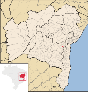
Santo Amaro, also known as Santo Amaro da Purificação is a municipality in the state of Bahia in Brazil. The population is 61,702 in an area of 492.9 square kilometres (190.3 sq mi). It is located in the metropolitan area of Salvador. Santo Amaro is located approximately 73 kilometres (45 mi) from the city of Salvador. Santo Amaro was home to numerous Amerindian peoples until the arrival of the Portuguese, who developed the region for sugarcane production. Santo Amaro is now noted for its numerous historic structures. The city is also a center of Candomblé, having more than 60 terreiros, or temples of the religion.
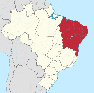
The Northeast Region of Brazil is one of the five official and political regions of the country according to the Brazilian Institute of Geography and Statistics. For the socio-geographic area see Nordeste. Of Brazil's twenty-six states, it comprises nine: Maranhão, Piauí, Ceará, Rio Grande do Norte, Paraíba, Pernambuco, Alagoas, Sergipe and Bahia, along with the Fernando de Noronha archipelago.

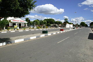
Paulo Afonso is a city in Bahia, Brazil. It was founded in 1958.

Bom Jesus da Lapa is a municipality in Bahia, Brazil located 796 kilometres (495 mi) from the state capital. The population as of 2014 was recorded at 68,922 according to the Brazilian Institute of Geography and Statistics. The city covers a total area of 4,115.5 square kilometres (1,589.0 sq mi) along the banks of the São Francisco River. Its economy is based on agriculture, commerce, tourism and fishing. The current mayor is Eures Ribeiro Pereira. It is the site of the Roman Catholic Diocese of Bom Jesus da Lapa.

Barra (Bahia) is a municipality in the state of Bahia in the North-East region of Brazil. Barra covers 11,422.537 km2 (4,410.266 sq mi), and has a population of 49,325 with a population density of 4.3 inhabitants per square kilometer.
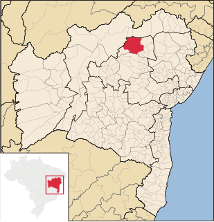
Campo Formoso is a municipality in the state of Bahia in the North-East region of Brazil. Campo Formoso covers 7,258.68 km2 (2,802.59 sq mi), and has a population of 71,900 with a population density of 9.9 inhabitants per square kilometer. It is about 248 miles from Bahia's capital Salvador. It is famous for the gems, rare stones and caves that are abundant in the area and it is the host of the cement factory, Cimpor. The city is surrounded by green mountains, and on the edge of one of them there are four transmission towers which allow the population to be connected to the Internet, TV, cable TV, wireless and phone. Campo Formoso has hot weather with temperatures of about 25 °C.
Cravolândia is a municipality in the state of Bahia in the North-East region of Brazil. Cravolândia covers 162.171 km2 (62.615 sq mi), and has a population of 5042 with a population density of 32 inhabitants per square kilometer. It borders the municipalities of Santa Inês, Itaquara, Ubaíra and Wenceslau Guimarães. Cravolândia is located 317 kilometres (197 mi) from Salvador, the state capital of Bahia, and is connected to Salvador by federal highways BR-116 and BR-101.
Itaeté is a municipality in the state of Bahia in the North-East region of Brazil.

São Francisco do Conde is a municipality in the state of Bahia in the North-East region of Brazil. São Francisco do Conde covers 262.856 km2 (101.489 sq mi), and has a population of 38,838 with a population density of 150 inhabitants per square kilometer. It is located 67 kilometres (42 mi) from the state capital of Salvador. According to the Brazilian Institute of Geography and Statistics São Francisco do Conde has the highest concentration of Brazilians of African descent (90%) in Bahia.

Mata de São João is a municipality in the state of Bahia in the North-East region of Brazil. It covers 632.26 km2 (244.12 sq mi) and a population of 46,392. Mata de São João has a population density of 73 inhabitants per square kilometer. It is located 56 km (35 mi) from the state capital of Bahia, Salvador.

Nazaré, also known as Nazaré das Farinhas, is a municipality in the state of Bahia in the North-East region of Brazil. The municipality has a population of 29,546 with a population density of 107 inhabitants per square kilometer. It is located 110 km (68 mi) from the state capital of Bahia, Salvador. Nazaré is within the Bahian Recôncavo, an interior region of the state of Bahia. It borders the municipalities of Muniz Ferreira, Aratuípe, Jaguaripe, São Felipe, and Maragogipe. The Jaguaripe River crosses through the middle of the town. It is sits on the intersection of two Bahian state highways, BA-001 and BA-046..

Remanso (backwater) is a municipality in the state of Bahia in the North-East region of Brazil.

Arataca is a municipality in the state of Bahia in the North-East region of Brazil. Arataca covers 435.96 km2 (168.33 sq mi), and has a population of 11,779 with a population density of 27 inhabitants per square kilometer. It consists of two districts: Arataca, the municipal seat, and Itatingui.

Muquém de São Francisco is a municipality in the state of Bahia in the North-East region of Brazil. Muquém de São Francisco covers 3,853.185 km2 (1,487.723 sq mi), and has a population of 11,552 with a population density of 3 inhabitants per square kilometer.
Buritirama is a municipality in the state of Bahia in the North-East region of Brazil. Buritirama covers 3,941.872 km2 (1,521.965 sq mi), and has a population of 21,418 with a population density of 5.4 inhabitants per square kilometer.

Feira da Mata is a municipality in the state of Bahia in the North-East region of Brazil. Feira da Mata covers 1,176.105 km2 (454.097 sq mi), and has a population of 5,911 with a population density of 5 inhabitants per square kilometer. It was originally part of Carinhanha, but became an independent municipality in 1989.
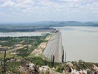
Sobradinho is a municipality located in the state of Bahia, in Brazil. It has a population of approximately 23,511 with a land area of 1,238.9 km2 (478.3 sq mi). Once part of the municipality of Juazeiro it grew with the construction of the Sobradinho Dam and the flooding of the huge Sobradinho Reservoir. With the creation of the reservoir, the inhabitants of four cities and thirty villages had to leave their homes. In all 11,853 families abandoned the old towns before the end of 1977. Of this total, 5,806 families remained in rural lots around the lake and 3,851 families moved to the new towns, including Sobradinho.


