Ituaçu is a city in the Chapada Diamantina region of Bahia, Brazil. The city is 530 km from Salvador, the capital city of Bahia. It is the birthplace of singer Moraes Moreira, while another singer Gilberto Gil lived there from 2 months old. The climate is temperate, falling to 12 °C during the winter. Its estimated population in 2020 is 19,030.

Caculé is a Brazilian municipality located in the state of Bahia, which possesses 23,291 inhabitants as of 2020, according to IBGE. It is situated 750 kilometers southwest from Salvador. Its economy is based mostly on agriculture. The climate in Caculé is warm and dry during the day, being cooler at night, at about 15 °C. The "Rio Antônio" crosses the city. Although it presently has no operational railroad station, Caculé is midpoint on the Ferrovia Centro Atlântica railroad route connecting Montes Claros to Salvador, Bahia.
Serra Dourada is a municipality in the Brazilian state of Bahia. In 2020, the estimated population was 17,321.

Caldeirão Grande is a Brazilian municipality in the state of Bahia. Its estimated population as of 2020 was 13,391 inhabitants, up from 12,491 in 2010. It has an area of 458.31 square kilometres (176.95 sq mi). As of 2020, the mayor was Candido Pereira da Guirra Filho.

Biritinga is a municipality in Bahia, Brazil. As of 2020, it had a population of 15,984 and a land area of 214 square miles (553 km2).
Morro do Chapéu is a municipality in the Brazilian state of Bahia, 386 km northwest of its capital, Salvador, 1012 meters above the sea level, because of which it is one of the coolest towns in Bahia, with temperatures occasionally falling below 10 °C in the winter. Its estimated population in 2020 is 35,440.
Belmonte is a municipality (município) in the Brazilian state of Bahia. It is located at 15º51'47" S, 38º52'58" W. It is 8 metres above sea level. In 2020 it had an estimated population of 23,437 inhabitants.

Belém is a municipality located in the center of the Brazilian state of Alagoas. Its population is 4,284 (2020) and its area is 48 km2.

Cacimbinhas is a municipality in the western of the Brazilian state of Alagoas. Its population is 10,889 (2020) and its area is 273 km2.

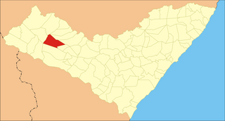
São Sebastião is a municipality located in the Brazilian state of Alagoas. Its population was 34,290 (2020) and its area is 306 km2.
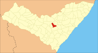
Senador Rui Palmeira is a municipality located in the western of the Brazilian state of Alagoas. Its population was 13,921 (2020) and its area is 360 km².
Taquarana is a municipality located in the center of the Brazilian state of Alagoas. Its population was 20,072 (2020) and its area is 166 km2.

Santa Rita de Cássia is a Brazilian municipality in the state of Bahia. In 2020 the town's population was estimated as 28,481 inhabitants.

Correntina is a municipality in the state of Bahia in Brazil, 500 km from Brasília and 980 km from Salvador. In 2020, the population was estimated at 32,191.

Serra Preta is a city located in the eastern state of Bahia, Brazil. The population in this arid region is 14,699. Serra Preta is about 150 miles northwest from Bahia's capital, Salvador, and 600 miles north of Rio de Janeiro.

Andorinha is a municipality in the Brazilian state of Bahia. Its estimated population in 2020 was 14,503.

Serrinha is a city in the state of Bahia, in eastern Brazil.

Candeias is a municipality in Brazil, in the state of Bahia. It is located 46 kilometres (29 mi) to the north of Salvador, the capital of Bahia. The town is near the BR-324 motorway. The town has a current population of 87,458.

Frei Miguelinho is a city in Pernambuco, Brazil.

Altinho is a municipality/city in the state of Pernambuco in Brazil. The population in 2020, according with IBGE was 22,984 inhabitants and the total area is 452.52 km2.