Jonggol | |
|---|---|
Nicknames:
| |
 Jonggol  Jonggol Jonggol (Java)  Jonggol Jonggol (Indonesia) | |
| Coordinates: 6°29′23″S107°02′32″E / 6.489835°S 107.042341°E | |
| Country | |
| Province | West Java |
| Regency | Bogor Regency |
| Area | |
• Total | 118.86 km2 (45.89 sq mi) |
| Elevation | 295.32 m (968.9 ft) |
| Highest elevation | 1,890 m (6,200 ft) |
| Lowest elevation | 150 m (490 ft) |
| Population (mid 2024 estimate [1] ) | |
• Total | 155,396 |
| • Density | 1,307.4/km2 (3,386.1/sq mi) |
| Time zone | UTC+7 (IWST) |
| Area code | (+62) 251 |
| Vehicle registration | F |
| Villages | 14 |
| Website | kecamatanjonggol |
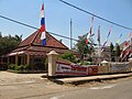
Jonggol is a town and an administrative district (Indonesian: Kecamatan) in the Bogor Regency, West Java, Indonesia. The town is located 50 km to the southeast of Jakarta. The district is part of the Greater Jakarta metropolitan area, and is situated within the Bekasi river basin. It covers a land area of 118.86 km2, and had a population of 122,697 at the 2010 Census [2] and 143,512 at the 2020 Census; [3] the official estimate as at mid 2024 was 155,396 (comprising 78,278 males and 77,118 females). [1] The district centre is at the town of Jonggol, and the district is sub-divided into 14 villages (desa), all sharing the postcode of 16830, as listed below with their areas and populations as at mid 2024. [1] Besides being a district, Jonggol is now the centre of a vast tourist area in the southeast of the Jakarta Metropolitan Area which includes several neighbouring districts - Sukamakmur, Cariu, Tanjungsari, Cileungsi, and Klapanunggal.
Contents
| Kode Wilayah | Name of kelurahan or desa | Area in km2 | Population mid 2023 estimate |
|---|---|---|---|
| 32.01.06.2013 | Sukajaya | 11.82 | 7,753 |
| 32.01.06.2005 | Sukanegara | 6.40 | 6,674 |
| 32.01.06.2008 | Cibodas | 14.16 | 4,746 |
| 32.01.06.2011 | Singasari | 16.25 | 11,613 |
| 32.01.06.2003 | Singajaya | 11.53 | 23,637 |
| 32.01.06.2004 | Sukasirna | 11.45 | 15,979 |
| 32.01.06.2012 | Balekambang | 9.26 | 8,514 |
| 32.01.06.2010 | Bendungan | 6.54 | 6,500 |
| 32.01.06.2002 | Sirnagalih | 4.77 | 4,652 |
| 32.01.06.2009 | Jonggol (town) | 6.47 | 15,718 |
| 32.01.06.2001 | Sukamaju | 6.41 | 25,925 |
| 32.01.06.2006 | Sukamanah | 4.22 | 14,003 |
| 32.01.06.2007 | Weninggalih | 4.81 | 5,269 |
| 32.01.06.2014 | Sukagalih | 4.77 | 4,413 |
| 32.01.06 | Totals | 118.86 | 155,396 |