
Urambo is one of the seven districts of the Tabora Region of Tanzania. It is bordered to the north by the Kaliua District, to the east by the Uyui District, to the southeast by the Sikonge District, and to the southwest by the Katavi Region. Its administrative seat is the town of Urambo.

Uyui District is one of the seven districts of the Tabora Region of Tanzania. It is bordered to the north by Nzega District and Igunga District as well as by the Shinyanga Region, to the south by Sikonge District, to the west by Urambo District and Kaliua District, and to the east by the Singida Region. Tabora Urban District is an enclave within the Uyui District. Its administrative seat is the city of Tabora.

Kibondo District is one of the six districts of Kigoma Region, Tanzania. It is bordered to the north by the Kakonko District, to the east by the Tabora Region, to the south by the Uvinza District, to the west by the Kasulu District and to the northwest by Burundi.

Uvinza is one of the eight administrative districts of Kigoma Region in Tanzania. Uvinza is bordered to the northwest by Kigoma District and Kigoma-Ujiji District. North of the district is bordered by Kasulu District. Lake Tanganyika borders the district on the west. Mpanda District in Katavi Region boders the district to the south and Kaliua District in Tabora Region borders the district to the east. The district is named in honor of the Vinza people whom the western part of district was their historic kingdom. Southern Uvinza District is home to the Mahale Mountains National Park. A unique park that is home to both Chimpanzees and lions in the same habitat.

Geita Region is one of Tanzania's 31 administrative regions. The region covers an area of 20,054 km2 (7,743 sq mi)."Geita Region Size". The region is comparable in size to the combined land area of the nation state of Slovenia. Geita Region is bordered to the east by Lake Victoria, Mwanza Region and Shinyanga Region. The region is bordered by Tabora Region and Kigoma Region to the south and south west respectively. Lastly, Gieta is borders Kagera Region to the west.
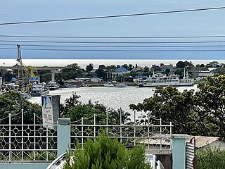
Kigoma District is one of the eight administrative districts of Kigoma Region in Tanzania. The district lies north of the city of Kigoma-Ujiji. Uvinza District, to the west and south of Ujiji, was split off from the Kigoma District in 1 July, 2013.

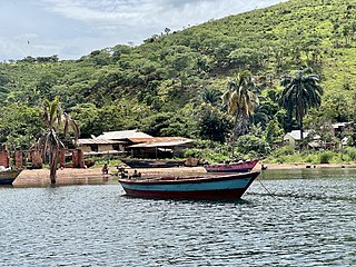
Kagera is an administrative ward in Kigoma-Ujiji District of Kigoma Region in Tanzania. The ward covers an area of 24.3 km2 (9.4 sq mi), and has an average elevation of 786 m (2,579 ft). In 2016 the Tanzania National Bureau of Statistics report there were 9,950 people in the ward, from 9,040 in 2012.

Kasingirima is an administrative ward in Kigoma-Ujiji District of Kigoma Region in Tanzania. The ward covers an area of 0.2 km2 (0.077 sq mi), and has an average elevation of 799 m (2,621 ft). In 2016 the Tanzania National Bureau of Statistics report there were 3,156 people in the ward, from 2,867 in 2012.

Kibirizi is an administrative ward in Kigoma-Ujiji District of Kigoma Region in Tanzania. The ward covers an area of 12.5 km2 (4.8 sq mi), and has an average elevation of 826 m (2,710 ft). In 2016 the Tanzania National Bureau of Statistics report there were 27,675 people in the ward, from 25,143 in 2012.
Kigoma is an administrative ward in Kigoma-Ujiji District of Kigoma Region in Tanzania. The ward covers an area of 4 km2 (1.5 sq mi), and has an average elevation of 789 m (2,589 ft). In 2016 the Tanzania National Bureau of Statistics report there were 7,604 people in the ward, from 6,908 in 2012.

Kitongoni is an administrative ward in Kigoma-Ujiji District of Kigoma Region in Tanzania. The ward covers an area of 1.2 km2 (0.46 sq mi), and has an average elevation of 773 m (2,536 ft). In 2016 the Tanzania National Bureau of Statistics report there were 7,675 people in the ward, from 6,973 in 2012.

Mwanga Kaskazini is an administrative ward in Kigoma-Ujiji District of Kigoma Region in Tanzania. The ward covers an area of 3.7 km2 (1.4 sq mi), and has an average elevation of 803 m (2,635 ft). In 2016 the Tanzania National Bureau of Statistics report there were 26,620 people in the ward, from 24,184 in 2012.

Rusimbi is an administrative ward in Kigoma-Ujiji District of Kigoma Region in Tanzania. The ward covers an area of 0.7 km2 (0.27 sq mi), and has an average elevation of 783 m (2,569 ft). In 2016 the Tanzania National Bureau of Statistics report there were 7,462 people in the ward, from 6,779 in 2012.
Buzebazeba is an administrative ward in Kigoma-Ujiji District of Kigoma Region in Tanzania. The ward covers an area of 7.8 km2 (3.0 sq mi), and has an average elevation of 792 m (2,598 ft). In 2016 the Tanzania National Bureau of Statistics report there were 20,304 people in the ward, from 18,446 in 2012.
Kasimbu is an administrative ward in Kigoma-Ujiji District of Kigoma Region in Tanzania. The ward covers an area of 1.9 km2 (0.73 sq mi), and has an average elevation of 783 m (2,569 ft). In 2016 the Tanzania National Bureau of Statistics report there were 5,405 people in the ward, from 4,910 in 2012.
Katubuka is an administrative ward in Kigoma-Ujiji District of Kigoma Region in Tanzania. The ward covers an area of 3 km2 (1.2 sq mi), and has an average elevation of 814 m (2,671 ft). In 2016 the Tanzania National Bureau of Statistics report there were 27,287 people in the ward, from 24,790 in 2012.
Kipampa is an administrative ward in Kigoma-Ujiji District of Kigoma Region in Tanzania. The ward covers an area of 1.8 km2 (0.69 sq mi), and has an average elevation of 777 m (2,549 ft). In 2016 the Tanzania National Bureau of Statistics report there were 8,714 people in the ward, from 7,917 in 2012.
Machinjioni is an administrative ward in Kigoma-Ujiji District of Kigoma Region in Tanzania. The ward covers an area of 1.1 km2 (0.42 sq mi), and has an average elevation of 839 m (2,753 ft). In 2016 the Tanzania National Bureau of Statistics report there were 3,814 people in the ward, from 3,465 in 2012.
Majengo is an administrative ward in Kigoma-Ujiji District of Kigoma Region in Tanzania. The ward covers an area of 1.1 km2 (0.42 sq mi), and has an average elevation of 784 m (2,572 ft). In 2016 the Tanzania National Bureau of Statistics report there were 4,765 people in the ward, from 4,329 in 2012.
Rubuga is an administrative ward in Kigoma-Ujiji District of Kigoma Region in Tanzania. The ward covers an area of 1.2 km2 (0.46 sq mi), and has an average elevation of 784 m (2,572 ft). In 2016 the Tanzania National Bureau of Statistics report there were 2,899 people in the ward, from 2,634 in 2012.
