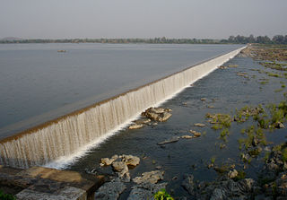
Khammam is the city in Khammam district of the Indian state of Telangana. It is the fourth largest city in the state. It is the headquarters of the Khammam district and Khammam mandal also. It is located about 193 kilometres (120 mi) east of the state capital, Hyderabad, 61 kilometres (38 mi) from Suryapet, 120 kilometres (75 mi) from Warangal and also it is located about 121 kilometres (75 mi) North of the Andhra Pradesh state capital, Amaravathi. The river Munneru flows on the western side of the city. As of 2011 census of India, Khammam urban agglomeration has a population of 313,504. However, on 19 October 2012, the civic body of Khammam was upgraded to a municipal corporation. Post- upgradation to corporation, the population of Khammam was approximated to be 3,07,000.

Anantapur, officially Anantapuramu, is a city in Anantapur district of the Indian state of Andhra Pradesh. It is the mandal headquarters of Anantapuru mandal and also the divisional headquarters of Anantapur revenue division. The city is located on National Highway. It was also the headquarters of the Datta Mandalam in 1799. It was also a position of strategic importance for the British Indian Army during the Second World War.

Khammam district is a district in the eastern region of the Indian state of Telangana. The city of Khammam is the district headquarters. The district shares boundaries with Suryapet, Mahabubabad, Bhadradri districts and with Eluru and NTR districts.

Hanamkonda district, is a district in the Indian state of Telangana. The district headquarters are located at Hanamakonda. The district borders the districts of Jangaon, Karimnagar, Warangal, Bhupalpally and Siddipet.

Proddatur (1915) is a city in the YSR Kadapa District of Andhra Pradesh, located on the banks of the Penna River. The city is a municipality, and also the mandal headquarters of Proddatur mandal. It is the second-largest town in former Kadapa District. It is the oldest municipality which formed before Independence.

Palvancha is a town in Bhadradri district of the Indian state of Telangana. It is located in Palvancha mandal of Kothagudem revenue division.
Sathupalli is a town in Khammam district of the Indian state of Telangana. It is a Municipality in Sathupalli mandal of Kalluru revenue division. It is situated approximately 276 km (171 mi) east of Hyderabad, 80 km (50 mi) from Khammam and 200 km (120 mi) from Warangal. It is about 135 km (84 mi) north of Amaravati, the state capital of Andhra Pradesh, and 126 km (78 mi) west of Rajahmundry.

Penuganchiprolu is a village situated in the NTR district of Andhra Pradesh, India. Serving as the mandal headquarters for Penuganchiprolu mandal, it falls under the administration of the Nandigama revenue division. It is situated 71 kilometers northwest of the district headquarters, Vijayawada, and 50 kilometers south of the nearest city, Khammam.

Pathapatnam is a town in Srikakulam district of the Indian state of Andhra Pradesh. It is located in Pathapatnam mandal of Palakonda revenue division. Pathapatnam is located on the border of Srikakulam district of Andhra Pradesh and Gajapati district of Odisha. Parlakhemundi, the headquarters of Gajapati District, can be considered as twin town of Pathapatnam because of its close proximity. It is located around 65 km from srikakulam. It was the old capital of Paralakhemundi Gajapati Maharajah of his erstwhile kingdom.
Chirunomula is a small village located in Bonakal Mandal of Khammam district, Telangana, India.
Gundala is a mandal of Bhadradri Kothagudem District of Telangana state in India. It is located at and is near the town of Kothagudem. The headquarters of the sub-division are in the village of Gundala. The sub-division has 17 villages under its administration. Markode, Muthapuram and Lingagudem are the other populated regions in the mandal.
Dummugudem is a village in Bhadradri Kothagudem district of the Indian state of Telangana. It is located in Dummugudem mandal of Bhadrachalam revenue division.
Enukuru mandalam is a mandalam in Khammam district of Telangana, India. As per 2011 Census, it has a total population of 33,151 and falls under Kalluru revenue division.
Kusumanchi is a village in Khammam district of Telangana in India. It is the headquarters of Kusumanchi mandal.
Pulicherla mandal is one of the 66 mandals in Chittoor district of the Indian state of Andhra Pradesh.

Warangal district, formerly Warangal Rural district, is a district in the Indian state of Telangana. The district shares boundaries with Mahabubabad, Jangaon, Hanamkonda, Mulugu and Bhupalpally districts.

Bhadradri Kothagudem is a district in the east of the Indian state of Telangana. Kothagudem is the district headquarters. It is the largest district in Telangana, with an area of 7483 km2. It borders the districts Khammam, Mahabubabad, Mulugu, Eluru and East Godavari, and shares a boundary with the bordering states Chhattisgarh and Andhra Pradesh. The district comprises 24 mandals and 2 revenue divisions, Kothagudem and Bhadrachalam.
Suryapet district is a district in the Indian state of Telangana. The city of Suryapet is the district headquarters. The district has three revenue divisions Suryapet, Kodad and Huzurnagar. It is sub-divided into 23 mandals. The district shares boundaries with Nalgonda, Khammam, Yadadri, Jangaon and Mahabubabad districts and with Andhra Pradesh state.
T. Narasapuram Mandal is one of the 28 mandals in Eluru district of the Indian state of Andhra Pradesh. The headquarters are located in T. Narasapuram town. The mandal is bordered by Jangareddygudem Mandal and Jeelugumilli to the north, Kamavarapukota Mandal to the east, Chintalapudi Mandal to the south and Khammam district to the west.

Sathupalli mandal is an administrative division located in the Khammam district of the Indian state of Telangana. It is situated in the Kalluru revenue division. Sathupalli town serves as the headquarters of this mandal.

