
Dahod is a city on the banks of the Dudhimati River in Dahod District in the State of Gujarat, India. It is said that it has taken its name from Saint Dadhichi, who had an Ashram on the bank of Dudhumati river. The city serves as District Headquarters for Dahod District. It is 214 kilometres (133 mi) from Ahmedabad and 159 kilometres (99 mi) from Vadodara. It is also known as Dohad.

Mehsana, also spelled Mahesana, is a city and municipality in Mehsana district, in the Indian state of Gujarat. Established in 14th century, the city was under Gaekwads of Baroda State from 18th century to the independence of India in 1947. The municipality was established in 1919–20. The town has population of about 185,000. Dairy, oil and natural gas are major industries while there are several small and medium enterprises in the city.
Banaskantha district is one of the thirty-three districts of the Gujarat state of India. The administrative headquarters of the district is at Palanpur which is also its largest city. The district is located in the Northeast of Gujarat and is presumably named after the West Banas River which runs through the valley between Mount Abu and Aravalli Range, flowing to the plains of Gujarat in this region and towards the Rann of Kutch. The district is famous for the Ambaji temple which draws many tourists. It covers an area of 12703 km2 and is the second largest district in the state.
Valsad, historically known as Bulsar, is a city and a municipality in Valsad district of the Indian state of Gujarat. It is the district headquarters of Valsad district. The city of Valsad is located in the south of Navsari and Surat.
Modasa is a town and a municipality in Aravalli district in the Indian state of Gujarat. Modasa was named after the Bhil chieftain Malaji Bhil, who ruled in Modasa during 1466.

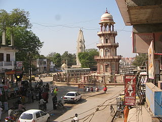
Palanpur is a city and a municipality of Banaskantha district in the Indian state of Gujarat. Palanpur is the administrative headquarters of Banaskantha district. Palanpur is the ancestral home to an industry of Indian diamond merchants.

Gandhinagar district is an administrative division of Gujarat, India, whose headquarters are at Gandhinagar, the state capital. It was organized in 1964.
Radhanpur is a town and a municipality in Patan district in the Indian state of Gujarat.
Navapur is a Nagar Parishad (municipality) and headquarters for Navapur Taluka in Nandurbar district, in the state of Maharashtra, India.
Arimalam is a Town Panchayath in the district of Pudukkottai, in the state of Tamil Nadu, India.
Dhrol is a city and a municipality in Jamnagar district in the state of Gujarat, India.

Gajapathinagaram is a census town in Vizianagaram district of the Indian state of Andhra Pradesh. It is located in Gajapathinagaram mandal of Vizianagaram revenue division. It is located on National Highway 26 between Vizianagaram and Ramabhadrapuram.
Ghatlodiya is an area in Ahmedabad in the state of Gujarat, in western India.
Halol is a city and a municipality (tehsil) in Panchmahal district in the Indian state of Gujarat. Located in western India, it has an average elevation of 499 metres (1637 feet). Halol is a major manufacturing hub of Western India, home to manufacturing facilities of numerous domestic and multinational companies like MG Motor India, Siemens Gamesa, JCB India, Hero Motocorp, Sun Pharma, TOTO India, CEAT Tyres, LM Wind Power, Polycab India, etc.
Hnahthial is the headquarters of Hnahthial district in the Indian state of Mizoram. The term Hnahthial is a Mizo term which means Phrynium capitatum, a plant which grows in plenty in Hnahthial.
Jafrabad is a town and a nagarpalika in Amreli District in the Indian state of Gujarat.
Mahemdavad is a town with municipality in the Kheda district in the Indian state of Gujarat. Mahemdavad is situated on the Vatrak River bank. The nearest city is Kheda. It is 30 km from largest city of Gujarat, Ahmedabad.
Mangrol is a town and a minor port in Junagadh district in the state of Gujarat, western India. It was formerly the seat of the princely state of Mangrol. Pin code of Mangrol is 362225.
Daman is the capital city of the Indian union territory of Dadra and Nagar Haveli and Daman and Diu. It is a municipal council situated in the Daman district of the union territory.
Unava is a village located near Unjha, in Mehsana district of Gujarat, India. It is on the SH41 (Mehsana-Palanpur). Unava is about 40 km from Palanpur if visitor is coming via Rajasthan and 90 km from Ahmedabad via Maharashtra route.

