
A wetland is a distinct ecosystem that is flooded by water, either permanently or seasonally. Flooding results in oxygen-free (anoxic) processes prevailing, especially in the soils. The primary factor that distinguishes wetlands from terrestrial land forms or water bodies is the characteristic vegetation of aquatic plants, adapted to the unique anoxic hydric soils. Wetlands are considered among the most biologically diverse of all ecosystems, serving as home to a wide range of plant and animal species. Methods for assessing wetland functions, wetland ecological health, and general wetland condition have been developed for many regions of the world. These methods have contributed to wetland conservation partly by raising public awareness of the functions some wetlands provide.

A marsh is a wetland that is dominated by herbaceous rather than woody plant species. Marshes can often be found at the edges of lakes and streams, where they form a transition between the aquatic and terrestrial ecosystems. They are often dominated by grasses, rushes or reeds. If woody plants are present they tend to be low-growing shrubs, and then sometimes called carrs. This form of vegetation is what differentiates marshes from other types of wetland such as swamps, which are dominated by trees, and mires, which are wetlands that have accumulated deposits of acidic peat.

Haliburton is a county of Ontario, Canada, known as a tourist and cottage area in Central Ontario for its scenery and for its resident artists. Minden Hills is the county seat. Haliburton County and the village of Haliburton are named after Thomas Chandler Haliburton, author, statesman, and the first chairman of the Canadian Land and Emigration Company.
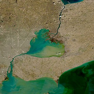
The St. Clair River is a 40.5-mile-long (65.2 km) river in central North America which flows from Lake Huron into Lake St. Clair, forming part of the international boundary between the Canadian province of Ontario and the United States at Michigan. The river is a significant component in the Great Lakes Waterway, whose shipping channels permit cargo vessels to travel between the upper and lower Great Lakes.

The Qu'Appelle River is a river in the Canadian provinces of Saskatchewan and Manitoba that flows 430 kilometres (270 mi) east from Lake Diefenbaker in south-western Saskatchewan to join the Assiniboine River in Manitoba, just south of Lake of the Prairies, near the village of St. Lazare. It is located in a region called the Prairie Pothole Region of North America, which extends throughout three Canadian provinces and five U.S. states. It is also within Palliser's Triangle and the Great Plains ecoregion.

Minden Hills is a township in and the county seat of Haliburton County, Ontario, Canada. It is an amalgam of the townships of Snowdon, Lutterworth, Anson, Hindon and Minden. It is usually referred to as Minden, after its largest community.
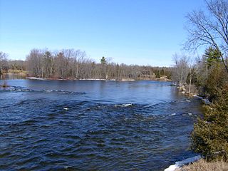
The Crowe River is a river in the counties of Haliburton, Hastings, Northumberland and Peterborough in southern Ontario, Canada. It is in the Lake Ontario drainage basin and is a tributary of the Trent River.

An aquatic ecosystem is an ecosystem in and surrounding a body of water, in contrast to land-based terrestrial ecosystems. Aquatic ecosystems contain communities of organisms that are dependent on each other and on their environment. The two main types of aquatic ecosystems are marine ecosystems and freshwater ecosystems. Freshwater ecosystems may be lentic ; lotic ; and wetlands.
Sparrow Lake is a lake in the Great Lakes Basin in Central Ontario, Canada. It is situated north-west of the town of Orillia and south of the town of Gravenhurst, Ontario and approximately 150 kilometres and a 1.5 hour drive north of the Greater Toronto Area. Sparrow Lake is the most southerly lake in the popular Muskoka tourist region.

Kennisis Lake is the 2nd largest lake in the Haliburton Highlands with a surface area of over 1,640 hectares in the area of Ontario just south west of Algonquin Provincial Park. From end to end, the lake is approximately 23 kilometres (14 mi) long. There is a smaller counterpart, named Little Kennisis Lake.
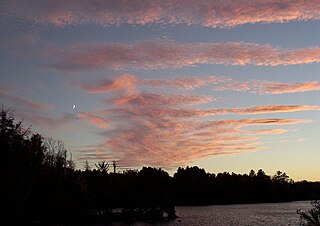
Paudash Lake is a lake in south central Ontario southwest of Bancroft along Highway 28. The lake is located just north of Silent Lake Provincial Park in Haliburton County, 27 km (17 mi) south of the panhandle of Algonquin Provincial Park. The nearest communities to Paudash Lake are the village of Cardiff, close to the lake's Inlet Bay, and the hamlet of Paudash to the northeast of Lower Paudash Lake. Actually two lakes, 'Paudash' and 'Lower Paudash', the lakes are located on the Crowe River, near its head waters, which flows into the Trent River at Crowe Bay north of Campbellford.
Watershed management is the study of the relevant characteristics of a watershed aimed at the sustainable distribution of its resources and the process of creating and implementing plans, programs and projects to sustain and enhance watershed functions that affect the plant, animal, and human communities within the watershed boundary. Features of a watershed that agencies seek to manage to include water supply, water quality, drainage, stormwater runoff, water rights and the overall planning and utilization of watersheds. Landowners, land use agencies, stormwater management experts, environmental specialists, water use surveyors and communities all play an integral part in watershed management.
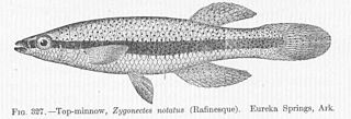
The blackstripe topminnow, Fundulus notatus, is a small freshwater fish in the family Fundulidae, found in central North America.
Mississippi Lake is a lake in Lanark County in Ontario, Canada. Ontario's Mississippi River flows northeast and north through the lake. Several small creeks including Cranberry Creek, McCrearys Creek, and McGibbon Creek drain into the lake from adjoining forest and agricultural land. The lake is distinctive for having one side that is part of the Canadian shield, while the other is mostly limestone. The lake is a remnant of the old Champlain Sea, which flooded eastern Ontario at the end of last ice age. The former shoreline of the sea can still be traced inland from the north shore of the lake.

The Gull River is a river in Algonquin Highlands and Dysart et al, Haliburton County and the single-tier municipality of Kawartha Lakes in south-central Ontario, Canada. It is in the Trent River and Lake Ontario drainage basins, and flows from southern Algonquin Provincial Park to Balsam Lake on the Trent–Severn Waterway.

Head Lake is a lake in the village of Haliburton, in Haliburton County, Ontario, Canada. Haliburton Village is in south central Ontario, about 25 km (15 mi) east of the village of Minden and approximately 50 km (31 mi) south-west of the panhandle of Algonquin Park. From Ontario's largest city, Toronto, it is just over 200 km (124 mi) to Haliburton, and from the national capital of Ottawa, it is about 300 km (186 mi).
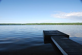
Boshkung Lake, also known by its historic name Lake Boshkung, or affectionately as 'Big Boshkung', is a lake in the township of Algonquin Highlands, Haliburton County in Central Ontario, Canada. It is located near Buttermilk Falls and has been a common cottage and recreation destination with a rich history that includes: logging, camping, and even some farming activities.

The San Dieguito River is a major river in Southern California, United States. Its headwaters rise on the southern slope of the Volcan Mountains in San Diego County and the river flows generally southwest for 23.8 miles (38.3 km), draining 346 square miles (900 km2) before emptying into the Pacific Ocean 20 miles (32 km) north of San Diego.
The Drag River is a river in the municipalities of Minden Hills and Dysart et al in Haliburton County, Southern Ontario, Canada. It is in the Great Lakes Basin and is a right tributary of the Burnt River.
Grass Lake is a lake in Haliburton County, Ontario, Canada. It is in the "cottage country" area of central Ontario and has many cottages along its shores. It is connected to Head Lake in the east and Kashagawigamog Lake to the west. Like other lakes in the five lake chain, Grass Lake is essentially a widening of the Drag River, which flows from Drag Lake into the chain of lakes at Head Lake and out again at Canning Lake where a dam is controlled by the Trent–Severn Waterway.


