Nichinan is a city in Miyazaki Prefecture, Japan. As of 1 May 2023, the city had an estimated population of 47,872 in 21482 households, and a population density of 89 persons per km². The total area of the city is 536.11 km2 (206.99 sq mi).
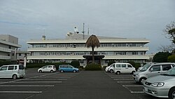
Hyūga is a city in Miyazaki Prefecture, Japan. As of 1 October 2023, the city had an estimated population of 57,746, and a population density of 170 persons per km²., making it the 4th largest city in Miyazaki Prefecture in terms of population. The total area of the city is 336.94 km2 (130.09 sq mi).Hyūga is a port city known for the production of Go stones and for beaches, many of which are popular surfing spots.

Kushima is a city located in Miyazaki Prefecture, Japan. As of 1 November 2023, the city had an estimated population of 15,623 in 6950 households, and a population density of 53 persons per km². The total area of the city is 295.16 km2 (113.96 sq mi).

Saito is a city located in Miyazaki Prefecture, Japan. As of 1 November 2023, the city had an estimated population of 28,538 in 13964 households, and a population density of 65 persons per km2. The total area of the city is 438.79 km2 (169.42 sq mi).

Takaharu is a town located in Nishimorokata District, Miyazaki Prefecture, Japan. As of 1 November 2023, the town had an estimated population of 8137 in 3648 households, and a population density of 101.3 persons per km2. The total area of the town is 85.39 km2 (32.97 sq mi).

Kunitomi is a town located in Higashimorokata District, Miyazaki Prefecture, Japan. As of 1 October 2023, the town had an estimated population of 17,757 in 7481 households, and a population density of 140 persons per km². The total area of the town is 130.63 square kilometres (50.44 sq mi).

Shintomi is a town located in Koyu District, Miyazaki Prefecture, Japan. As of 1 October 2023, the town had an estimated population of 16,117 in 6593 households, and a population density of 260 persons per km2. The total area of the town is 61.53 square kilometres (23.76 sq mi).

Nishimera is a village located in Koyu District, Miyazaki Prefecture, Japan. As of 1 October 2023, the village had an estimated population of 1,040 in 533 households, and a population density of 3.8 persons per km2. The total area of the village is 271.51 square kilometres (104.83 sq mi).

Kijō is a town located in Koyu District, Miyazaki Prefecture, Japan. As of 1 October 2023, the town has an estimated population of 4,642 in 1857 households, and a population density of 32 persons per km2. The total area of the town is 145.96 square kilometres (56.36 sq mi).

Tsuno is a town located in Koyu District, Miyazaki Prefecture, Japan. As of 1 October 2023, the town has an estimated population of 9,577 in 3997 households, and a population density of 94 persons per km². The total area of the town is 145.96 square kilometres (56.36 sq mi).

Koyu is a district in Miyazaki Prefecture, Japan.

Takanabe is a town located in Koyu District, Miyazaki Prefecture, Kyushu, Japan. As of 1 October 2023, the town had an estimated population of 19242 in 8650 households, and a population density of 160 persons per km2. The total area of the town is 43.80 square kilometres (16.91 sq mi).

Kadogawa is a town located in Higashiusuki District, Miyazaki Prefecture, Japan. As of 1 October 2023, the town has an estimated population of 16,760 in 6887 households and a population density of 140 persons per km2. The total area of the town is 120.52 square kilometres (46.53 sq mi).

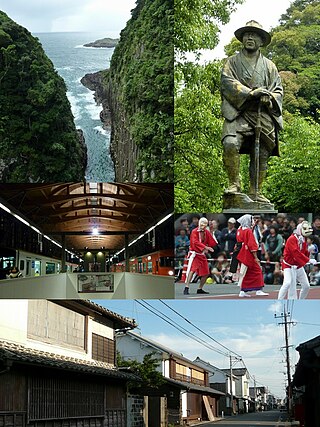
Takachiho is a town in Nishiusuki District, Miyazaki Prefecture, Japan. As of 1 October 2023, the town has an estimated population of 11,065 in 4865 households, and a population density of 47 persons per km2. The total area of the town is 237.54 square kilometres (91.71 sq mi).

Hinokage is a town located in Nishiusuki District, Miyazaki Prefecture, Japan. As of 1 October 2023, the town has an estimated population of 3260 in 1400 households, and a population density of 12 persons per km2. The total area of the town is 277.67 square kilometres (107.21 sq mi). Located next to the religio-historically significant town of Takachiho, Hinokage is known primarily for its three large bridges, traditional Kagura dances, and the work of Kazuo Hiroshima, a traditional weaver of bamboo baskets.

Gokase is a town in Nishiusuki District, Miyazaki Prefecture, Japan. As of 30 September 2023, the town has an estimated population of 3400 in 1504 households and a population density of 20 persons per km2. The total area of the town is 171.73 square kilometres (66.31 sq mi).

Miyakonojō is a city in Miyazaki Prefecture, Japan. As of 1 November 2023, the city had an estimated population of 158,235 in 72394 households, and a population density of 240 persons per km2. The total area of the city is 653.36 km2 (252.26 sq mi), making it the largest city in the prefecture in terms of area.

Nobeoka is a city located in the north of Miyazaki Prefecture, Japan. As of 1 October 2023, the city had an estimated population of 113,367 in 51272 households, and a population density of 130 persons per km². The total area of the city is 868.02 km2 (335.14 sq mi).

Misato is a town located in Higashiusuki District, Miyazaki Prefecture, Japan. As of 31 August 2023, the town has an estimated population of 4297 in 2020 households, and a population density of 9.8 persons per km². The total area of the town is 448.84 square kilometres (173.30 sq mi)..
This is an outline of the history of Miyazaki Prefecture.