
Panchkula district was formed as the 17th district of the Indian state of Haryana on 15 August 1995. It comprises two sub divisions and two tehsils: Panchkula and Kalka. It has 264 villages, out of which 12 are uninhabited and ten wholly merged with towns or treated as census towns according to the 1991 census. There are five towns in the district: Barwala, Kalka, Panchkula, Pinjore and Raipur Rani. The total population of the district is 319,398 out of which 173,557 are males and 145,841 are females.

Chamba district is the northwestern district of Himachal Pradesh, in India, with its headquarters in Chamba town. The towns of Dalhousie, Khajjhiar and Churah Valley are popular hill stations and vacation spots for the people from the plains of northern India.

Qadian is a city and a municipal council in Gurdaspur district, north-east of Amritsar, situated 18 kilometres (11 mi) north-east of Batala city in the state of Punjab, India. Qadian is the birthplace of Mirza Ghulam Ahmad, the founder of the Ahmadiyya movement within Islam. It remained the headquarters of the Ahmadiyya movement until the Partition of India in 1947.

Jindo district is one of the 22 districts of Haryana state in northern India. Jind town is the administrative headquarters of the district. It is part of Hisar Division and was created in 1966.

Una is a City and a Municipal Council in Una district in the Indian state of Himachal Pradesh. It serves as the headquarters of Una district. There are 11 wards under Municipal Council. Una City is home to the Kila, which is a historical fort and an ancestral home of the descendants of the first guru of the Sikhs, Guru Nanak.

Ambala district is one of the 22 districts of Haryana state in the country of India with Ambala town serving as the administrative headquarters of the district. District Ambala lies on the North-Eastern edge of Haryana and borders Punjab and Himachal Pradesh. Ambala district is a part of Ambala Division.
Kalanaur is a tehsil in Gurdaspur District of Punjab state in India. It is located 25 km towards west from District headquarters Gurdaspur. This historical town is situated on newly constructed National Highway 354. The town has historical significance as Mughal Emperor Akbar, was enthroned in a garden near the Kalanaur by Bairam Khan. It was first established as a Principality by Prince Nakhashena, a brother of King Janamejaya, which was further ruled by his descendants known as Jarral Rajputs. Jarral rule in Kalanaur lasted for 350 Years.
Dhanaula is a city and a municipal council in Barnala district in the state of Punjab, India. Situated 18 km west of Sangrur, Ranjit kaur Sodhi w/o Harwinder singh Sodhi is president of nagar council Dhanaula lies on the Sangrur-Barnala road. It is about 12 km from Barnala. Dhanaula was founded by Gurditta, eldest son of Taloka, in 1718. It was the capital of the erstwhile Princely State of Nabha until 1755 when Raja Hamir Singh founded Nabha town and made it the capital of the state. He also built a fort which now houses the police station of Dhanaula. A temple of Hanuman exists here. It is said that a man was digging a ditch and found an idol of Hanuman. A temple was constructed at that place, the idol was placed there, and the people began to worship it. Dhanaula is a town of temples.

Rupnagar is a city and a municipal council in Rupnagar district in the Indian state of Punjab. Rupnagar is a newly created fifth Divisional Headquarters of Punjab comprising Rupnagar, Mohali, and its adjoining districts. It is also one of the bigger sites belonging to the Indus Valley civilization. Rupnagar is nearly 43 km (27 mi) to the northwest of Chandigarh. It is bordered by Himachal Pradesh to the north and Shahid Bhagat Singh Nagar district to its west.

Baddi is an industrial town and Nagar parishad, near Solan City in the southwestern Solan district of Himachal Pradesh, India. The town lies on the border of Himachal Pradesh, Punjab and Haryana states in the Shivalik Hills, around 35 kilometres west of Solan City. Baddi is largest pharmaceutical hub of Asia.

Ludhiana district is one of the 23 districts in the Indian state of Punjab. It is Punjab's largest district by both area and population. Ludhiana, the largest city in Punjab, is the district headquarters.

Shaheed Bhagat Singh Nagar district is one of twenty-three districts of state of Punjab, India. It is located in Doaba region. It consists of three subdivisions, Nawanshahr, Banga, and Balachaur. There are three legislative seats in the district, Nawanshahr, Balachaur and Banga. They fall under the Anandpur Sahib Lok Sabha Constituency. Nawanshahr, the district headquarters is about 92 kilometres (57 mi) from Chandigarh, the state's capital.
Ajnala is a town, near Amritsar city and a nagar panchayat in Amritsar district in the state of Punjab, India. Kalian Wala Khuh, a martyrs place, is a tourist destination.
Dasuya (Dasua) is a town and a municipal council in Hoshiarpur district in the state of Punjab, India. It is one of the major subdivisions with 398 villages under its jurisdiction. This town has a great historical and mythological importance.
Gagret is a nagar panchayat in Tehsil Ghanari of Una district in the state of Himachal Pradesh, India. It is situated in plains of Jaswan valley of Una.
Kharar is a town and a municipal council in Mohali district in the state of Punjab, India. It is nearby Mohali city. Kharar is located at 30.74°N 76.65°E and has an average elevation of 309 metres (1,014 feet). The area of Kharar is part of the "Greater Mohali" region.
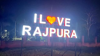
Rajpura is a city in Patiala district in the Indian state of Punjab, India, situated along the border of the Indian state of Haryana. It is located 26 KM Patiala city, towards East from District Head Quarter. It is Tehsil Head Quarter. Rajpura is the largest tehsil of the district.

Samrala is a city and a municipal council in Ludhiana district in the Indian state of Punjab. It is about 35 km east of the district headquarters Ludhiana, on the highway to Chandigarh. Samrala is a Class III Municipality. It is also known for the oldest tehsil situated in this city. It is also believed that the name Samrala came from the name of two brothers Sama and Rala.
Khant is a small village in the Khamanon tehsil of Fatehgarh Sahib district in Punjab, India. Maanpur is just 0.6 km away in the east so they often called Khant Maanpur, together. A noted Punjabi singer-songwriter and actor, Babbu Maan, belongs to the village.
Apra also known as The Golden City Apra is a census town in Phillaur Tehsil in Jalandhar district of Punjab State, India. The town is known for gold jewelry and paddy crops which are produced in large amounts. It is located 46 kilometres (29 mi) towards East from Jalandhar, 12 kilometres (7.5 mi) from Phillaur and 110 kilometres (68 mi) from Chandigarh. Apra is the largest town as compared to other surrounding villages and has the main marketplace. The town is administrated by Sarpanch an elected representative of the village.

