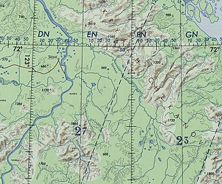
The Tatta is a river in the Sakha Republic (Yakutia), Russia, a left tributary of the Aldan, part of the Lena basin.

The Derba, also known as Derbe or Dzherba, is a river in Yakutia, Russia. It is a tributary of the Lena with a length of 299 kilometres (186 mi) —320 kilometres (200 mi) counting the Mas-Turukhtaakh at its head— and a drainage basin area of 8,780 square kilometres (3,390 sq mi).

The Lungkha is a river in Yakutia, Russia. It is the 14th longest tributary of the Lena with a length of 508 kilometres (316 mi) —533 kilometres (331 mi) counting its Yychaky tributary. Its drainage basin area is 10,300 square kilometres (4,000 sq mi).

The Namana is a river in Yakutia, Russia. It is the 17th longest tributary of the Lena with a length of 444 kilometres (276 mi). Its drainage basin area is 16,900 square kilometres (6,500 sq mi).

The Sitte is a river in Yakutia, Russia. It is a left tributary of the Lena with a length of 431 kilometres (268 mi). Its drainage basin area is 8,250 square kilometres (3,190 sq mi).

The Tyugyuene is a river in Yakutia, Russia. It is a tributary of the Lena with a length of 492 kilometres (306 mi) and a drainage basin area of 8,740 square kilometres (3,370 sq mi). The river marks the border between Gorny and Kobyaysky Districts in a stretch of its middle course.

The Kenkeme is a river in Yakutia, Russia. It is a tributary of the Lena with a length of 589 kilometres (366 mi) —627 kilometres (390 mi) together with the Yagas-Yyaabyt at its head— and a drainage basin area of 10,000 square kilometres (3,900 sq mi).

The Motorchuna is a river in Yakutia, Russia. It is a left tributary of the Lena with a length of 423 kilometres (263 mi). Its drainage basin area is 9,250 square kilometres (3,570 sq mi). Since its river basin is uninhabited, the Motorchuna is one of the most untouched rivers in Yakutia; the waters are clean and there is abundant wildlife.

The Syungyude is a river in the Sakha Republic (Yakutia), Russia. It is the largest tributary of the Molodo, of the Lena basin. Its length is 466 kilometres (290 mi) and the area of its basin 9,550 square kilometres (3,690 sq mi).

The Eyekit is a river in the Sakha Republic (Yakutia), Russia. It is a left tributary of the Lena. Its length is 313 kilometres (194 mi) from the sources of the Buor Eyekit. The area of its basin including the latter is 8,740 square kilometres (3,370 sq mi).

The Tympylykan is a river in the Sakha Republic (Yakutia), Russia. It is a left tributary of the Lena. Its length is 357 kilometres (222 mi) and the area of its basin is 5,130 square kilometres (1,980 sq mi).

The Khoruongka is a river in the Sakha Republic (Yakutia), Russia. It is a left tributary of the Lena. Its length is 377 kilometres (234 mi) and the area of its basin is 8,330 square kilometres (3,220 sq mi). The Khoruongka flows across Zhigansky District, not far to the west of Zhigansk town.

The Menda is a river in Yakutia, Russia. It is a tributary of the Lena with a length of 168 kilometres (104 mi) and a drainage basin area of 2,370 square kilometres (920 sq mi).

The Ura, also known as Kamenka and Uksakan, is a river in Yakutia, Russia. It is a tributary of the Lena with a length of 181 kilometres (112 mi) and a drainage basin area of 2,830 square kilometres (1,090 sq mi).

The Biryuk is a river in Yakutia, Russia. It is a tributary of the Lena with a length of 267 kilometres (166 mi) and a drainage basin area of 9,710 square kilometres (3,750 sq mi).

The Cherendey is a river in Yakutia, Russia. It is a tributary of the Lena with a length of 226 kilometres (140 mi) and a drainage basin area of 2,910 square kilometres (1,120 sq mi).

The Nuora, also known as Strekalovka is a river in Yakutia, Russia. It is a left tributary of the Lena with a length of 69 kilometres (43 mi). Its drainage basin area is 1,110 square kilometres (430 sq mi).

The Kelimyar is a river in Yakutia, Russia. It is a tributary of the Olenyok with a length of 254 kilometres (158 mi) and a drainage basin area of 4,050 square kilometres (1,560 sq mi).

The Khatyng-Yuryakh is a river in Yakutia, Russia. It is the longest tributary of the Lungkha, of the Lena basin. Its length is 315 kilometres (196 mi) and its drainage basin area 2,570 square kilometres (990 sq mi).

The Kyuelenke is a river in Yakutia, Russia. It is a left tributary of the Lena with a length of 211 kilometres (131 mi). Its drainage basin area is 4,090 square kilometres (1,580 sq mi).


