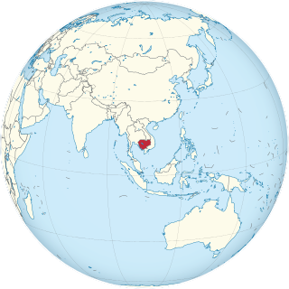
Cambodia is a country in mainland Southeast Asia, bordering Thailand, Laos, Vietnam, the Gulf of Thailand and covers a total area of 181,035 km2 (69,898 sq mi). The country is situated in its entirety inside the tropical Indomalayan realm and the Indochina Time zone (ICT).

Thailand is in the middle of mainland Southeast Asia. It has a total size of 513,120 km2 (198,120 sq mi) which is the 50th largest in the world. The land border is 4,863 km (3,022 mi) long with Myanmar, Cambodia, Laos and Malaysia. The nation's axial position influenced many aspects of Thailand's society and culture. It controls the only land route from Asia to Malaysia and Singapore. It has an exclusive economic zone of 299,397 km2 (115,598 sq mi).
Trat is one of seventy-seven provinces (changwat) located in eastern Thailand the easternmost region along the Thai coast. It has borders with Chanthaburi Province to the northwest, Cambodia to the east, and the Gulf of Thailand to the south. Trat is 315 km from Bangkok.

Hat Yai is a city in southern Thailand near the Malaysian border. Located at 7°1′N100°28′E, it is 946 km (588 mi) south of Bangkok, and has a population of 156,802 (2019) in the city itself and about 800,000 in the greater Hat Yai area. Hat Yai is the largest city of Songkhla Province, the largest metropolitan area in the south, and the third largest metropolitan area of the country. It is often mistaken for being the provincial capital. In fact, Songkhla is the capital and the center of administration and culture while Hat Yai is the business center.

Thesaban nakhon Trang, City of Trang, or Trang, also called Mueang Thap Thiang (เมืองทับเที่ยง), is a thesaban nakhon and the capital of Trang Province, Thailand. The city has a population of 59,637 (2005) and covers the whole tambon Thap Thiang of Mueang Trang district. Trang is 839 km south of Bangkok.

Songkhla, also known as Singgora or Singora, is a city in Songkhla Province of southern Thailand, near the border with Malaysia. As of 2006 it had a population of 75,048. Songkhla lies 968 km (601 mi) south of Bangkok.

Chaiyaphum is a town in northeastern Thailand, capital of Chaiyaphum Province. As of 2015 it had a population of 58,350, and covers the full tambon Nai Mueang of Mueang Chaiyaphum District. Chaiyaphum is 337 road kilometres northeast of Bangkok.

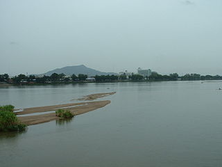
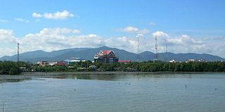
Chanthaburi is a town in the east of Thailand, on the banks of the Chanthaburi River. It is the capital of the Chanthaburi Province and the Mueang Chanthaburi District.

Phetchabun is a town in Thailand, capital of Phetchabun Province. It covers the tambon Nai Mueang of the Phetchabun District, along the Pa Sak River. As of 2005, it had a population of 23,823. Phetchabun lies 340 km (210 mi) north of Bangkok.

Prachuap Khiri Khan is a town in southern Thailand. It is the capital of Prachuap Khiri Khan Province and is on the coast at one of the narrowest stretches in Thailand, only 10 kilometres (6.2 mi) from the border with Myanmar at Dan Sing Khon in the Tenasserim Hills. The area has large pineapple and coconut industries, in addition to being popular with Thai tourists. The town is 291 km south of Bangkok by road.
Tak is a town in north-west Thailand, capital of the Tak Province and the Tak district. As of 2005 the town had a population of 19,900 and an area of 7.27 km². It covers the tambon Rahaeng, Nong Luang, Chiang Ngoen, and Hua Diat. It is on the Ping River, 418 km north-north-west of Bangkok.
Narathiwat is a town in southern Thailand and capital of Narathiwat Province. The town is in the Mueang Narathiwat District and was established in 1936. As of 2008, the population was 40,521. It lies 1,141 km south of Bangkok.
Chumphon is a town in southern Thailand, capital of the Chumphon Province and Mueang Chumphon District. The city is about 463 kilometers from Bangkok. As of 2005 it had a population of 33,522. The town covers the commune (tambon) Tha Taphao completely and parts of tambons Bang Mak, Wang Phai, Na Thung, Tak Daet, and Khun Krathing. Its main economic activity is agriculture.

Khlong Yai is a district (amphoe) of Trat Province, eastern Thailand. A border crossing into Cambodia is at Hat Lek, known as the Cham Yeam crossing in Koh Kong Province of Cambodia. The nearest Cambodian city is Koh Kong. Thailand Route 3 ends at the Cambodian border in this district.

Aranyaprathet is a town in Sa Kaeo Province in eastern Thailand. It covers the entire tambon of Aranyaprathet, in Aranyaprathet District. As of 2005, the town has 16,937 inhabitants. It is located just 6 kilometres (3.7 mi) from the border with Cambodia; the town of Poipet is on the other side of the border. On the Thai side of the border is the huge Rongkluea market. Cambodian people cross the border daily with pushcarts and scooters with side cars loaded with their products. A significant part of the trade is in second hand clothes. Just over the border on the Cambodian side there are casinos. These are visited by many Thai people because gambling is prohibited in Thailand. Special free buses run between Bangkok and these casinos. Cambodians themselves are not allowed to gamble in these border casinos.

Ko Lanta District is a district (amphoe) in Krabi Province, Thailand.

Mueang Trat is the capital district of Trat Province, eastern Thailand.
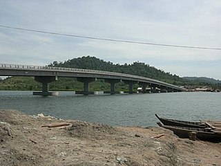
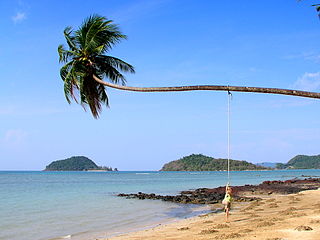
Khemarak Phoumin, also Koh Kong, is the capital and largest city of Koh Kong Province in Cambodia. It is near the mouth of the Kah Bpow river in Smach Mean Chey District on the Gulf of Thailand. The city lies only 10 kilometres from the Thai border. It is 138 kilometres by Highway 48 to National Highway 4 at Sre Ambel and a further 133 kilometres to Phnom Penh. After completion of the bridges on Highway 48 in 2010 the land link to Phnom Penh and Sihanoukville has significantly improved.
Chonburi is the capital of Chonburi Province and Mueang Chonburi District in Thailand. It is about 100 km southeast of Bangkok, on the coast of the Gulf of Thailand. Its name means 'city of water'. Chonburi, along with other areas along the coast to Pattaya, forms a conurbation known as the Pattaya-Chonburi Metropolitan Area.

Nakhon Sawan is a city in Thailand, the name literally means "Heavenly City". The city is the capital of Nakhon Sawan Province, and covers the complete subdistrict (tambon) Pak Nam Pho and parts of Khwae Yai, Nakhon Sawan Tok, Nakhon Sawan Ok and Wat Sai, all of Mueang Nakhon Sawan district. As of 31 December 2020, it has a population of 82,305. Nakhon Sawan is 238 km north of Bangkok.
