
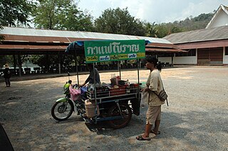
Chiang Rai is the northernmost major city in Thailand, with a population of about 200,000 people. It is located in Mueang Chiang Rai District, Chiang Rai Province. Chiang Rai was established as a capital city in the reign of King Mangrai, in 1262 CE.

Kanchanaburi is a town municipality in Kanchanaburi Province, Thailand. The town of lies to the southeast of Erawan National Park within Kanchanaburi Province, approximately 120km west of Bangkok. In 2006 it had a population of 31,327. That number was reduced to 25,651 in 2017. The town covers tambons Ban Nuea and Ban Tai and parts of Pak Phraek and Tha Makham, all of Mueang Kanchanaburi District, and parts of tambon Tha Lo of Tha Muang District.
Kalasin is a town in northeast Thailand, the capital of Kalasin Province. As of 2015, it has a population of 34,429 It covers the whole tambon Kalasin of the Mueang Kalasin District, an area of 16.96 km2 (6.55 sq mi). Kalasin lies 513 kilometres (319 mi) north-northeast of Bangkok by road.
Ranong is one of Thailand's southern provinces (changwat), on the west coast along the Andaman Sea. It has the fewest inhabitants of all Thai provinces. provinces neighboring Ranong are (clockwise) Chumphon, Surat Thani, and Phang Nga. To the west, it borders Kawthaung, Tanintharyi, Myanmar.

Thesaban nakhon Trang, City of Trang, or Trang, also called Mueang Thap Thiang (เมืองทับเที่ยง), is a thesaban nakhon and the capital of Trang Province, Thailand. The city has a population of 59,637 (2005) and covers the whole tambon Thap Thiang of Mueang Trang district. Trang is 839 km south of Bangkok.

Chaiyaphum is a town in northeastern Thailand, capital of Chaiyaphum Province. As of 2015 it had a population of 58,350, and covers the full tambon Nai Mueang of Mueang Chaiyaphum District. Chaiyaphum is 337 road kilometres northeast of Bangkok.

Phetchabun is a town in Thailand, capital of Phetchabun Province. It covers the tambon Nai Mueang of the Phetchabun District, along the Pa Sak River. As of 2005, it had a population of 23,823. Phetchabun lies 340 km (210 mi) north of Bangkok.

Suphan Buri is a town in central Thailand. It covers tambon Tha Philiang and parts of tambons Rua Yai and Tha Rahat, all within the Mueang Suphan Buri District. As of 2006 it had a population of 26,656. The town is 101 km north-northwest of Bangkok.

Sakon Nakhon is a city in Thailand within the Isan region, and capital city of Sakon Nakhon Province as well as Mueang Sakon Nakhon District, with a population of approximately 76,000. Sakon Nakhon covers the whole tambon of That Choeng Chum and parts of tambons Ngio Don, Huai Yang, Dong Mafai, That Na Weng and Hang Hong. Sakon Nakhon is 651 km (405 mi) north-east of Bangkok by road.

Prachuap Khiri Khan is a town in western Thailand. It is the capital of Prachuap Khiri Khan Province and is on the coast at one of the narrowest stretches in Thailand, only 10 kilometres (6.2 mi) from the border with Myanmar at Dan Sing Khon in the Tenasserim Hills. The area has large pineapple and coconut industries, in addition to being popular with Thai tourists. The town is 291 km south of Bangkok by road.
Tak is a town in north-west Thailand, capital of the Tak Province and the Tak district. As of 2005 the town had a population of 19,900 and an area of 7.27 km2. It covers the tambon Rahaeng, Nong Luang, Chiang Ngoen, and Hua Diat. It is on the Ping River, 418 km north-north-west of Bangkok.

Mae Hong Son is a town in north-west Thailand, capital of Mae Hong Son Province. It is in the Shan Hills, near the border with Burma along the banks of the River Pai. As of 2018, the town had 7,066 inhabitants. The town covers the tambon Chong Kham of the Mueang Mae Hong Son district. Mae Hong Son is 883 kilometres (549 mi) north of Bangkok and 251 kilometres (156 mi) northwest of Chiang Mai.
Narathiwat is a town in southern Thailand and capital of Narathiwat Province. The town is in the Mueang Narathiwat District and was established in 1936. As of 2008, the population was 40,521. It lies 1,141 km south of Bangkok.

Chumphon is a town in southern Thailand, capital of the Chumphon Province and Mueang Chumphon District. The city is about 463 kilometers from Bangkok. As of 2018 it had a population of around 33,600. The town covers the commune (tambon) Tha Taphao completely and parts of tambons Bang Mak, Wang Phai, Na Thung, Tak Daet, and Khun Krathing. Its main economic activity is agriculture.
Prachinburi is a town in central Thailand, capital of Prachinburi Province. It covers the entire tambon Na Mueang of the Mueang Prachinburi District. As of 2000, the population of the town was 25,157.

Nakhon Phanom is a town in northeastern Thailand, capital of Nakhon Phanom Province. The town covers tambons Nai Mueang and Nong Saeng and parts of tambons At Samat and Nong Yat, all in Mueang Nakhon Phanom District. As of 2006, it had a population of 27,591. This town is located 736 kilometres (457 mi) northeast of Bangkok.

Aranyaprathet is a town in Sa Kaeo province in eastern Thailand. It covers the entire tambon of Aranyaprathet, in Aranyaprathet district. As of 2005, the town has 16,937 inhabitants. It is located just 6 kilometres (3.7 mi) from the border with Cambodia; the town of Poipet is on the other side of the border. On the Thai side of the border is the huge Rongkluea market. Cambodian people cross the border daily with pushcarts and scooters with side cars loaded with their products. A significant part of the trade is in second hand clothes. Just over the border on the Cambodian side there are casinos. These are visited by many Thai people because gambling is prohibited in Thailand. Special free buses run between Bangkok and these casinos. Cambodians themselves are not allowed to gamble in these border casinos.
Khlong Yai is a town in Trat Province in east Thailand, capital of the Khlong Yai District, of which it covers part of the tambon Khlong Yai. It is on the coast of the Gulf of Thailand near the border with Cambodia.
Chonburi is the capital of Chonburi Province and, as part of the district Mueang Chonburi, the seventh-largest city in Thailand. It is about 100 km southeast of Bangkok, on the coast of the Gulf of Thailand, and has an urban population of 342,959. Its name means 'city of water'.

Nakhon Sawan is a city in Thailand. The name literally means "Heavenly City". The city is the capital of Nakhon Sawan province, and covers the complete subdistrict (tambon) of Pak Nam Pho and parts of Khwae Yai, Nakhon Sawan Tok, Nakhon Sawan Ok and Wat Sai, as well as all of Mueang Nakhon Sawan district. As of 31 December 2020, it has a population of 82,305. Nakhon Sawan is 238 km north of Bangkok.

