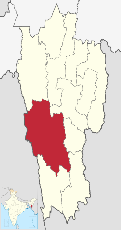
Demographics
Historical population| Year | | |
|---|
| 1971 | 60,403 | — |
|---|
| 1981 | 86,511 | +3.66% |
|---|
| 1991 | 111,415 | +2.56% |
|---|
| 2001 | 137,223 | +2.11% |
|---|
| 2011 | 161,428 | +1.64% |
|---|
| source: [5] |
According to the 2011 census Lunglei district has a population of 161,428, roughly equal to the nation of Saint Lucia. [6] This gives it a ranking of 597th in India (out of a total of 640). The district has a population density of 36 inhabitants per square kilometre (93/sq mi). Its population growth rate over the decade 2001-2011 was 17.64%. Lunglei has a sex ratio of 947 females for every 1000 males, and a literacy rate of 88.86%. [1]
After division of Lunglei district, the residual district has a population of 132,960, of which 61,565 (46.30%) live in urban areas. The residual district has a sex ratio of 936 females per 1000 males. Scheduled Tribes make up 125,449 (94.35%) of the population. [1]
According to the 2011 census, 66.48% of the population spoke Mizo, 24.85% Chakma, 3.55% Tripuri, 15.25% Chakma, 1.41% Bengali and 1.40% Hindi as their first language. [8]
This page is based on this
Wikipedia article Text is available under the
CC BY-SA 4.0 license; additional terms may apply.
Images, videos and audio are available under their respective licenses.

