Kikorongo–Ishaka Road

Last updated

Kikorongo–Ishaka Road
Route information
Length 45 mi (72 km)
Major junctions
North end Kikorongo
  Katunguru
Rubirizi
South end Ishaka
Highway system
Roads in Uganda

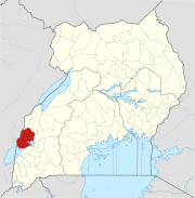
Kikorongo–Ishaka Road is a road in the Western Region of Uganda, connecting the towns of Kikorongo in Kasese District with Ishaka in Bushenyi District.

Western Region, Uganda Region in Western, Uganda

The Western region is one of four regions in the country of Uganda. As of Uganda's 2014 census, the region's population was 8,874,862.

Uganda republic in East Africa

Uganda, officially the Republic of Uganda, is a landlocked country in East-Central Africa. It is bordered to the east by Kenya, to the north by South Sudan, to the west by the Democratic Republic of the Congo, to the south-west by Rwanda, and to the south by Tanzania. The southern part of the country includes a substantial portion of Lake Victoria, shared with Kenya and Tanzania. Uganda is in the African Great Lakes region. Uganda also lies within the Nile basin, and has a varied but generally a modified equatorial climate.

Kikorongo

Kikorongo, also Kikorongo Junctiom, is a settlement in Kasese District, in the Western Region of Uganda.

Contents

Location

This road starts at Kikorongo, on the Fort Portal–Kasese–Mpondwe Road. It proceeds southward across the Kazinga Channel at Katunguru, continuing through Rubirizi, to end at Ishaka, a total distance of about 73 kilometres (45 mi). [1] The coordinates of the road near Rubirizi are 0°16'37.0"S, 30°06'27.0"E (Latitude:-0.276949; Longitude:30.107488). [2]

The Fort Portal–Kasese–Mpondwe Road also Fort Portal–Mpondwe Road, is a road in the Western Region of Uganda, connecting the towns of Fort Portal, Hima, Kasese, Kikorongo and the border town of Mpondwe.

Kazinga Channel river in Uganda

The Kazinga Channel in Uganda is a wide, 32-kilometre (20 mi) long natural channel that links Lake Edward and Lake George, and a dominant feature of Queen Elizabeth National Park. The channel attracts a varied range of animals and birds, with one of the world's largest concentration of hippos and numerous Nile crocodiles.

Katunguru, Uganda

Katunguru, is a small town in Rubirizi District, Ankole sub-region, in the Western Region of Uganda.

Overview

This road is an important transport corridor for people and goods from Rwanda, Burundi and the Western Region of Uganda, destined for South Sudan. [3] The section between Ishaka and Katunguru, measuring about 55 kilometres (34 mi) [4] was rehabilitated between August 1990 and July 1993 by China Sichuan International Cooperation Company Limited (SIETCO), at a cost of US$13.8 million, borrowed from the African Development Bank. [5]

Rwanda Country in Africa

Rwanda, officially the Republic of Rwanda, is a country in Central and East Africa and one of the smallest countries on the African mainland. Located a few degrees south of the Equator, Rwanda is bordered by Uganda, Tanzania, Burundi and the Democratic Republic of the Congo. Rwanda is in the African Great Lakes region and is highly elevated; its geography is dominated by mountains in the west and savanna to the east, with numerous lakes throughout the country. The climate is temperate to subtropical, with two rainy seasons and two dry seasons each year.

Burundi country in Africa

Burundi, officially the Republic of Burundi, is a landlocked country amid the African Great Lakes region where East and Central Africa converge. The capital is Gitega, having moved from Bujumbura in February 2019. The southwestern border is adjacent to Lake Tanganyika.

South Sudan country in Africa

South Sudan, officially known as the Republic of South Sudan, is a landlocked country in East-Central Africa. The country gained its independence from the Republic of the Sudan in 2011, making it the newest country with widespread recognition. Its capital and largest city is Juba.

See also

Related Research Articles

Kasese Place in Western Region, Uganda

Kasese is a town north of Lake George in the Western Region of Uganda. It originally grew around the copper mine at Kilembe, while attention later turned to cobalt mining. It is the chief town of Kasese District, and the district headquarters are located there. Kasese is also the largest town in the Rwenzururu region. Charles Mumbere, the Omusinga of Rwenzururu, maintains a palace in the town.

Bushenyi Place in Western Uganda, Uganda

Bushenyi is a town in Western Uganda. It is the 'chief town' of Bushenyi District and the district headquarters are located there. The district is named after the town, in keeping with the practice in most of the districts in the country.

Holy Family Virika Hospital, commonly referred to as Virika Hospital, is a private, community hospital, in Fort Portal, Kabarole District, Western Uganda.

Mpondwe Place in Uganda

Mpondwe is a town in the Western Region of Uganda.

Rwimi Place in Bunyangabu District

Rwimi is a town in Bunyangabu District in the Western Region of Uganda.

Ishaka Place in Uganda

Ishaka is a town in the Western Region of Uganda. It is one of the municipalities in Bushenyi District.
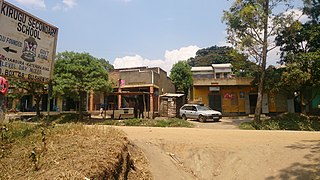
Rubirizi Ugandan town

Rubirizi, sometimes spelled Rubiriizi, is a town in Rubirizi District, Ankole sub-region, Western Uganda. The town is the main municipal, administrative and commercial center of Rubirizi District. The district is named after the town.

Kitagata, Uganda in Uganda


Kitagata is a town in Western Uganda. It is one of the urban centers in Sheema District.

Rwimi Hydroelectric Power Station building in Uganda

Rwimi Hydroelectric Power Station, also Rwimi Power Station, is an operational 5.54 megawatts (7,430 hp) hydroelectric power station in the Western Region of Uganda.

The Ishaka–Kagamba Road is a road in the Western Region of Uganda, connecting the town of Kagamba in Ntungamo District with Ishaka in Bushenyi District.

Kilembe, Uganda Place in Western Region, Uganda

Kilembe is a community in Kasese District, in the Western Region of Uganda.

Kasindi Place in North Kivu, Democratic Republic of the Congo

Kasindi is a town in north eastern Democratic Republic of Congo.

Mbarara–Ishaka Road is a road in the Western Region of Uganda, connecting the towns of Mbarara in Mbarara District with Ishaka in Bushenyi District.

Kibiito Place

Kibiito is a town in the Western Region of Uganda. It is the chief administrative center of Bunyangabu District, and the district headquarters are located there.

Rubona, Bunyangabu in Western Uganda, Uganda

Rubona is a town in the Western Region of Uganda.

Nkenda in Western Uganda, Uganda

Nkenda is a hill in Kasese District in the Western Region of Uganda. The name is also applied to the settlement at the bottom of that hill.

The Mbarara–Kisangani Road is a road in Uganda and the Democratic Republic of the Congo, connecting the cities of Mbarara and Mpondwe in Uganda to Kasindi, Beni, Komanda and Kisangani in the Democratic Republic of the Congo.

References

Coordinates: 00°16′37″S30°06′27″E / 0.27694°S 30.10750°E / -0.27694; 30.10750

Geographic coordinate system Coordinate system

A geographic coordinate system is a coordinate system that enables every location on Earth to be specified by a set of numbers, letters or symbols. The coordinates are often chosen such that one of the numbers represents a vertical position and two or three of the numbers represent a horizontal position; alternatively, a geographic position may be expressed in a combined three-dimensional Cartesian vector. A common choice of coordinates is latitude, longitude and elevation. To specify a location on a plane requires a map projection.