
Manchester Piccadilly is the principal railway station in Manchester, England. Opened as Store Street in 1842, it was renamed Manchester London Road in 1847 and became Manchester Piccadilly in 1960. Located to the south-east of Manchester city centre, it hosts long-distance intercity and cross-country services to national destinations including London, Birmingham, Nottingham, Glasgow, Edinburgh, Cardiff, Bristol, Exeter, Plymouth, Reading, Southampton and Bournemouth; regional services to destinations in Northern England including Liverpool, Leeds, Sheffield, Newcastle and York; and local commuter services around Greater Manchester. It is one of 19 major stations managed by Network Rail. The station has 14 platforms: 12 terminal and two through platforms. Piccadilly is also a major interchange with the Metrolink light rail system with two tram platforms in its undercroft.

The M67 is a 5-mile (8.0 km) urban motorway in Greater Manchester, England, which heads east from the M60 motorway passing through Denton and Hyde before ending near Mottram. The road was originally conceived as the first section of a trans-Pennine motorway between Manchester and Sheffield that would connect the A57(M) motorway with the M1 motorway; however, the motorway became the only part to be built.

The A34 is a major road in England. It runs from the A33 and M3 at Winchester in Hampshire, to the A6 and A6042 in Salford, close to Manchester City Centre. It forms a large part of the major trunk route from Southampton, via Oxford, to Birmingham, The Potteries and Manchester. For most of its length, it forms part of the former Winchester–Preston Trunk Road. Improvements to the section of road forming the Newbury Bypass around Newbury were the scene of significant direct action environmental protests in the 1990s. It is 151 miles (243 km) long.

The M56 motorway, serves the Cheshire and Greater Manchester areas of England. It runs east to west from junction 4 of the M60 at Gatley, south of Manchester, to Dunkirk, approximately four miles north of Chester. With a length of 33.3 miles (53.6 km), it connects North Wales and the Wirral peninsula with much of the rest of North West England, serves business and commuter traffic heading towards Manchester, particularly that from the wider Cheshire area, and provides the main road access to Manchester Airport from the national motorway network.

Wilmslow Road is a major road in Manchester, England, running from Parrs Wood northwards to Rusholme. There it becomes Oxford Road and the name changes again to Oxford Street when it crosses the River Medlock and reaches the city centre.
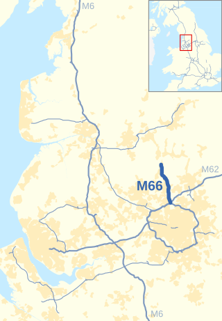
The M66, also known as the Bury Easterly Bypass, is a motorway in Lancashire and Greater Manchester, England. It is 8 miles (13 km) long and provides part of the route between the M62 and M60 motorways and the M65, with the rest being provided by the A56.
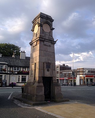
Didsbury is a suburban village in Manchester, Greater Manchester, England, on the north bank of the River Mersey, 5 miles south of Manchester city centre. The population at the 2011 census was 26,788.
Burnage is a suburb of Manchester in Greater Manchester, North West England, about 4 miles (6.4 km) south of Manchester city centre and bisected by the dual carriageway of Kingsway. Within the boundaries of the historic county of Lancashire, the population of the Burnage Ward at the 2011 census was 15,227. It lies between Withington to the west, Levenshulme to the north, Heaton Chapel to the east and Didsbury and Heaton Mersey to the south.

Cheadle is a village in the Metropolitan Borough of Stockport, Greater Manchester, England. Within the boundaries of the historic county of Cheshire, it borders Cheadle Hulme, Gatley, Heald Green and Cheadle Heath in Stockport, and East Didsbury in Manchester. In 2011, it had a population of 14,698.
The Styal line is a suburban commuter railway line which runs through south Manchester, England; it commences at Slade Lane Junction, 1.2 miles (1.9 km) south of Manchester Piccadilly, and ends 12 miles (19 km) south at Wilmslow.

Alderley Edge railway station serves the large village of Alderley Edge in Cheshire, England. The station is 13¾ miles (22 km) south of Manchester Piccadilly on the Crewe to Manchester Line.

The A5103 is a major road in England. It runs from Piccadilly Gardens in Manchester city centre to junction 3 of the M56 motorway and is one of Manchester's principal radial routes.
Gatley is a suburb in the Metropolitan Borough of Stockport, Greater Manchester, England, 3 miles north-east of Manchester Airport.

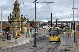
St Werburgh's Road is a tram stop on the South Manchester Line (SML) and Airport Line of Greater Manchester's light-rail Metrolink system in Chorlton-cum-Hardy, Manchester. It was built as part of Phase 3a of the network's expansion and opened on 7 July 2011.

Stockport bus station in Stockport, Greater Manchester was a bus terminus for approximately sixty-five bus services. It opened on 2 March 1981 on the site of a former car park. Before the bus station opened, most services terminated at Mersey Square.

The South Manchester Line (SML) is a tram line of the Manchester Metrolink in Greater Manchester running from Manchester city centre to Didsbury. The line was opened as far as St. Werburgh's Road in 2011 and then to East Didsbury in 2013 as part of phase three of the system's expansion, and runs entirely along a former railway trackbed.
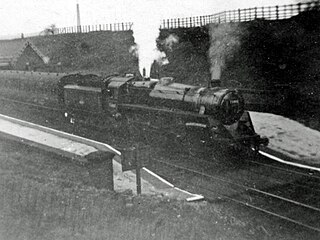
The Manchester South District Railway (MSDR) was a British railway company that was formed in 1873. It was formed by a group of landowners and businessmen in the south of Manchester, England, with the purpose of building a new railway line through the city's southern suburbs.

The Airport Line is a tram line of the Manchester Metrolink in Greater Manchester running from Manchester city centre to Manchester Airport via the suburb of Wythenshawe. The line was opened in November 2014 as part of phase three of the system's expansion.
The Oldham and Rochdale Line (ORL) is a tram line of the Manchester Metrolink in Greater Manchester running from Manchester city centre to Rochdale town centre via Oldham, using most of the trackbed of the former Oldham Loop Line which closed in 2009. The line was re-opened in a modified form as a tramway between 2012 and 2014, as part of phase three of the system's expansion.


