Kinsarvik Municipality Kinsarvik herad | |
---|---|
Kinservik herred (historic name) | |
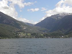
Coordinates: 60°22′28″N06°43′12″E / 60.37444°N 6.72000°E | |
Country | Norway |
County | Hordaland |
District | Hardanger |
Established | 1 Jan 1838 |
• Created as | Formannskapsdistrikt |
Disestablished | 1 Jan 1869 |
• Succeeded by | Ullensvang Municipality |
Re-established | 1 Jan 1913 |
• Preceded by | Ullensvang Municipality |
Disestablished | 1 Jan 1964 |
• Succeeded by | Ullensvang Municipality |
Administrative centre | Kinsarvik |
Area (upon dissolution) | |
• Total | 382 km2 (147 sq mi) |
Population (1963) | |
• Total | 1,585 |
• Density | 4.1/km2 (11/sq mi) |
Time zone | UTC+01:00 (CET) |
• Summer (DST) | UTC+02:00 (CEST) |
ISO 3166 code | NO-1231 [1] |
Kinsarvik is a former municipality in the old Hordaland county, Norway. The administrative centre of the municipality was the village of Kinsarvik where Kinsarvik Church is located. The municipality of Kinsarvik existed two different times: from 1838 until 1869 and then again from 1913 until 1964. The municipality centered on the inner part of the Hardangerfjorden, and (originally) surrounded all of the Sørfjorden. The original Kinsarvik encompassed all of the present day municipalities of Ullensvang (except for Røldal) and a small part of Voss. Upon its final dissolution in 1964, it covered an area of 382 square kilometres (147 sq mi). [2]
The large parish of Kinsarvik (spelled Kinzervig at that time) was established as a municipality on 1 January 1838 (see formannskapsdistrikt law). The parish of Kinsarvik was centered at Kinsarvik Church and it had one parish annex: Ullensvang. In 1869, Ullensvang became the main parish, and Kinsarvik became an annex to Ullensvang (and the municipality then changed its name to Ullensvang). [3]
On 1 July 1913, the municipality of Ullensvang was split into three separate municipalities. The northwestern part became Kinsarvik (population: 1,736), the central part was Ullensvang (population: 1,941) and the southern part became Odda (population: 3,077). During the 1960s, there were many municipal mergers across Norway due to the work of the Schei Committee. On 1 January 1964, Kinsarvik municipality was dissolved. The Lussand-Kvanndal area north of the Hardangerfjorden (population: 72) was transferred to Granvin Municipality. The remainder of Kinsarvik (population: 1,513) was merged into Ullensvang Municipality once again. [3]
The municipality (originally the parish) is named after the old Kinsarvik farm (Old Norse : Kinsarvík) since the first Kinsarvik Church was built there. The first element is the genitive case of the old river name Kinns (now called Kinso). That name comes from the word kinn which means "steep hillside". The last element is vík which means "bay" or "cove". [4] Historically, the name of the municipality was spelled Kinservik. On 3 November 1917, a royal resolution changed the spelling of the name of the municipality to Kinsarvik. [5]
During its existence, this municipality was governed by a municipal council of directly elected representatives. The mayor was indirectly elected by a vote of the municipal council. [6]
The municipal council (Heradsstyre) of Kinsarvik is made up of 13 representatives that were elected to four year terms. The party breakdown of the final municipal council was as follows:
Party name (in Nynorsk) | Number of representatives | |
---|---|---|
Labour Party (Arbeidarpartiet) | 3 | |
Conservative Party (Høgre) | 1 | |
Centre Party (Senterpartiet) | 7 | |
Liberal Party (Venstre) | 2 | |
Total number of members: | 13 |
Party name (in Nynorsk) | Number of representatives | |
---|---|---|
Local List(s) (Lokale lister) | 13 | |
Total number of members: | 13 |
Party name (in Nynorsk) | Number of representatives | |
---|---|---|
Local List(s) (Lokale lister) | 12 | |
Total number of members: | 12 |
Party name (in Nynorsk) | Number of representatives | |
---|---|---|
Labour Party (Arbeidarpartiet) | 1 | |
Joint List(s) of Non-Socialist Parties (Borgarlege Felleslister) | 11 | |
Total number of members: | 12 |
Party name (in Nynorsk) | Number of representatives | |
---|---|---|
Labour Party (Arbeidarpartiet) | 3 | |
Local List(s) (Lokale lister) | 9 | |
Total number of members: | 12 |
Party name (in Nynorsk) | Number of representatives | |
---|---|---|
Labour Party (Arbeidarpartiet) | 2 | |
Joint List(s) of Non-Socialist Parties (Borgarlege Felleslister) | 10 | |
Total number of members: | 12 | |
Note: Due to the German occupation of Norway during World War II, no elections were held for new municipal councils until after the war ended in 1945. |
Jondal is a former municipality in the old Hordaland county, Norway. The 247-square-kilometre (95 sq mi) municipality existed from 1863 until its dissolution in 2020 when it became part of Ullensvang Municipality in Vestland county. It was located on the Folgefonna peninsula in the Hardanger district, on the eastern shore of the Hardangerfjorden. The administrative centre of the municipality was the village of Jondal. Other villages in Jondal include Herand, Kysnesstranda, and Torsnes.
Ullensvang is a municipality in Vestland county, Norway. It is located in the traditional district of Hardanger. The administrative centre is the town of Odda. Some of the notable villages in the municipality include Lofthus, Utne, Vikebygd, Alsåker, Botnen, Eitrheim, Håra, Røldal, Seljestad, Skare, Tyssedal, Jondal, Herand, Kysnesstranda, and Torsnes.
Eidfjord is a municipality in Vestland county, Norway. The municipality is located in the traditional district of Hardanger. The administrative centre of the municipality is the village of Eidfjord, where the majority of the municipal population lives. The other major population centre in the municipality is the village of Øvre Eidfjord.
Kvam is a municipality in Vestland county, Norway. The municipality is located along the Hardangerfjorden in the traditional district of Hardanger. The administrative centre of the municipality is the village of Norheimsund. Other larger settlements in the municipality include Øystese, Bru, Ålvik, Tørvikbygd, Omastranda, and Mundheim. Historically, the municipality was named Vikør.
Holum is a former municipality that was located in the old Vest-Agder county in Norway. The 116-square-kilometre (45 sq mi) municipality existed from 1838 until its dissolution in 1964. The administrative centre was the village of Krossen where Holum Church is located. The municipality was located in the present-day municipality of Lindesnes in what is now Agder county.
Bru is a former municipality in the old Sogn og Fjordane county, Norway. The 382-square-kilometre (147 sq mi) municipality existed from 1923 until 1964 and it included several islands including Svanøya, Askrova, and Stavøya as well as parts of the mainland including the Solheimsdalen valley, east of the village of Norddalsfjord. It is now part of the present-day Kinn Municipality which is in Vestland county in the traditional district of Sunnfjord. The administrative center of Bru was the village of Stavang.
Voll is a former municipality in Møre og Romsdal county, Norway. It existed from 1874 until its dissolution in 1964. The 260-square-kilometre (100 sq mi) municipality encompassed the Måndalen and Innfjorden valleys west of the Romsdalsfjorden in the west-central part of the present-day Rauma Municipality. The administrative centre of the village was the village of Måndalen which is also where the main Voll Church is located.
Høvåg is a former municipality in the old Aust-Agder county in Norway. The 77 km2 (30 sq mi) municipality existed from 1865 until its dissolution in 1962. It was located in the southern part of the present-day municipality of Lillesand which is now in Agder county. The administrative centre of the municipality was the village of Høvåg where the Høvåg Church is located. Old coastal settlements in Høvåg include Ulvøysund, Gamle Hellesund, Skottevik, Kjøbmannsvig and Åkerøyhamn. The village of Høvåg is located midway between the towns of Lillesand and Kristiansand.
Tromøy is a former municipality in the old Aust-Agder county in Norway. The 30-square-kilometre (12 sq mi) municipality existed from 1878 until its dissolution in 1992. The municipal area is now part of the municipality of Arendal in Agder county. The administrative centre was the village of Brekka, where the historic Tromøy Church is located. The municipality encompassed all of the island of Tromøya as well as many smaller surrounding islands such as Merdø, Gjesøya, Skilsøy, and Tromlingene.
Vartdal is a former municipality in Møre og Romsdal county, Norway. The municipality existed from 1895 until its dissolution in 1965. The 125-square-kilometre (48 sq mi) area now sits in the northwestern part of the Ørsta municipality, along the Vartdalsfjorden. The administrative centre was the village Sætre, which is also known as Vartdal. Other villages in the municipality were Flåskjer and Nordre Vartdal. The main church for Vartdal was Vartdal Church, located in the village of Nordre Vartdal.
Ålvundeid is a former municipality in Møre og Romsdal county, Norway. The 179-square-kilometre (69 sq mi) municipality existed from 1899 until its dissolution in 1960. It had one of the smallest municipal populations in Norway. It was located in the northern part of the present-day Sunndal Municipality. The old municipality included the Innerdalen valley and the Ålvund valley area. The administrative centre was the village of Ålvundeidet, also where the Ålvundeid Church is located.
Øksendal is a former municipality in Møre og Romsdal county, Norway. The 223-square-kilometre (86 sq mi) municipality existed from 1854 until its dissolution in 1960. It had one of the smallest municipal populations in Norway. It was located in the northern part of the present-day municipality of Sunndal, along the Sunndalsfjorden. It included the coastal area along the fjord as well as the whole Øksendalen valley. The administrative centre of the municipality was the village of Øksendalsøra, where Øksendal Church is also located.
Eikefjord is a former municipality in the Sunnfjord district in the old Sogn og Fjordane county, Norway. The 145-square-kilometre (56 sq mi) municipality existed from 1923 until 1964 when it joined Flora Municipality. The administrative center of the former municipality was the village of Eikefjord, where Eikefjord Church is located. The municipality of Eikefjord was located at the end of the Eikefjorden, about 30 kilometres (19 mi) east of the town of Florø. The lake Endestadvatnet was part of the municipality. The municipality encompassed the immediate area around the village of Eikefjord and to the east and south of the village.
Strandebarm is a former municipality in the old Hordaland county, Norway. The original municipality was large, spanning both sides of the central part of the Hardangerfjorden. It also included the island of Varaldsøy. Over time, the municipality was divided and by the time of its dissolution in 1965, it was 112 square kilometres (43 sq mi). The municipality included land in the present-day municipalities of Ullensvang, Kvam, and Kvinnherad. The administrative center of the municipality was the village of Bru, where Strandebarm Church is located.
Vikebygd is a former municipality in the old Hordaland county, Norway. The municipality existed from 1902 until its dissolution in 1964. It was located along the eastern and western shores of the Ålfjorden, a small branch off the main Hardangerfjorden. The 102-square-kilometre (39 sq mi) municipality is located in the present-day municipalities of Sveio and in Vindafjord. The administrative centre of the municipality was the village of Vikebygd, where Vikebygd Church is located.
Røldal is a former municipality in the southeastern corner of the old Hordaland county, Norway. The 719-square-kilometre (278 sq mi) municipality existed from 1838 until 1964 and it was located in the southeastern part of the present-day Ullensvang Municipality. The administrative centre was the village of Røldal, where the Røldal Stave Church is located. The municipality encompassed the Røldalen valley and some small side valleys, as well as a large area up on the vast Hardangervidda plateau. Historically, Røldal was an important trade and transportation route between Eastern and Western Norway.
Sollia is a former municipality in Hedmark county, Norway. The 511-square-kilometre (197 sq mi) municipality existed from 1864 until its dissolution in 1965. Since then, it has made up the northern part of the present-day Stor-Elvdal Municipality. The administrative centre of the municipality was the village of Sollia where Sollia Church is located.
Bjørnskinn is a former municipality in Nordland county, Norway. The 310-square-kilometre (120 sq mi) municipality existed from 1924 until its dissolution in 1964. The municipality was centered around the Risøysundet strait. It encompassed the southern part of the island of Andøya and the northern part of the island of Hinnøya in the southern part of what is now Andøy Municipality. The administrative centre was the small village of Bjørnskinn where Bjørnskinn Church is located. The largest village in Bjørnskinn was the village of Risøyhamn.
Åsskard is a former municipality in Møre og Romsdal county, Norway. The 151-square-kilometre (58 sq mi) municipality existed from 1895 until its dissolution in 1965. It was located in what is now the northern part of Surnadal Municipality. The former municipality of Åsskard included the area around the Åsskardfjorden, north of the Hamnesfjorden, and east of the Trongfjorden. The administrative centre was the village of Åsskard where the Åsskard Church is located.
Straumsnes is a former municipality in Møre og Romsdal county, Norway. The 124-square-kilometre (48 sq mi) municipality existed from 1866 until its dissolution in 1964. It included the northern part of the Straumsnes peninsula, the eastern part of the island of Aspøya, and several surrounding islands in the northern part of the present-day Tingvoll Municipality. The administrative centre of the municipality was the village of Straumsnes where the Straumsnes Church is located.