
Palakkad is one of the 14 districts in the Indian state of Kerala. It was carved out of the southeastern region of the former Malabar District on 1 January 1957. It is located at the central region of Kerala and is the second largest district in the state after Idukki. The city of Palakkad is the district headquarters. Palakkad is bordered on the northwest by the Malappuram district, on the southwest by the Thrissur district, on the northeast by Nilgiris district, and on the east by Coimbatore district of Tamil Nadu. The district is nicknamed "The granary of Kerala". Palakkad is the gateway to Kerala due to the presence of the Palakkad Gap, in the Western Ghats. The 2,383 m high Anginda peak, which is situated in the border of Palakkad district, Nilgiris district, and Malappuram district, in Silent Valley National Park, is the highest point of elevation in Palakkad district. Palakkad city is about 347 kilometres (216 mi) northeast of the state capital, Thiruvananthapuram.

Shoranur is a town and a municipality located in the Palakkad district, in the Indian state of Kerala, located on the banks of the Bharathapuzha River. The town covers an area of 32.28 km2.

Ottapalam is a town, taluk and municipality in the Palakkad District, Kerala, India. It is the administrative headquarters of the Ottapalam taluk. Ottapalam is located about 34 km (21 mi) from district headquarters Palakkad. Ottapalam is located along the banks of Bharathapuzha, second longest river of the state.
Palappuram is a neighbourhood in Ottapalam located 4 km from Ottapalam, between Shornur and the Palakkad Highway in Kerala, South India. In olden days most of them were farmers and weavers. There are various temple in this village. Chinakkathur Kavu, Mariyamman temple, NeeliKavu, and Sree Kurumba kavu.

Muthuthala is a village and gram panchayat. It lies northwest of Pattambi in Palakkad district, of the state of Kerala, India. It is located on the banks of the Bharathapuzha River.

Thrissur, anglicised as Trichur, is one of the 14 districts in the Indian state of Kerala. It is situated in the central region of the state. Spanning an area of about 3,032 km2 (1,171 sq mi), the district is home to over 9% of Kerala's population.
Nadapuram is a census town and a special grade panchayath located in Kozhikode District of Kerala, coming under Nadapuram assembly constituency. It is in the North Malabar region of Kerala, India.

Kudallur is in the Palakkad district of Kerala. It is in Pattambi taluk, bordering Malappuram district, also on the banks of Bharathapuzha. The Bharathappuzha river separates Kudallur from Kuttippuram town in Malappuram district. Kudallur is a part of Thrithala and Ponnani.

Chavakkad, formerly Chowghat, is a Municipality in Thrissur district of the Indian state of Kerala. Chavakkad is noted for its beach and fishing. It lies on National Highway 66 is located about 83 km (52 mi) north of the city of Kochi, 26 km (16 mi) northwest of Thrissur, and 24 km (15 mi) south of Ponnani.

Melattur is a town in Malappuram district of Kerala. It is situated on the banks of the Velliyar river. The name Melattur came from the Malayalam words 'Mele' (above), 'Aaru' (river) and 'Ooru' (place); i.e., 'place near upstream'. There are places named Edayattur, and Keezhattur on the banks of the river Olippuzha. The town is well connected to Perinthalmanna (17 km [11 mi]), Manjeri (23 km [14 mi]), Mannarkkad (24 km [15 mi]), Pandikkad (8 km [5.0 mi]) and Karuvarakundu (11 km [6.8 mi]) by road. Melattur Railway Station is a minor railway station on the Nilambur - Shornur Line.

Changaramkulam is a town in Ponnani Taluk of the Malappuram district in the Indian state of Kerala. It falls on the Nannamukku and Alamcode panchayats. Changaramkulam in part of the Ponnani Lok Sabha constituency.

Kumaranellur is a small Village/hamlet in Pattambi Taluk in Palakkad District of Kerala, India. It comes under Kappur Grama Panchayath. It is located 75 km westwards from District headquarters Palakkad, 48 km southwards from the neighbouring district headquarters Malappuram, 27 km from Tirur, 22 km from Valanchery, 20 km from Pattambi, 20 km from Kunnamkulam, 15 km from Ponnani, 14 km from Kuttippuram, 8 km from Thrithala, and 5 km from Edappal town. This Place is in the border of the Palakkad District and Malappuram District. Malappuram District Kuttippuram is North towards this place and Edappal is westward from this place. Kumaranellur basically depends upon neighbouring Ponnani, Edappal, and Kuttippuram in Malappuram district for education and healthcare purposes. It is a part of Thrithala and Ponnani.

Thamarassery, formerly known as Thazhmalachery, is one of the taluks and a major hill town in the Kozhikode district of Kerala, India, 30 km north-east of Kozhikode (Calicut) city and 29 km east of Koyilandy. The town lies on National highway 766.

Shoranur Junction is an NSG–3 category Indian railway station in Palakkad railway division of Southern Railway zone. It is the railway station located at Shoranur, Palakkad District, Kerala. It comes under the Palakkad Railway Division of the Southern Railway. It is the largest railway station in the state of Kerala in terms of area. It is an important junction because it is the point at which the line from Chennai via Jolarpettai, Erode and Palakkad meets the coastal line from Mangalore to Kanyakumari. Further, Shoranur junction is the node from which a separate Branch line goes to the town of Nilambur, about 66 km to the north. The Nilambur–Shoranur line, which connects two tiny hill-towns, is one of the most picturesque in India.
Mezhathur is an Indian village in the state of Kerala situated at Pattambi taluk of Palakkad district at the border of Thrissur, Malappuram and Palakkad districts. It is a historical and cultural village in Kerala. It is also the native place of renowned writer and social reformer V. T. Bhattathiripad.

The Bharathappuzha, also known as the Nila River or Ponnani River, is a river in the Indian states of Tamil Nadu and Kerala. With a length of 209 km, it is the second longest river that flows through Kerala after the Periyar. It flows through Palakkad Gap, which is also the largest opening in the Kerala portion of Western Ghats. The Nila has groomed the culture and life of South Malabar part of Kerala. It is also referred to as the "Peraar" in ancient scripts and documents. River Bharathapuzha is an interstate river and lifeline water source for a population residing in four administrative districts, namely Malappuram and Palakkad districts, and parts of Palakkad-Thrissur district border of Kerala and Coimbatore, and Tiruppur of Tamil Nadu. The fertile Thrissur-Ponnani Kole Wetlands lie on its bank.

The following outline is provided as an overview of and topical guide to Kerala:
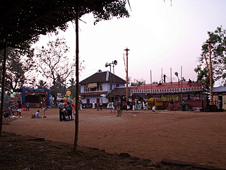
Kodumunda is a small village in Muthuthala and Parudur gramapanchayath, Pattambi Taluk, Palakkad district Kerala. It is a minor trading center in Muthuthala Panchayath. The portions of Kodumunda in Parudur Panchayath are called west Kodumunda. The only railway station in Muthuthala is situated in Kodumunda and is home to four significant temples: Muthassiyarkavu, Cheruneerkara Shiva Temple, Manniyampathoor Saraswathi temple, and Madayil lakshminarasimha temple. Muthassiyarkavu thalapoli and Kodumunda nercha are the major festivals in this village.

Pattambi is a taluk at the western end of the Palakkad district in the state of Kerala, India. The town of Pattambi is the administrative headquarters of the taluk. Pattambi taluk is bounded by Ottapalam Taluk of Palakkad district to the east, Ponnani taluk of Malappuram district to the west, Tirur and Perinthalmanna Taluks of Malappuram district to the north, and Kunnamkulam Taluk of Thrissur district to the south.

South Malabar refers to a geographical area of the southwestern coast of India covering some parts of the present-day Kerala state. South Malabar covers the regions included in present-day Kozhikode and Thamarassery taluk of Kozhikode district, Wayanad district excluding Mananthavady taluk, the whole area of Malappuram district, Chavakkad taluk of Thrissur district, and Palakkad district, excluding parts of Chittur taluk. The Fort Kochi region of Kochi city also historically belongs to South Malabar. The term South Malabar refers to the region of the erstwhile Malabar District south to the river Korapuzha, and bears a high cultural similarity to both the Cochin and the North Malabar regions.


