Krimml

Last updated
Krimml
Krimmler Wasserfall.JPG
View from Krimml Falls
Wappen at krimml.png
Austria adm location map.svg
Red pog.svg
Krimml
Location within Austria
Coordinates: 47°13′06″N12°10′24″E / 47.21833°N 12.17333°E / 47.21833; 12.17333
Country Austria
State Salzburg
District Zell am See
Government
   Mayor Erich Czerny (ÖVP)
Area
[1]
  Total
169.23 km2 (65.34 sq mi)
Elevation
1,067 m (3,501 ft)
Population
 (2018-01-01) [2]
  Total
847
  Density5.0/km2 (13/sq mi)
Time zone UTC+1 (CET)
  Summer (DST) UTC+2 (CEST)
Postal code
5743
Area code 06564
Vehicle registration ZE
Website www.krimml.at

Krimml is a municipality in Zell am See District, in the federal state of Salzburg, Austria, in the Pinzgau region.

Contents

Geography

Krimml Waterfalls Utazgato Krimmler wasserfall.JPG
Krimml Waterfalls

Krimml is situated on the Salzach river, at the southwestern rim of the upper (western) Pinzgau region near the border with Tyrol. It is located about 54 km (34 mi) west of the town of Mittersill and 54 km (34 mi) from the district capital Zell am See. The settlement's centre area is situated at an elevation of 1,067 m (3,501 ft) above sea level.

In the west, the Gerlos Pass road leads via Wald im Pinzgau into the Tyrolean Zillertal. In the south, the Krimmler Ache Valley (Krimmler Achental) with its extended mountain pastures leads up to the Dreiherrnspitze peak at 3,499 m (11,480 ft), part of the Venediger Group subrange in the High Tauern. The nearby bridle path across Birnlücke Pass leads across the Alpine crest into the Tauferer Ahrntal of South Tyrol (Italy).

Krimml is known for the Krimml Waterfalls which are a popular tourist destination. With a total drop of about 380 m (1,250 ft) these waterfalls are among Europe's highest. Also, the source of the Salzach river is located north of Krimml, at an elevation of 2,300 m (7,500 ft) above sea level.

Climate

The Köppen Climate Classification subtype for the Krimml climate is "Dfb" (Warm Summer Continental Climate). [3]

Krimml
Climate chart (explanation)
J
F
M
A
M
J
J
A
S
O
N
D
 
 
46
 
 
1
−6
 
 
42
 
 
3
−5
 
 
68
 
 
7
−2
 
 
77
 
 
11
1
 
 
109
 
 
16
5
 
 
159
 
 
19
8
 
 
185
 
 
21
10
 
 
170
 
 
21
10
 
 
107
 
 
17
7
 
 
65
 
 
13
3
 
 
69
 
 
5
−2
 
 
57
 
 
1
−5
Average max. and min. temperatures in °C
Precipitation totals in mm
Source: ZAMG
Imperial conversion
JFMAMJJASOND
 
 
1.8
 
 
34
21
 
 
1.7
 
 
37
23
 
 
2.7
 
 
45
28
 
 
3
 
 
52
34
 
 
4.3
 
 
61
41
 
 
6.3
 
 
66
46
 
 
7.3
 
 
70
50
 
 
6.7
 
 
70
50
 
 
4.2
 
 
63
45
 
 
2.6
 
 
55
37
 
 
2.7
 
 
41
28
 
 
2.2
 
 
34
23
Average max. and min. temperatures in °F
Precipitation totals in inches

History

While archaeological findings denote a settlement of the area in the Early Bronze Age, and also in the Hallstatt culture from the 8th to 6th centuries BC, the present-day Pinzgau was part of the Celtic kingdom of Noricum from about 200 BC. Incorporated into the Roman Empire from 15 BC, a Roman road ran along the Krimmler Ache stream up to the Alpine crest. After the Empire's decline in the 5th century, the area became largely Germanised by Bavarian settlers.

Initially part of the medieval Duchy of Bavaria, the Chrvmbel manor was first mentioned in a 1228 deed, when the upper Pinzgau region was purchased by the Salzburg archbishops. A parish church was mentioned in 1244. At the time, Krimml was strategically important as a stop on the route connecting Salzburg with the Ahrntal and the County of Tyrol.

As in many Salzburg lands where the Protestant Reformation had spread, the peasants in the Krimml area were subject to Counter-Reformation measures enacted by the prince-archbishops and several Protestant families were expelled. After the Archbishopric was secularised, the former ecclesiastical estates finally passed to the Austrian Empire in 1815. From the late 19th century onwards, Alpine tourism gradually became an important economic factor.

Transport

Krimml railway station SLB Ds 03 Krimml, 2014 (04).JPG
Krimml railway station

Krimml station is the western terminus of the Pinzgauer Lokalbahn narrow-gauge railway line to Zell am See.

Politics

Seats in the municipal assembly (Gemeinderat):

Related Research Articles

<span class="mw-page-title-main">Salzburg (state)</span> Austrian federal state

Salzburg is an Austrian federal state. In German it is called a Bundesland, a German-to-English dictionary translates that to federal state and the European Commission calls it a province. In German, its official name is Land Salzburg, to distinguish it from its eponymous capital Salzburg. For centuries, it was an independent Prince-Bishopric of the Holy Roman Empire. It borders Germany and Italy.

<span class="mw-page-title-main">Salzach</span> River in Austria and Germany

The Salzach is a river in Austria and Germany. It is 227 kilometres (141 mi) in length and is a right tributary of the Inn, which eventually joins the Danube. Its drainage basin of 6,829 km2 (2,637 sq mi) comprises large parts of the Northern Limestone and Central Eastern Alps. 83% of its drainage basin lies in Austria, the remainder in Germany (Bavaria). Its largest tributaries are Lammer, Berchtesgadener Ache, Saalach, Sur and Götzinger Achen.

<span class="mw-page-title-main">Kitzbühel Alps</span> Mountain range in Austria

The Kitzbühel Alps are a mountain range of the Central Eastern Alps surrounding the town of Kitzbühel in Tyrol, Austria. Geologically they are part of the western slate zone.
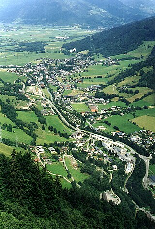
<span class="mw-page-title-main">Kaprun</span> Municipality in Salzburg, Austria

Kaprun is a municipality in the Zell am See District in the province of Salzburg in Austria. Together with the neighboring city of Zell am See the town presents itself as the tourist destination and skiing area "Zell am See-Kaprun". Kaprun distinguishes itself from its larger neighbor at the lake, by offering all year access to the Kitzsteinhorn with its Top of Salzburg viewing platform at 3029 metres (9938') altitude and its glacier ski area that is open October through May.
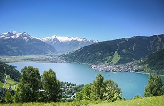
<span class="mw-page-title-main">Zell am See</span> Municipality in Salzburg, Austria

Zell am See is the administrative capital of the Zell am See District in the Austrian state of Salzburg. Located in the Kitzbühel Alps, the town is an important tourist destination due to its ski resorts and shoreline on Lake Zell. While Zell am See has been a favored winter and summer resort for the European aristocracy since the 19th century, it is known as a hub of the international jet set today.

<span class="mw-page-title-main">Mittersill</span> Municipality in Salzburg, Austria

Mittersill is a city in the federal state of Salzburg, Austria, in the Pinzgau region of the Alps. It is located on the Salzach River. It has a population of 5,408 as of 2011.

<span class="mw-page-title-main">Fusch an der Großglocknerstraße</span> Municipality in Salzburg, Austria

Fusch an der Großglocknerstraße is a municipality, at the foot of Grossglockner mountain, in the district of Zell am See, in the state of Salzburg in Austria. The Fusch valley lies north of the main chain of the Alps. The population is 697. Fusch has an elevation of 813 metres (2,667 ft), but the maximum elevation within the municipality is 3,564 metres (11,693 ft), rising up Grossglockner mountain.

<span class="mw-page-title-main">Saalfelden</span> Municipality in Salzburg, Austria

Saalfelden am Steinernen Meer is a town in the district of Zell am See in the Austrian state of Salzburg. With approximately 16,000 inhabitants, Saalfelden is the district's largest town and the third of the federal state after Salzburg and Hallein.

<span class="mw-page-title-main">Radstadt</span> Municipality in Salzburg, Austria

Radstadt is a historic town in the district of St. Johann im Pongau in the Austrian state of Salzburg.

<span class="mw-page-title-main">Bruck an der Großglocknerstraße</span> Municipality in Salzburg, Austria

Bruck an der Großglocknerstraße is a municipality in Zell am See District, in the state of Salzburg in Austria.
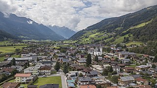
<span class="mw-page-title-main">Bramberg am Wildkogel</span> Municipality in Salzburg, Austria

Bramberg am Wildkogel is a municipality in the district of Zell am See, in the state of Salzburg, Austria. The town lies at the south foot of the 2,225-metre (7,300 ft) high Wildkogel mountain. The town's average elevation is 819 metres (2,687 ft).
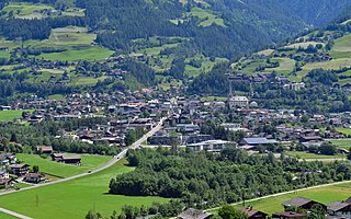
<span class="mw-page-title-main">Matrei in Osttirol</span> Place in Tyrol, Austria

Matrei in Osttirol is a market town in the Lienz District in the Austrian state of Tyrol. It is situated about 29 km (18 mi) north of Lienz within the Hohe Tauern mountain range of the Central Eastern Alps. Its municipal area comprises parts of the Granatspitze Group and the Venediger Group, with the Großvenediger peak as its highest point. The population largely depends on tourism, seasonal agriculture and forestry.
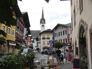
<span class="mw-page-title-main">Golling an der Salzach</span> Municipality in Salzburg, Austria

Golling an der Salzach is a market town in the Hallein district of Salzburg, Austria.
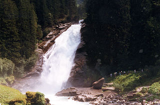
<span class="mw-page-title-main">Krimml Waterfalls</span>

The Krimml Waterfalls, with a total height of 380 metres, are the highest waterfall in Austria. The falls are on the Krimmler Ache river and are located near the village of Krimml in the High Tauern National Park in Salzburg state.

<span class="mw-page-title-main">Venediger Group</span> Mountain range in the Central Eastern Alps

The Venediger Group is a mountain range of the Central Eastern Alps. Together with the Granatspitze Group, the Glockner Group, the Goldberg Group, and the Ankogel Group, it forms the main ridge of the High Tauern. The highest peak is the Großvenediger at 3,657 m (AA), which gives its name to the group. Considerable parts of the Venediger Group belong to the core zone of the High Tauern National Park.
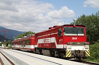
<span class="mw-page-title-main">Pinzgauer Lokalbahn</span>

The Pinzgauer Lokalbahn is a narrow-gauge railway in Salzburg in Austria. The 53 kilometre railway follows the Salzach valley from Zell am See to Krimml through the Pinzgau mountains. The section between Mittersill and Krimml was damaged by flooding in 2005 and reopened in September 2010.

Hinterwaldberg is a dispersed settlement in the Oberpinzgau, the upper Salzach valley and the district of Zell am See/Pinzgau, and is a village and Katastralgemeinde in the municipality of Wald im Pinzgau, on the southern edge of the Kitzbühel Alps in Austria.

Vorderwaldberg is a dispersed settlement in the Oberpinzgau, the upper Salzach valley and the district of Zell am See/Pinzgau, and also a village in the municipality of Wald im Pinzgau, on the southern edge of the Kitzbühel Alps in Austria.

Lahn is a dispersed settlement in the Oberpinzgau, the upper Salzach valley and the district of Zell am See/Pinzgau, and a village in the municipality of Wald im Pinzgau, on the southern rim of the Kitzbühel Alps.
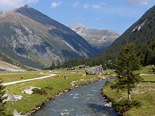
<span class="mw-page-title-main">Krimmler Ache</span> River in Salzburg, Austria

The Krimmler Ache is a river in the Pinzgau region of the Austrian state of Salzburg, a right tributary of the Salzach at Vorderkrimml, Wald im Pinzgau.

References

  1. "Dauersiedlungsraum der Gemeinden Politischen Bezirke und Bundesländer - Gebietsstand 1.1.2018". Statistics Austria. Retrieved 10 March 2019.
  2. "Einwohnerzahl 1.1.2018 nach Gemeinden mit Status, Gebietsstand 1.1.2018". Statistics Austria. Retrieved 9 March 2019.
  3. Climate Summary for Krimml