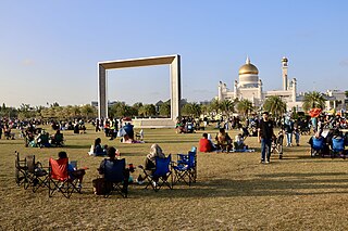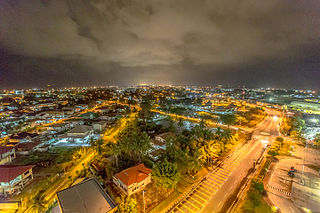
Brunei, officially Brunei Darussalam, is a country in Southeast Asia, situated on the northern coast of the island of Borneo. Apart from its coastline on the South China Sea, it is completely surrounded by the Malaysian state of Sarawak, with its territory bifurcated by the Sarawak district of Limbang. Brunei is the only sovereign state entirely on Borneo; the remainder of the island is divided between its multi-landmass neighbours of Malaysia and Indonesia. As of 2023, the country had a population of 455,858, of whom approximately 180,000 resided in the capital and largest city of Bandar Seri Begawan. Its official language is Malay and Islam is the state religion of the country, although other religions are nominally tolerated. The government of Brunei is a constitutional absolute monarchy ruled by the Sultan, and it implements a fusion of English common law and jurisprudence inspired by Islam, including sharia.

Belait District or simply known as Belait, is the largest as well as the westernmost district in Brunei. It has an area of 2,727 square kilometres (1,053 sq mi) and the population of 65,531 as of 2021. The administrative town is Kuala Belait, located at the mouth of the 32 kilometres (20 mi) long Belait River. The district is commonly associated with the oil and gas industry of the country, mainly concentrated near the town of Seria.

Brunei–Muara District or simply known as Brunei–Muara, is the smallest as well as the most populated district in Brunei. It has an area of 571 square kilometres (220 sq mi) and the population of 318,530 as of 2021. The district is also home to its administrative centre is Bandar Seri Begawan, as well as the Brunei International Airport and Muara Port, the country's only international airport and deep-water port respectively. The Brunei River flows within this district and is home to Kampong Ayer. As the administrative center of Brunei is located in the district, it remains the most developed in the country with the most up-to-date infrastructure, despite not being the center of Brunei's main economic activity.

Tutong District or simply known as Tutong, is the third largest and populated district in Brunei. It has an area of 1,166 square kilometres (450 sq mi) and the population of 47,210 as of 2021. The district is also home to its administrative centre is Tutong Town, as well as the Tutong River and Tasek Merimbun, the country's second longest river and the only ASEAN Heritage Parks in Brunei respectively.

Kuala Belait or officially the Kuala Belait Town, and colloquially referred to as KB, is the administrative town of Belait District, Brunei. The population of the town proper was 4,259 in 2016. Kuala Belait is officially a municipal area, as well as a village under the mukim of the same name. The town is located 85 kilometres (53 mi) west of the country's capital Bandar Seri Begawan, and 20 kilometres (12 mi) west of Seria, the district's other town. It is also in the westernmost part of country, near the mouth of the Belait River.

Seria or officially known as Seria Town, is a town in Belait District, Brunei. It is located about 65 kilometres (40 mi) west from the country's capital Bandar Seri Begawan. The total population was 3,625 in 2016. It was where oil was first struck in Brunei in 1929 and has since become a centre for the country's oil and gas industry. The town's bazaar, officially opened on 19 September 1954, has few retail establishments, fresh food markets, supermarkets, banking services, tourist information centers, and a range of restaurants, including Malay, Chinese, Indian, Indonesian and Italian ones as well as outdoor dining in somewhat rustic settings. For processing documentation related to owning a car and hiring domestic helpers (amahs), government offices are located in Kuala Belait.
The administrative divisions of Brunei Darussalam mainly consist of daerah (districts), mukim (sub-districts), and kampung or kampong (villages). They are organised hierarchically in Brunei Darussalam, with daerah being the largest first level, and kampong the smallest third level.

Kampong Mumong, or simply known as Mumong, is a residential suburb of Kuala Belait, the principal town of Belait District, in Brunei Darussalam. It comprises the original Mumong settlement, as well as the Mumong public housing estate of the Landless Indigenous Citizens' Housing Scheme. However, it officially consists of two village sub-divisions, namely Mumong 'A' and Mumong 'B', which are under the mukim of Kuala Belait.

Rasau is an area in Brunei. The area contains one of the many oil fields of Brunei, the Rasau Field, and a small village, Kampong Rasau, which has a population of 103.

Kampong Sungai Duhon is a village that is located within the town of Kuala Belait in Mukim Kuala Belait, Belait District of Brunei. The postcode is KA3131.

Sungai Tujoh, is the westernmost point of Brunei. It is located in the Belait district.

Brunei LNG (BLNG), located in Lumut, Belait District, is the largest oil and gas producer in Brunei and has been a key player in the country's energy sector since its establishment in 1969. As the fourth largest oil producer in Southeast Asia and the ninth largest liquefied natural gas (LNG) producer globally, BLNG has supplied LNG to Japan since its first shipment in 1972. The joint venture between Brunei Shell Petroleum (BSP) and Mitsubishi Corporation has also expanded into ownership of LNG carriers and deepwater upstream oil and gas exploration.

Transport in Brunei consists of air, land, and sea transport. Previously there was some rail transport in Brunei, but eventually most of it was closed down. Several public and commercial sector organizations are in charge of creating and overseeing these networks and infrastructures. The Ministry of Transport and Infocommunications (MTIC) is in charge of overseeing the maritime and aviation industries, as well as planning and regulating all kinds of land transportation.

Kampong Kuala Tutong, also simply known as Kuala Tutong, is a village in Tutong District, Brunei, within the mukim of Pekan Tutong. The postcode for Kampong Kuala Tutong is TA3341. It holds great historical importance due to its contribution to the country's socio-economic development in the past. Before World War II, a ferry jetty was constructed at the end of Jalan Kuala Tutong, approximately 5 kilometres (3.1 mi) from Kampong Penabai. Since no bridges connected the Tutong and Belait districts at that time, the Brunei government introduced a ferry service in 1930, which operated from Kuala Sungai Tutong. This ferry became a crucial transportation link for vehicles traveling between Brunei Town, Tutong, Seria, and Kuala Belait. However, the service ceased in 1958 following the completion of bridges in Serambangun and Telamba, which made the ferry redundant.

Chung Hua Middle School, Kuala Belait, is a private school in Kuala Belait, Belait District, Brunei Darussalam. In 1987, it was estimated that 39,000 of the Brunei's total population (222,000), was Chinese.

The Muara Port, also known as Muara Harbour, is a seaport operated by the Muara Port Company (MPC) Sdn Bhd, under the supervision of the Maritime and Port Authority of Brunei Darussalam. The port also contributed to the Brunei Darussalam–Indonesia–Malaysia–Philippines East ASEAN Growth Area (BIMP-EAGA).

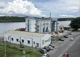
The Serasa Ferry Terminal, also known as Serasa Muara Terminal and Serasa Terminal, is a passenger terminal operated by the Department of Immigration and National Registration in Mukim Serasa, Brunei-Muara District, Brunei. It is one of the two ferry terminals in Brunei, which is located in Kuala Belait Port and Serasa.

Belait Beach, also known as KualaBelait Beach, is a beach in Kuala Belait, Mukim Kuala Belait, Belait District, Brunei. The beach used to stretch from Kuala Belait to Pelumpong Spit but was cut and split at Muara Beach.

Eric Ernest Falk Pretty (1891–1967) or commonly referred to as Dato Pretty, was a civil servant and resident minister who formerly held the position of British Resident to Brunei.


