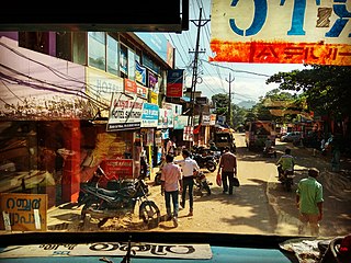
Vithura, also known as the Hill City Of Trivandrum, is located 36 km from Thiruvananthapuram capital of the Kerala state in India. Vithura is the culmination of the crossroads to many tourist, cultural, and religious centres. Surrounded by the Western Ghats (Sahyadris), Vithura is a tourist spot. The village has a good climate year-round. The Indian Institute of Science Education and Research, Thiruvananthapuram campus is situated here.
Nemom is an area in the city of Thiruvananthapuram. It is surrounded by Thirumala in the north, Malayinkeezhu in the north-east, Balaramapuram in the south-east, Kovalam in the south and Thiruvallam in the west. Nemom falls within the municipal corporation of Thiruvananthapuram, though partly exclusive. It is connected with Thiruvananthapuram, Neyyattinkara, Vizhinjam, Poovar, Kattakkada, Nagarcoil, and Kanyakumari through the main arterial highway National Highway 66.
Nalanchira is a suburb of Thiruvananthapuram the capital of Kerala state in India. It is an educational hub of Kerala, situated between Mannanthala and Pananvila. Nalanchira is approximately 8 km from the Thiruvananthapuram railway station and 11 km away from Thiruvananthapuram International Airport. The Main Central Road runs through this place. This middle-class residential locality is famous for its educational and social service institutions. The Nalanchira Bethany Hills were originally owned by a chettiar and was given to Mar Ivanios the founder of Syro-Malankara Catholic (MSC) Church to start an educational institution. The main residential areas are Benedict Nagar, Christian medical centre (CMC) lane, Parakodu lane, Mangalathu Lane, Convent Lane, Rajeev Gandhi Nagar, Puliyoor Gardens, Rose Nagar, Akshaya Gardens, Shawallace Lane, Thattinakam Souhrda Residents Association, Parkanthara Lane, Post Office Lane, Chathiode Lane, Udayannoor Lane, Kurishadi Jn., Anupama Nagar, Kushavarkal Road, Bethany Nagar Lane and Jayamatha Lane.
Mannar is a census town in Chengannur Taluk in Alappuzha District of Kerala state, India, on State Highway 6. It is also known as the Bell Metal Town.

Chathannoor is a town in the Indian state of Kerala situated at the Kollam District on the banks of Ithikkara River. It is about 16 km (9.9 mi) from Kollam(Quilon) City. Chathannoor is around 55 km (34 mi) north of the state capital Thiruvananthapuram(Trivandrum).

Kadinamkulam is a panchayat and the northern suburb of Trivandrum City. It is one of the residential and industrial area of Trivandrum City in Kerala, India. It is situated 22 km north of Trivandrum, 20 km from Varkala, 20 km from the Trivandrum International Airport and 22 km from Trivandrum Central Railway station and bus station. National Highway 66 is also 8 km away. Kadinamkulam is surrounded by Kadinamkulam Kayal to the east, the Arabian Sea to the west, Puthucurichy to the north and Channankara to the south. Kadinamkulam forms part of Kadinamkulam panchayat of Trivandrum district. Kinfra international apparel park, Marian Engineering College etc. are situated in Kadinamkulam.

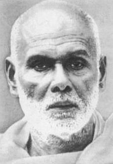
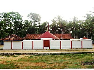
Narayana Guru built temples at various locations in India: Kollam, Thiruvananthapuram, Thrissur, Kannur, Anchuthengu, Thalassery, Kozhikode, Mangalore. Some of the temples built by the guru are:

Krishnapuram is a village in Alappuzha district in the Indian state of Kerala.
Poothakkulam, also known as Bhoothakkulam, is a village in Kollam district in the state of Kerala, India. The village is located 3.9 km away from Paravur, 11.4 km from Varkala and 23 km from Kollam. In 2011, it had a population of 628,451 residents. The village covers an area of 16.56 km2.
Karakulam is a panchayat in Nedumangad Taluk in Thiruvananthapuram District in the state of Kerala, India. It is the most populated panchayat in the district according to 2011 census.
Parasuvaikkal is a village in Thiruvananthapuram district in the state of Kerala, India.
Vattappara is a village in Thiruvananthapuram district in the state of Kerala, India. , well known for its geographical peculiarities with quarries that are generally used for extracting building materials (rock).This town is by the side of MC Road connecting Trivandrum and Kottayam and 14 km away from Trivandrum City. The nearest township is Nedumangad.There is no recorded history on the origin of this place. The major occupation in Vattappara is farming(Rubber, Coconut).
Peyad //peɪjɑd// is a place located in the suburb of Thiruvananthapuram, the capital city of Kerala state in India. The offices of Vilappil Grama Panchayath and Vilappil Village are situated at Peyad.
Venjaramoodu is a north-east suburb of Trivandrum city, the capital of Kerala. It is 9 km (5.6 mi) east of Attingal, 11 km (6.8 mi) northwest of Nedumangad and 12 km (7.5 mi) northeast of Thiruvananthapuram City.
Mannanmoola is a residential locality near Peroorkada to the north eastern part of Thiruvananthapuram (Trivandrum) in the Indian state of Kerala, on the way to vattiyoorkavu. Once a remote village, Mannanmoola has seen rapid development over the last decade with the setting up of several residential colonies. Mannanmoola has one boundary demarked by the Killi River, which is crossed by the Mannanmoola Bridge en route to Vattiyoorkavu. The other localities in Mannanmoola's neighbourhood are Melathumele, Manikanteswaram, Thozhuvancodu, Oolampara etc. This area is part of Peroorkada Ward of the Corporation of Thiruvananthapuram and the elected Ward member is Mrs.P.Jameela Sreedharan.
There are many places of worship in the town of Piravom in the Indian state of Kerala, catering for the Hindu and Christian faiths. Religious festivals are also celebrated.

Kunnathu Sri Mahadeva Temple (കുന്നപ്പുറം, കുന്നത്ത്കാവ്)is located in the city of Thiruvananthapuram at Kudappanakunnu in Thiruvananthapuram district. The presiding deity of the temple is Lord Shiva, located in separate sanctum sanatoriums, facing east. It is believed that this temple is one of the 108 Shiva temples of Kerala and is installed by sage Parasurama dedicated to Lord Shiva. The temple is located near the Kudappanakkunnu Civil Station on the Peroorkada-Mannanthala road.


