
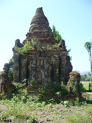
Magway Region is an administrative division in central Myanmar. It is the second largest of Myanmar's seven divisions, with an area of 44,820 km2. Pa Del Dam (ပဒဲဆည်) is one of the dams in Aunglan Township, Magway Division. The capital and second largest city of the Magway Division is Magway. The largest city is Pakokku. The major cities of Magway Division are Magway, Pakokku, Aunglan, Yenangyaung, Taungdwingyi, Chauk, Minbu, Thayet and Gangaw.

Magway is the capital city of Magway Region of Myanmar, and situated on the banks of the Irrawaddy River. The Myathalun Pagoda, the beauty of Magway, located at the north of the city, is the landmark of Magway. Magway Region is famous for the cultivation of sesame and many kinds of nuts. It is also the second largest city of Magway Region and it is home to Magway Airport.

Chin State is a state in western Myanmar. Chin State is bordered by Sagaing Division and Magway Division to the east, Rakhine State to the south, the Chittagong Division of Bangladesh to the west, and the Indian states of Mizoram to the west and Manipur to the north. The population of Chin State is about 488,801 according to the 2014 census, and its capital city is Hakha.

Pakokku is the largest city in the Magway Region of Myanmar. It is situated about 30 km northeast of Bagan on the Irrawaddy River. It is the administration seat of Pakokku Township, Pakokku District and Gangaw District. Pakokku Bridge is part of the India–Myanmar–Thailand Trilateral Highway and is the longest bridge in Myanmar. It is home of the Pakokku Airport.
Gangaw is a town of Gangaw Township in Gangaw District in the Magway Division in Myanmar. Gangaw is also known as the City of Yaw, a certain region in Myanmar including Gangaw (ဂန့်ဂေါ), Tilin (ထီးလင်း), Saw (ဆော) and villages around them. Gangaw District and Gangaw township was a part of Pakokku District until 2003.In 2003,Gangaw District was established. Myit Thar river (မြစ်သာမြစ်) flows from South to North dividing the town into Gangaw and Western Gangaw (အနောက်ဂန့်ဂေါ) village.
Pauk is a town in Pauk Township, Pakokku District, Magway Region, in north-west Myanmar. It is the administrative center for Pauk Township. Pauk is located on the western bank of the Kyaw River just above its intersection with the Yaw River.

Mindat District is a district in the Chin State of Myanmar. It consists of two townships and 840 villages.

Mindat Township is a township located in Mindat District in the Chin State of Myanmar. The township is located between latitude 21.19 and 21.47, longitude 93.23 and 94.29. The third highest peak in Myanmar, Nat Ma Taung at 3,053 metres (10,016 ft), is visible from here, though it is within Kanpetlet township boundary. Mindat was a part of Pakokku Hill Tracts District.
Mindat is located at south of the Chin State. Mindat is a town in the Chin State of Western Myanmar.It is the administration seat of Mindat Township and Mindat District. The people speak the Kʼchò language.
Matupi is the principal town of Matupi Township of Chin State in western Myanmar. There are 6 major Chin tribes living in Matupi; the Matu, Mara(Tlosai,Hlaipao, Hawthai,Sizo,etc), Dai, Zotung, Lautuv and Khumi tribes.

Saw Township is a township of Pakokku District in the Magway Region of Burma (Myanmar). The principal town and administrative seat is Saw.
Htilin is a town in Gangaw District in the Magway Region of Myanmar. It is the administrative seat for Tilin Township. It is located in western Magway Division contacted with Chin Hills.The people in this township speak Yaw Dialect(Sub-Burmese).
Minbu District is a district of the Magway Division in central Myanmar. The city of Minbu is the administrative centre. Minbu District has 5 townships.
The Daai are an ethnic group living in Chin State, Myanmar. The Daai consist of 32 Chin tribes, which have been registered by the Government of Burma since 1890. The recent Military Regime’s census mentions the Daai tribe as the 62nd of 135 tribes of Burma. Researchers refer to them as the Daai group in the ethnic survey book of Burma. The Daai-Chin appear to be of Tibeto-Burman descent. The Daai people live in the Mindat, Paletwa, Matupi and Kanpetlet townships of Southern Chin State in Burma. There are more than 180 Daai villages with a total population of somewhere between 40,000 and 50,000. Their population makes the Daai-Chin the majority tribe of the Southern Chin Hills.
Sidoktaya, also Sitoktaya or Setoketaya is a town and seat of Sidoktaya Township in Minbu District of Magway Division, situated in middle west region of Burma. It is bordered with Salin township to the east, with Pwintbyu township to the south-east, with Ngape township to the south, with Minbya township to the west, with Kanpelek township to the north-west and with Saw township to the north. It is a hilly region of Rakhine. Mount Sun Taung, the highest mountain in Rakhine, 6,527 feet (1,989 m) high, is in Sidoktaya township.

Pakokku District is a district of the Magway Division in central Burma (Myanmar). It is situated in northern part of Magwe Region. The administrative centre is the city of Pakokku. Pakokku is a largest city of Magway Division. It is also the 13th largest city of Burma (Myanmar). The townships of Pakokku District are Pakokku, Yesagyo, Pauk, Seikphyu, Myaing, Htilin, Saw and Gangaw.

Seikphyu Township is a township of Pakokku District in Magway Division of Burma (Myanmar). The principal town and administrative seat is Seikphyu. The township has its southeastern border along the Irrawaddy where its principal town, Seikphyu, is a port. The township lies between 20° 51' and 21° 15' north latitude and 94° 09' and 94° 48' east longitude. The Yaw River forms the township's eastern boundary. It is one of the areas destroyed by Cyclone Giri on 23 October 2010.

Pakokku Township is a township of Pakokku District in Magway Division of Burma (Myanmar). The principal town and administrative seat is Pakokku. The township has its eastern and southeastern border along the Irrawaddy where its principal town, Pakokku, is a port. The Yaw River forms the township's southwest border. There is a commercial airport at Lanywa (Lan).

Yesagyo Township is a township of Pakokku District in the Magway Region of central Burma (Myanmar). The principal town and administrative seat is Yesagyo.
Minhla Township is a township of Thayet District in the Magway Region of Myanmar (Burma). The administrative seat of the township is Minhla.


