
Indore ) is the largest and most populous city in the Indian state of Madhya Pradesh. It is consistently ranked as the cleanest city in India. It serves as the headquarters of both the Indore District and the Indore Division. It is also considered as the state education hub and houses campuses of both the Indian Institute of Technology and the Indian Institute of Management. Located on the southern edge of Malwa Plateau, at an average altitude of 553 meters (1,814 ft) above sea level, it has the highest elevation among major cities of Central India. The city is 190 km (120 mi) west of the state capital of Bhopal. It is 57 km (35 mi) from Ujjain and 35 km (20 mi) from Dewas. Indore had a census-estimated 2011 population of 1,994,397 and 3,570,295. The city is distributed over a land area of just 530 square kilometres (200 sq mi), making Indore the most densely populated major city in the central province.

Dhule is a city located in the Dhule District in the northwestern part of Maharashtra state, India known as West Khandesh. Situated on the banks of Panzara River, Dhule is the regional headquarters of MIDC, RTO, and MTDC.

Ujjain or Ujjayinī is a city in Ujjain district of the Indian state of Madhya Pradesh. It is the fifth-largest city in Madhya Pradesh by population and is the administrative centre of Ujjain district and Ujjain division. It is one of the Hindu pilgrimage centres of Sapta Puri famous for the Kumbh Mela (Simhastha) held there every 12 years. The famous temple of Mahakaleshwar Jyotirlinga is located in the center of the city. The city has been one of the most prominent trade and political centres of the Indian Subcontinent from the time of the ancient Mahājanapadas until the British colonisation of India.

Dewas is a city in the Malwa region of the Indian state of Madhya Pradesh. The municipality was formerly the seat of two 15-Gun Salute state princely states during the British Raj, Dewas Junior state and Dewas Senior state, ruled by the Pawar clan of the Marathas. The city is the administrative capital of Dewas district. Dewas is an industrialised city and houses a government bank note press.

Gangapur City is a city and a municipal council located in Gangapur district in the Indian state of Rajasthan. It is the administrative headquarters of Gangapur district. It is famous for its Sweet Cuisine Kheermohan and newly built Kushalgarh Baba Shyam Temple.
Narasimhanaickenpalayam is a part of Coimbatore city. It is about 14 km from Coimbatore city junction in the northern direction. Narasimhanaickenpalayam is on the stretch of National Highway NH 67 Extn (NH-181) Mettupalayam Road, one of the arterial roads of Coimbatore city. Neighbouring places are Thudiyalur, NGGO Colony, and Periyanaickenpalayam
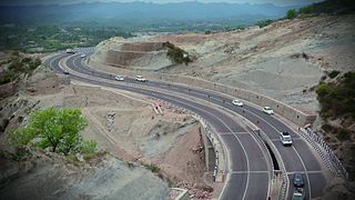
National Highway 44 is a major north–south National Highway in India and is the longest in the country.
The city of Nagpur is strategically located in central India. It has a vast railway network and its road network is well-maintained to avoid congestion. There are 4 modes of transportation in Nagpur. Nagpur is connected to India's four major metropolitan areas by road, rail and air. Auto rickshaws operate in most parts of the city, and are the main form of hired transport.
The Indian city of Thiruvananthapuram has a well-developed transport infrastructure. The city and its suburbs may be traversed using road and rail. Within the city, city buses, taxis and auto rickshaws provide mobility. Scooters and motorcycles are the favored means of personal transport. Ola, Uber and other taxi services operate there.
Bijalpur is in the south-west region of Indore city. It has population of 40,000.
Geeta Bhawan is a residential locality in the city Indore, Madhya Pradesh, India. Real estate prices have shot up and are comparable to any posh areas of Indore, in large part because of the continued boom of immigrants.
Dewas Naka is a suburb residential locality in the city of Indore, Madhya Pradesh, India. It got its name from a major industrial-town of Madhya Pradesh Dewas as it is the last suburb before the main Highway starts. Elected Member of the Legislative Assembly is Ramesh Mendola.
Navlakha is a residential locality within the city of Indore, Madhya Pradesh, India. The area is named after the famous Navlakha Temple in the city of Indore. Its postal code is 452012.
Bhanwarkuan is a sub-urban locality of Indore, India.
Azad Nagar is a sub-urb and residential locality in Indore. It is situated at the banks of the Kanh River in Indore.
Chandan Nagar is a sub-urban locality of Indore in the state of Madhya Pradesh, India.
Chandra Nagar is a residential locality in the largest city and commercial hub Indore in the state of Madhya Pradesh, India. Coaching centres and accommodation motels are growing and blooming up here as the growth of population in the locality. It is the Hindu majority area of Indore City.
Coimbatore is a city in the state of Tamil Nadu, India. Most transportation in the city and suburbs is by road. Coimbatore is well-connected to most cities and towns in India by road, rail, and air, but not through waterways. The city has successful transport infrastructure compared to other Indian cities, though road infrastructures are not well maintained and developed according to the growing needs of transport, making traffic congestion a major problem in the city. A comprehensive transport development plan has been made to address many traffic problems.
Mahalaxmi is a suburb of Indore.
Khandwa Naka is a sub-urb in the largest city and commercial hub Indore in the state of Madhya Pradesh, India.