Indore is the most populous and the largest city in the Indian state of Madhya Pradesh. It serves as the headquarters of both Indore District and Indore Division. It is also considered as an education hub of the state and has campuses of both the Indian Institute of Technology and the Indian Institute of Management. Located on the southern edge of Malwa Plateau, at an average altitude of 550 meters (1,800 ft) above sea level, it has the highest elevation among major cities of Central India. The city is 190 km (120 mi) west of the state capital of Bhopal. Indore had a census-estimated 2011 population of 1,994,397 and 2,170,295. The city is distributed over a land area of just 530 square kilometres (200 sq mi), making Indore the most densely populated major city in the central province. It comes under Tier 2 cities in India.

Dr. Ambedkar Nagar, commonly known as Mhow, is a cantonment in the Indore district in Madhya Pradesh state of India. It is located 23 kilometres (14 mi) south-west of Indore city, towards Mumbai on the old Mumbai-Agra Road. The town was renamed as Dr. Ambedkar Nagar in 2003, by the Government of Madhya Pradesh.

Chromepet is a residential neighbourhood and shopping district in Chennai, Tamil Nadu, India. It is located 22 kilometres from the Chennai Central Railway Station. It lies on both sides of the Grand Southern trunk, close to Thirumudivakkam and Tambaram, and next to Pallavaram. The 200 feet road connects Chromepet with Thoraipakkam. Chromepet is 6 km from Outer Ring Road, Thirumudivakkam, and 4 km south of the Chennai International Airport at Tirusulam. It is the home to the famous Madras Institute of Technology, the institute where Dr. A. P. J. Abdul Kalam, former president of India, and Tamil writer Sujatha studied. The neighbourhood is served by Chromepet railway station of the Chennai Suburban Railway Network, and is a calm residential locality. Chromepet votes for the Sriperumbudur parliamentary constituency in the Indian national elections.
Amravati district is a district of Maharashtra state in central India. Amravati is the administrative headquarters of the district.

Bilaspur is a city located in Bilaspur District in the Indian state of Chhattisgarh . Bilaspur is the administrative headquarters of Bilaspur District and Bilaspur Division. The Chhattisgarh High Court, located at Bodri, District Bilaspur has privileged it with the title 'Nyayadhani' of the state. This city is the commercial center and business hub of North East Chhattisgarh region. It is also an important city for the Indian Railways, as it is the headquarters for South East Central Railway Zone and the Bilaspur Railway Division. Bilaspur is 3rd cleanest and 4th longest railway station in India. Bilaspur is also the headquarters of South Eastern Coalfields Limited.NTPC, Sipat is near Bilaspur too.

Sitapur is a city and a municipal board in Sitapur district in the state of Uttar Pradesh, India. It is in the Lucknow Division. The town is located on the banks of river Sarayan, halfway between Lucknow and Shahjahanpur and is well connected to state capital Lucknow by the National Highway No. 24. In British India, it was spelled as Citapore and was a cantonment, garrisoned by a portion of a British regiment. The traditional origin for the name is said to be by the King Vikramāditya from Lord Ram's wife Sita.

Ujjain district is a district of Madhya Pradesh state in central India. The historic city of Ujjain is the district headquarters. Tropic of Cancer passes through Ujjain. The district has an area of 6,091 km², and a population of 1,986,864, a 16.12% increase from its 2001 population of 1,710,982.
Rau is a suburb and a nagar panchayat in Indore district in the Indian state of Madhya Pradesh. It is a part of the Indore Metropolitan Region.

Vijayanagar is a neighbourhood in Southwest Bangalore, India. It derives its name from the Vijayanagara empire that flourished in South India during the 15th and 16th centuries. It is bound by Mysore Road and Magadi Road, with Chord Road cutting through. It is the northernmost area in South Bangalore.
Rajendra Nagar or Rajendranagar is the name of several localities and towns in India, most of them named after the country's first president Dr. Rajendra Prasad. It may refer to:
Rajputana–Malwa Railway was a 1,000 mm railway line which ran from Delhi to Ajmer and from Ajmer to Indore and Ahmedabad. It was earlier known as Rajputana State Railway until 1882 when it was renamed.

Kandivali is a neighbourhood in the north Mumbai, Maharashtra, India. It is the 20th railway station on the western line from Churchgate.
Rajendra Nagar Terminal,, is the railway station serving the capital city of Patna in the Indian state of Bihar. It is located in Rajendra Nagar in Patna and is in the Danapur railway division of the East Central Railway zone of the Indian Railways. The city is a major railway hub and has five major stations: Rajendranagar Terminal, Patna Junction, Danapur Station, Patliputra Junction and Patna Sahib Station.Some famous trains departs from here Rajendranagar- Banka Intercity Superfast Express,Patna Rajdhani,Sampoorna kranti express etc

Indore Junction is one of the Railway junctions in Madhya Pradesh and serves Indore, the commercial capital of Central India. The railway station of Indore Junction BG falls under the administrative control of Western Railway Zone of Indian Railways. It consists of 6 main railway platforms. The Ujjain – Indore route and Indore Junction was electrified in 2011. The Station is located 1 km away from the city centre. It is one of the ISO Certified Railway Stations of India.
Bijalpur is in the south-west suburban of Indore city. It has population of 40000. It was included in Indore in 1983.
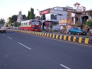
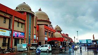
The Rajendra Nagar railway station is one of the local railway station in the City of Indore.

Kallikuppam is a locality in Ambattur, which is a large neighbourhood in Chennai City.

Institute Of Engineering & Science IPS Academy Indore is an engineering education institution located at Indore city beside NH-3 in Madhya pradesh state, India. It was established in Indore on 19 October 1999 after securing approval of the All India Council for Technical Education, New Delhi, and Government of Madhya Pradesh to commence in the 1999-2000 academic year. It ranks among the top 45 private engineering institutions in India.
Mhow Indore Passenger was a passenger train of Indian Railways, which ran between Indore Junction railway station (MG) to Mhow railway station in the Central Indian state of Madhya Pradesh. In 2015, the train was cancelled due to closure of Indore - Mhow line for Gauge Conversion.