La Gorce

Last updated
La Gorce
Neighborhood of Miami Beach
La Gorce, 1930.png
Golf course and surrounding neighborhood in La Gorce, 1930
Country United States
State Florida
County Miami-Dade County
City Miami Beach
Government
  Miami Beach Mayor Dan Gelber
  Miami-Dade County Commissioner Sally A. Heyman
   House of Representatives Richard L. Steinberg (D)
   State Senate Gwen Margolis (D)
   U.S. House Debbie Wasserman Schultz (D)
Area
  Total 1.189 sq mi (3.08 km2)
Elevation 3 ft (0.9 m)
Population (2010)
  Total 2,623
  Density 2,206/sq mi (852/km2)
Time zone EST (UTC-05)
ZIP Code 33140, 33141
Area code(s) 305, 786

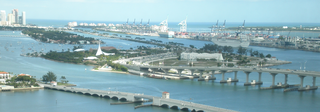
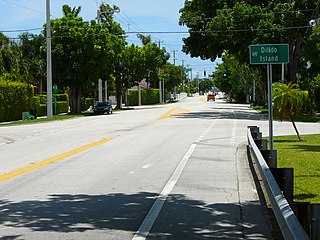
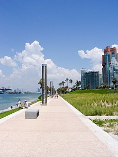
La Gorce is a neighborhood of Mid-Beach in the city of Miami Beach, Florida, United States. North of Indian Creek and just south of the Isle of Normandy, it is located along the shore of Biscayne Bay and include Allison and La Gorce islands. [1]

Mid-Beach Neighborhood of Miami Beach in Miami-Dade County, Florida, United States

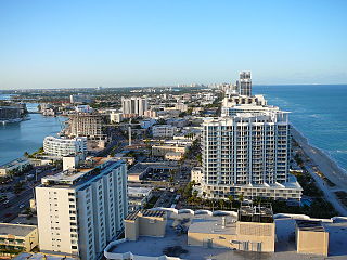
Mid-Beach is a section of the city of Miami Beach, Florida, United States. It is portion of the city which encompasses the area north of 23rd Street and the Indian Creek and south of Surprise Lake and 63rd Street. It collectively refers to neighborhoods including Oceanfront, Bayshore, and Nautilus.

Miami Beach, Florida City in Florida, United States

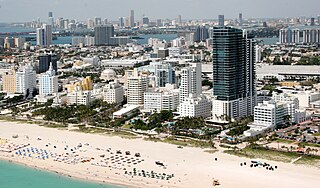
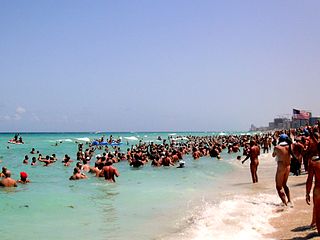
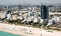
Miami Beach is a coastal resort city in Miami-Dade County, Florida, United States. It was incorporated on March 26, 1915. The municipality is located on natural and man-made barrier islands between the Atlantic Ocean and Biscayne Bay, the latter of which separates the Beach from Miami. The neighborhood of South Beach, comprising the southernmost 2.5 square miles (6.5 km2) of Miami Beach, along with downtown Miami and the Port of Miami, collectively form the commercial center of South Florida. Miami Beach's estimated population is 92,307 according to the most recent United States census estimates. Miami Beach is the 26th largest city in Florida based on official 2017 estimates from the US Census Bureau. It has been one of America's pre-eminent beach resorts since the early 20th century.

Florida State of the United States of America

Florida is the southernmost contiguous state in the United States. The state is bordered to the west by the Gulf of Mexico, to the northwest by Alabama, to the north by Georgia, to the east by the Atlantic Ocean, and to the south by the Straits of Florida. Florida is the 22nd-most extensive, the 3rd-most populous, and the 8th-most densely populated of the U.S. states. Jacksonville is the most populous municipality in the state and the largest city by area in the contiguous United States. The Miami metropolitan area is Florida's most populous urban area. Tallahassee is the state's capital.

Related Research Articles

El Nuevo Herald is a newspaper published daily in Spanish in Southeast Florida, United States. Its headquarters is in Doral. El Nuevo Herald's sister paper is the Miami Herald, also produced by the McClatchy Company.

The Miami Canal, or C-6 Canal, flows from Lake Okeechobee in the U.S. state of Florida to its terminus at the Miami River, which flows through downtown Miami. The canal flows in a south and southeasterly direction for approximately 77 miles, and passes through three counties: Broward, Palm Beach, and Miami-Dade. It was constructed in the early part of the 20th century to drain the Everglades Agricultural Area (EAA).

Ocean Drive (South Beach)

Ocean Drive is a major thoroughfare in the South Beach neighborhood of Miami Beach.

MacArthur Causeway Bridge in Florida, United States of America

The General Douglas MacArthur Causeway is a six-lane causeway which connects Downtown, Miami, Florida and South Beach, Miami Beach via Biscayne Bay.

Di Lido Island Neighborhood of Miami Beach in Miami-Dade County, Florida, United States

Di Lido Island is a neighborhood of South Beach in the city of Miami Beach on a man-made island in Biscayne Bay, Florida, United States. It is the third island from the east of the Venetian Islands, a chain of artificial islands in Biscayne Bay in the cities of Miami and Miami Beach. It is between San Marino Island and Rivo Alto Island. It is home to residential neighborhoods and a portion of the Venetian Causeway. The unfinished artificial island Isola di Lolando from the Florida land boom of the 1920s is located near the north tip of Di Lido Island.

The Holocaust Memorial of the Greater Miami Jewish Federation is a Holocaust memorial at 1933-1945 Meridian Avenue, in Miami Beach, Florida.

Haulover Park

Haulover Park is a 99-acre (40 ha) urban nude beach located in metropolitan Miami, just north of Bal Harbour, Florida. The park is located on a shoal between the Atlantic Ocean and Biscayne Bay, just north of the Broad Causeway and Collins Avenue.

Rivo Alto Island is a neighborhood of South Beach in the city of Miami Beach on a man-made island in Biscayne Bay, Florida, United States. It is one of the Venetian Islands, a chain of artificial islands in Biscayne Bay in the cities of Miami and Miami Beach. It is between Di Lido Island and Belle Isle. It is home to residential neighborhoods and a portion of the Venetian Causeway.

Collins Avenue, partly co-signed State Road A1A, is a major thoroughfare in southern Florida. The road runs parallel to the Atlantic Ocean in Miami Beach, Florida, one block west. Collins Avenue was named for John S. Collins a developer who in 1913 completed the first bridge, Collins Bridge, connecting Miami Beach to the mainland across Biscayne Bay.

Gorce or La Gorce may refer to:

North Beach (Miami Beach) Neighborhood of Miami Beach in Miami-Dade County, Florida, United States

North Beach is a neighborhood of the city of Miami Beach, Florida, United States. It is the northernmost section of the city, roughly bound by 63rd Street and Indian Creek Drive to the south and 87th Terrace to the north. It collectively refers to neighborhoods including Isles of Normandy, Biscayne Point, and La Gorce.

Isle of Normandy or Normandy Island or Normandy Isles or Normandy Isle is a neighborhood of North Beach in the city of Miami Beach, Florida, United States. It is located along the eastern shore of Biscayne Bay.

Clinton Hotel Miami Beach

Clinton Hotel Miami Beach or The New Clinton Hotel And Spa is an Art Deco hotel located in Miami Beach, Florida.

South Pointe Park

South Pointe Park, known locally as South Pointe, is a 17-acre (6.9 ha) county urban park in metropolitan Miami, in the South Beach neighborhood of Miami Beach, Florida.

San Marino Island Neighborhood of Miami Beach in Miami-Dade County, Florida, United States

San Marino Island is a neighborhood of South Beach in the city of Miami Beach on a man-made island in Biscayne Bay, Florida, United States. It is one of the Venetian Islands, a chain of artificial islands in Biscayne Bay in the cities of Miami and Miami Beach. It is between San Marco Island and Di Lido Island. It is home to residential neighborhoods and a portion of the Venetian Causeway.

Allison Island is an island within the city of Miami Beach in Miami-Dade County, Florida, United States. It is located inside the Indian Creek waterway in the La Gorce neighborhood, in the area of the city referred to as North Beach.

La Gorce Island is an island within the city of Miami Beach in Miami-Dade County, Florida, United States. It is located in Biscayne Bay in the La Gorce neighborhood, in the area of the city referred to as North Beach.

The Miami Beach Open was a golf tournament on the PGA Tour in the late 1920s and again in the 1950s. It was held at several different courses in the Miami Beach, Florida area.

The La Gorce Open was a golf tournament on the PGA Tour from 1928 to 1931. It was held at the La Gorce Country Club in Miami Beach, Florida.

References

Coordinates: 25°50′06″N80°07′39″W / 25.835123°N 80.127368°W / 25.835123; -80.127368

Geographic coordinate system Coordinate system

A geographic coordinate system is a coordinate system that enables every location on Earth to be specified by a set of numbers, letters or symbols. The coordinates are often chosen such that one of the numbers represents a vertical position and two or three of the numbers represent a horizontal position; alternatively, a geographic position may be expressed in a combined three-dimensional Cartesian vector. A common choice of coordinates is latitude, longitude and elevation. To specify a location on a plane requires a map projection.