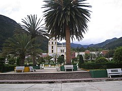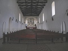
Boyacá is one of the thirty-two departments of Colombia, and the remnant of Boyacá State, one of the original nine states of the "United States of Colombia".
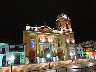
Tunja is a municipality and city on the Eastern Ranges of the Colombian Andes, in the region known as the Altiplano Cundiboyacense, 130 km northeast of Bogotá. In 2018 the municipality had a population of 172,548. It is the capital of Boyacá department and the Central Boyacá Province. Tunja is an important educational centre of well-known universities. In the time before the Spanish conquest of the Muisca, there was an indigenous settlement, called Hunza, seat of the hoa Eucaneme, conquered by the Spanish conquistadors on August 20, 1537. The Spanish city was founded by captain Gonzalo Suárez Rendón on August 6, 1539, exactly one year after the capital Santafé de Bogotá. The city hosts the most remaining Muisca architecture: Hunzahúa Well, Goranchacha Temple and Cojines del Zaque.

The Lache were an indigenous, agrarian people in the highlands of what is now central Colombia's northern Boyacá and Santander departments, primarily in Gutiérrez Province and García Rovira Province. They were part of the Cocuy Confederation and spoke Chibcha, trading predominantly with other Chibcha speakers, such as the Muisca, Guane, Pijao and Chitarero. Trade included salt and textiles, as well as food stuffs. The Lache farmed maize, potatoes, quinoa and cotton, among other crops.

Motavita is a town and municipality in the Colombian Department of Boyacá, part of the subregion of the Central Boyacá Province. It covers approximately 62 square kilometres (24 sq mi).
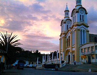
Boavita is a town and municipality in the Colombian Department of Boyacá, part of the subregion of the Northern Boyacá Province. The urban centre of Boavita is situated in the Eastern Ranges of the Colombian Andes at an altitude of 2,114 metres (6,936 ft) and a distance of 184 kilometres (114 mi) from the department capital Tunja. The municipality borders Capitanejo, Santander, and the Nevado River in the north, San Mateo and La Uvita in the east, Tipacoque and Soatá in the west and Susacón in the south.

San Mateo is a town and municipality in the Northern Boyacá Province, part of the Colombian department of Boyacá. The urban centre is located at an altitude of 2,500 metres (8,200 ft) in the Eastern Ranges of the Colombian Andes. San Mateo borders Guacamayas, Panqueba and El Cocuy in the east, Boavita in the west, Macaravita, Santander in the north and La Uvita in the south.
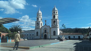
Susacón is a town and municipality in the Colombian Department of Boyacá, part of the subregion of the Northern Boyacá Province. Susacón borders to the north Soatá, in the east Boavita, La Uvita and Jericó, in the south Sativanorte and in the west the Santander municipality of Onzaga.

El Cocuy is a town and municipality in the Colombian Department of Boyacá, part of the sub-region of the Gutiérrez Province. The national natural park El Cocuy National Park is nearby.

Güicán de la Sierra, also known as Nuestra Señora de la Candelaria de Güicán, is a town and municipality in the Colombian Department of Boyacá. It is close to the national natural park El Cocuy National Park. As of the year 2020, it has a total population of 6,426.

The Northern Boyacá Province is a province of the Colombian Department of Boyacá. The province is formed by 9 municipalities.

The Gutiérrez Province is a province of the Colombian Department of Boyacá. The province is formed by six municipalities. The province is named after Colombian president José Santos Gutiérrez. The highest mountains of the Eastern Ranges of the Colombian Andes are located in the Gutiérrez Province. The Ritacuba Blanco, with 5,410 metres (17,750 ft) the highest peak in the Eastern Ranges is the second-most prominent peak of Colombia, after the highest double mountain Pico Cristóbal Colón.
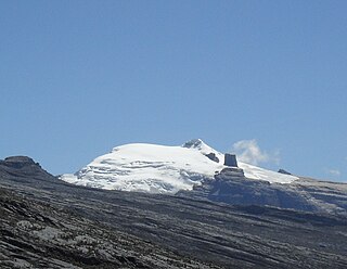
The Sierra Nevada del Cocuy Chita or Guican National Natural Park (or Sierra Nevada de Chita or Sierra Nevada de Güicán, Spanish: Parque Natural Sierra Nevada del Cocuy Chita o Guican is a national park and a series of highlands and glaciated peaks located within the Cordillera Oriental mountain range in the Andes Mountains of Colombia, at its easternmost point. It also corresponds to the highest range of the Eastern Cordillera and holds the biggest glacial mass in South America, north of the Equator. Since 1977, this region is protected within a National Natural Park because of its fragile páramos, extraordinary bio-diversity and endemism, and its function as a corridor for migratory species under conditions of climate change. Among the Sierra’s natural attractions are the remaining 18 ice-covered peaks, glacial lakes and waterfalls.

El Cocuy National Park is a national park located in the Andes Mountains within the nation of Colombia. Its official name is Parque Nacional Natural El Cocuy.
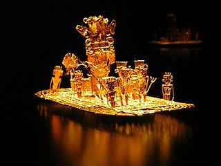
The Herrera Period is a phase in the history of Colombia. It is part of the Andean preceramic and ceramic, time equivalent of the North American pre-Columbian formative and classic stages and age dated by various archaeologists. The Herrera Period predates the age of the Muisca, who inhabited the Altiplano Cundiboyacense before the Spanish conquest of the Muisca and postdates the prehistory of the region in Colombia. The Herrera Period is usually defined as ranging from 800 BCE to 800 CE, although some scholars date it as early as 1500 BCE.

The Muisca inhabited the Altiplano Cundiboyacense in the Colombian Andes before the arrival of the Spanish and were an advanced civilisation. They mummified the higher social class members of their society, mainly the zipas, zaques, caciques, priests and their families. The mummies would be placed in caves or in dedicated houses ("mausoleums") and were not buried.
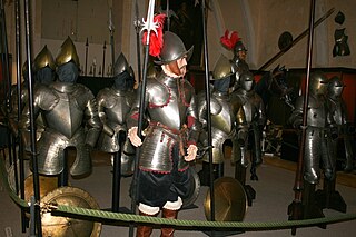
Hernán Pérez de Quesada, sometimes spelled as Quezada, was a Spanish conquistador. Second in command of the army of his elder brother, Gonzalo Jiménez de Quesada, Hernán was part of the first European expedition towards the inner highlands of the Colombian Andes. The harsh journey, taking almost a year and many deaths, led through the modern departments Magdalena, Cesar, Santander, Boyacá, Cundinamarca and Huila of present-day Colombia between 1536 and 1539 and, without him, Meta, Caquetá and Putumayo of Colombia and northern Peru and Ecuador between 1540 and 1542.

The Ocetá Páramo is a páramo, which means an ecosystem above the continuous forest line yet below the permanent snowline. This particular páramo is located at altitudes between 2,950 metres (9,680 ft) and 3,950 metres (12,960 ft) in the Eastern Ranges of the Colombian Andes. It covers parts of the municipalities Monguí, Mongua and Tópaga, belonging to the Sugamuxi Province, Boyacá. The Ocetá Páramo is known for its collection of small shrubs called frailejones, as well as other Andean flora and fauna. Hiking tours from Monguí or Mongua to the páramo take a full day.
Fernando Etayo Serna is a Colombian paleontologist and geologist. His contributions on the paleontology in Colombia has been mainly on the descriptions of ammonites and Etayo has helped describing many fossiliferous geologic formations of Colombia. Etayo obtained his MSc. degree in geology and geophysics from the Universidad Nacional de Colombia in 1963, and his PhD in paleontology from the University of California, Berkeley in 1975.


