
Iza is a town and municipality in Boyacá Department, Colombia. Iza is located near the Tota Lake and part of the Sugamuxi Province, a subregion of Boyacá. Iza is located in the Eastern Ranges of the Colombian Andes on the Altiplano Cundiboyacense at a distance of 13 kilometres (8.1 mi) from Sogamoso and 90 kilometres (56 mi) from the department capital Tunja. The municipality borders Firavitoba and Sogamoso in the north, Sogamoso and Cuítiva in the east, in the west Pesca and Firavitoba, and in the south Cuítiva.
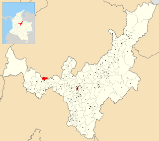
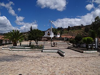
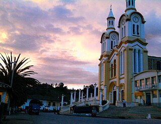
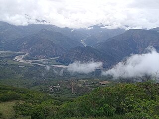
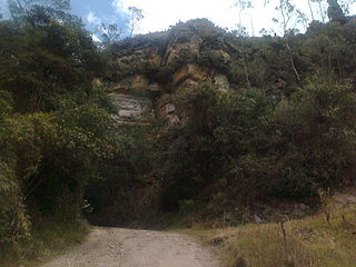
Tipacoque is a municipality and town in Boyacá Department, Colombia, located on the Altiplano Cundiboyacense, part of the Eastern Ranges of the Colombian Andes. Tipacoque is situated on the western flank of the Chicamocha river canyon. It is part of the Northern Boyacá Province.
Tununguá is a town and municipality in Boyacá Department, Colombia, part of the subregion of the Western Boyacá Province. Tununguá is situated in the Eastern Ranges of the Colombian Andes at a relatively low altitude of 1,246 metres (4,088 ft). The municipality borders the department of Santander in the north and east and the Boyacá municipalities Pauna and Briceño (south).
Sotaquirá is a town and municipality in the Central Boyacá Province, part of the Colombian department of Boyacá. Sotaquirá is situated in the Eastern Ranges of the Colombian Andes with the small urban center at an altitude of 2,860 metres (9,380 ft) at 39 kilometres (24 mi) from Tunja. Sotaquirá is a highly rural municipality with 90% of the people living in rural areas and about 50% more cows than inhabitants. The municipality borders Tuta in the east, Paipa in the north, Gámbita, Santander in the west and Cómbita in the south.
Onzaga is a town and municipality in the Santander Department in northeastern Colombia. Onzaga borders in the north San Joaquín, in the east and south the municipalities Soatá, Covarachía, Tipacoque and Tutazá of the department of Boyacá and in the west with Coromoro. Onzaga is 177 kilometres (110 mi) south of the department capital Bucaramanga. The topography of Onzaga varies greatly; from 900 metres (3,000 ft) to 3,600 metres (11,800 ft).

Támara is a town and municipality in the Department of Casanare, Colombia. The urban centre is located at an altitude of 1,156 metres (3,793 ft) at a distance of 95 kilometres (59 mi) from the department capital Yopal. It borders in the north Sacama, in the east Pore and Paz de Ariporo, in the west Socotá of the department of Boyacá and in the south Nunchia and Paya, Boyacá.
Chíquiza is a town and municipality in the Central Boyacá Province, part of the Colombian Department of Boyacá. Chíquiza was called San Pedro de Iguaque until July 17, 2003 when the name was changed to Chíquiza. The municipality is situated on the Altiplano Cundiboyacense with the urban centre at an altitude of 2,900 metres (9,500 ft) and 24 kilometres (15 mi) from the department capital Tunja. Chíquiza borders Arcabuco in the north, Sora and Sáchica in the south, Villa de Leyva in the west and Motavita in the east.
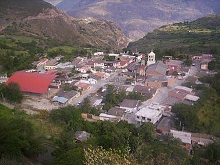
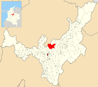
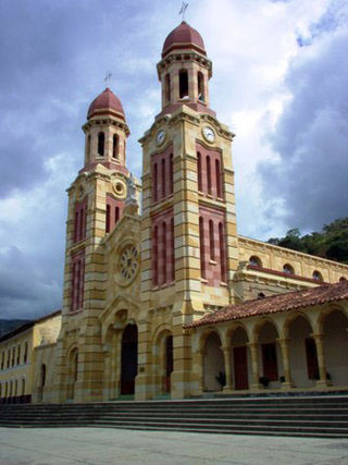
Boavita is a town and municipality in the Colombian Department of Boyacá, part of the subregion of the Northern Boyacá Province. The urban centre of Boavita is situated in the Eastern Ranges of the Colombian Andes at an altitude of 2,114 metres (6,936 ft) and a distance of 184 kilometres (114 mi) from the department capital Tunja. The municipality borders Capitanejo, Santander, and the Nevado River in the north, San Mateo and La Uvita in the east, Tipacoque and Soatá in the west and Susacón in the south.
Covarachía is a town and municipality in the Northern Boyacá Province, part of the Colombian Department of Boyacá. The urban centre is located at 208 kilometres (129 mi) from the department capital Tunja at an altitude of 2,320 metres (7,610 ft) in the Eastern Ranges of the Colombian Andes. The municipality borders San José de Miranda and Capitanejo in the north, Tipacoque in the south, Capitanejo in the east and in the west the municipalities Onzaga and San Joaquín (Santander).

Guayatá is a town and municipality in the Eastern Boyacá Province, part of the Colombian department of Boyacá. Guayatá is situated on the Altiplano Cundiboyacense at distances of 129 kilometres (80 mi) from the department capital Tunja and 132 kilometres (82 mi) from the national capital Bogotá. The urban centre is located at an altitude of 1,767 metres (5,797 ft) and the altitude ranges from 1,270 metres (4,170 ft) to 3,080 metres (10,100 ft).

Zetaquirá is a town and municipality in the Colombian Lengupá Province, part of the department of Boyacá. Zetaquirá is located at 67 kilometres (42 mi) from the department capital Tunja and borders Pesca in the north, Miraflores in the south, in the east Berbeo, San Eduardo and Aquitania and in the west Ramiriquí and Chinavita. The municipality stretches over an area of 262 square kilometres (101 sq mi) on the Altiplano Cundiboyacense at altitudes between 1,875 metres (6,152 ft) and 3,600 metres (11,800 ft).
Viracachá is a town and municipality in the Márquez Province, Colombia, part of the Colombian department of Boyacá. Viracachá is situated on the Altiplano Cundiboyacense at 22 kilometres (14 mi) from the department capital Tunja and the small urban center at 2,520 metres (8,270 ft) above sea level. Other parts of Viracachá reach 3,200 metres (10,500 ft). The municipality borders Siachoque, Rondón and Soracá in the north and east, in the south Ciénega and Ciénega, Soracá and Ramiriquí in the west.

Gachantivá is a town and municipality in the Ricaurte Province, part of the Colombian department of Boyacá. Gachantivá is located at altitudes ranging from 2,000 metres (6,600 ft) to 3,300 metres (10,800 ft) on the Altiplano Cundiboyacense and borders Villa de Leyva in the south, Santa Sofía in the west, Arcabuco in the east and Moniquirá in the north.
Cuítiva is a town and municipality in the Sugamuxi Province, part of the Colombian department of Boyacá. The urban centre is situated on the Altiplano Cundiboyacense at an altitude of 2,750 metres (9,020 ft) and a distance of 85 kilometres (53 mi) from the department capital Tunja. The altitudes of the municipality range from 2,727 metres (8,947 ft) to 3,200 metres (10,500 ft) and it borders Iza in the north, Sogamoso in the east, Aquitania in the west and Tota in the south.

Mongua is a town and municipality in Sugamuxi Province in the Colombian Department of Boyacá. Mongua is situated in the Eastern Ranges of the Colombian Andes at altitudes between 1,400 metres (4,600 ft) and 4,000 metres (13,000 ft). The municipality borders Gámeza, Socotá, Pisba, Labranzagrande, Aquitania, Sogamoso, Monguí and Tópaga.

Pesca is a town and municipality in the Colombian Department of Boyacá, part of the Sugamuxi Province, a subregion of Boyacá. The town is located in the Eastern Ranges of the Colombian Andes at altitudes between 2,540 metres (8,330 ft) and 4,000 metres (13,000 ft). Pesca is 108 kilometres (67 mi) west from the department capital Tunja and borders Firavitoba in the north, Iza in the northeast, Tuta in the northwest, in the east Tota, Zetaquirá in the south, Rondón and Siachoque in the southwest and Toca in the west.
Tópaga is a town and municipality in the Sugamuxi Province, part of the Colombian department of Boyacá. Tópaga is situated on the Altiplano Cundiboyacense with the urban center at an altitude of 2,900 metres (9,500 ft) while the topography varies over the municipality from 2,400 metres (7,900 ft) to 3,200 metres (10,500 ft). It borders Nobsa and Corrales in the west, in the east Mongua and Gámeza, in the north Gámeza and in the south Monguí and Sogamoso. Department capital Tunja is 98 kilometres (61 mi) away. Chicamocha River flows through Tópaga.

Socotá is a town and municipality in the Valderrama Province, part of the Colombian department of Boyacá. The municipality is situated in the Eastern Ranges of the Colombian Andes. The urban centre is at an altitude of 2,443 metres (8,015 ft) at a distance of 134 kilometres (83 mi) from the department capital Tunja. It borders Jericó and Sativanorte in the north, Pisba and Mongua in the south, Chita and Támara, Casanare in the east and Sativasur, Tasco, Socha and Gámeza in the west.

Socha is a town and municipality in the Colombian Department of Boyacá, part of the Valderrama Province, which is a subregion of Boyacá. It borders Socotá in the east, Sativasur in the north, Tasco in the south and in the west Paz de Río.
Tasco is a town and municipality in the Valderrama Province, part of the Colombian department of Boyacá. Tasco is situated on the Altiplano Cundiboyacense at altitudes ranging from 2,400 metres (7,900 ft) to 3,800 metres (12,500 ft). The Chicamocha River flows through the municipality which borders Socha in the north, Corrales and Gámeza in the south, Socotá in the east and Betéitiva and Paz de Río in the west. The urban centre is located at an altitude of 2,530 metres (8,300 ft) at 115 kilometres (71 mi) from the department capital Tunja.


