Boyacá is one of the thirty-two departments of Colombia, and the remnant of Boyacá State, one of the original nine states of the "United States of Colombia".

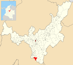
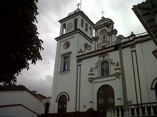
Muzo is a town and municipality in the Western Boyacá Province, part of the department of Boyacá, Colombia. It is widely known as the world capital of emeralds for the mines containing the world's highest quality gems of this type. Muzo is situated at a distance of 178 kilometres (111 mi) from the departmental capital Tunja and 118 kilometres (73 mi) from the capital of the Western Boyacá Province, Chiquinquirá. The urban centre is at an altitude of 815 metres (2,674 ft) above sea level. Muzo borders Otanche and San Pablo de Borbur in the north, Maripí and Coper in the east, Quípama in the west and the department of Cundinamarca in the south.

Sutatenza is a town and municipality in the Eastern Boyacá Province of the department of Boyacá, Colombia. It is located 125 kilometres (78 mi) from the Colombian capital Bogotá and 118 kilometres (73 mi) from the department capital Tunja. Sutatenza borders Somondoco, Guateque, Tenza and Garagoa.

Almeida is a town and municipality in Boyacá Department, Colombia, part of the province of the Eastern Boyacá Province.

The Gachalá Emerald, one of the most valuable and famous emeralds in the world, was found in 1967, in the mine called Vega de San Juan, located in Gachala, a town in Colombia, located 142 km (88 mi) from Bogota. Gachalá Chibcha means "place of Gacha." Presently the emerald is in the United States, where it was donated to the Smithsonian Institution by the New York City jeweler, Harry Winston.

Trapiche emerald is a rare variety of the gemstone emerald, characterized by a six-arm radial pattern of usually black spokes separating areas of green emerald. If weathered, the black spokes may become light in color. Trapiche emerald is one of an assortment of trapiche or trapiche-type minerals. Others include trapiche ruby, sapphire, tourmaline, quartz, and chiastolite. The name comes from the Spanish term trapiche, a sugar mill, because of the resemblance of the pattern to the spokes of a grinding wheel. Emerald is a gem variety of the mineral beryl, and owes it distinctive green color to the presence of chromium and/or vanadium.

Guayatá is a town and municipality in the Eastern Boyacá Province, part of the Colombian department of Boyacá. Guayatá is situated on the Altiplano Cundiboyacense at distances of 129 kilometres (80 mi) from the department capital Tunja and 132 kilometres (82 mi) from the national capital Bogotá. The urban centre is located at an altitude of 1,767 metres (5,797 ft) and the altitude ranges from 1,270 metres (4,170 ft) to 3,080 metres (10,100 ft).

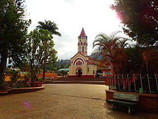
Somondoco is a town and municipality in the Colombian Department of Boyacá. This town and larger municipal area are located in the Valle de Tenza. The Valle de Tenza is the ancient route connecting the Altiplano Cundiboyacense and the Llanos. The area is dotted with many such little towns all located at approximately the same altitude. Somondoco borders Almeida in the east, Guayatá in the west, Guateque and Sutatenza in the north and in the south the Cundinamarca municipality of Ubalá.
Macanal is a town and municipality in the Colombian Department of Boyacá, part of the subregion of the Neira Province. The urban centre is located in the Tenza Valley in the Eastern Ranges of the Colombian Andes at an elevation of 1,680.3 metres (5,513 ft) but parts of the municipality reach elevations of 2,500 metres (8,200 ft). It borders Campohermoso in the east, Almeida in the west, Garagoa in the north and in the south Santa María and Chivor.
Gachalá is a municipality and town of Colombia in the Guavio Province, part of the department of Cundinamarca. The urban centre of Gachalá is situated at a distance of 148 kilometres (92 mi) from the capital Bogotá at an altitude of 1,712 metres (5,617 ft) in the Eastern Ranges of the Colombian Andes. The municipality borders the western portion of the split municipality Ubalá and the department of Boyacá in the north, the eastern part of Ubalá and Medina in the east, Fómeque, Junín and Gama in the west and Fómeque, Medina and the department of Meta in the south.

Manta is a municipality and town located in the northeast of the department of Cundinamarca (Colombia), 90 kilometres (56 mi) from Bogotá. It is located in the Almeidas Province in the Tenza Valley. Manta borders to the north Tibiritá, to the west Machetá, to the south Gachetá and to the east Guateque and Guayatá of the department of Boyacá.

The Eastern Boyacá Province is a province of the Colombian Department of Boyacá. The province is formed by 8 municipalities. The Tenza Valley is located in the Eastern Boyacá Province. The province hosts the eastern belt containing rich emerald deposits.

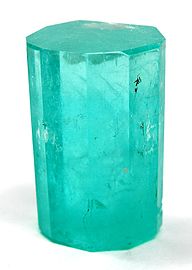
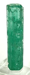
Emeralds are green and sometime green with a blueish-tint precious gemstones that are mined in various geological settings. They are minerals in the beryl group of silicates. For more than 4,000 years, emeralds have been among the most valuable of all jewels. Colombia, located in northern South America, is the country that mines and produces the most emeralds for the global market, as well as the most desirable. It is estimated that Colombia accounts for 70–90% of the world's emerald market. While commercial grade emeralds are quite plentiful, fine and extra fine quality emeralds are extremely rare. Colombian emeralds over 50 carat can cost much more than diamonds of the same size.

The Muzo people are a Cariban-speaking indigenous group who inhabited the western slopes of the eastern Colombian Andes. They were a highly war-like tribe who frequently clashed with their neighbouring indigenous groups, especially the Muisca.

The Tegua or Tecua were an Arawak-speaking indigenous people of Colombia who died out in the 19th century.
The Tenza Valley is an intermontane valley in the Eastern Ranges of the Colombian Andes. The valley stretches over the southeastern part of the department of Boyacá and the northeastern part of Cundinamarca. It is located east of the Altiplano Cundiboyacense and in the time before the Spanish conquest of the Muisca, as the Altiplano was inhabited by the Muisca in the higher altitudes and the Tegua in the lower areas to the east.
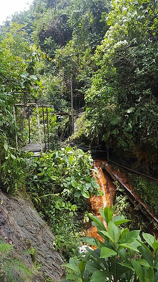
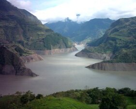
The Las Pavas, also called La Pava, is a Colombian emerald mining area that is neighboring Colombia's largest emerald mine, Puerto Arturo. It is located 200 kilometres (120 mi) northwest of the capital Bogotá in the western emerald belt of Muzo, and about 235 kilometres (146 mi) west of Chivor, which is in the eastern emerald belt. The mining area spans the municipalities Quípama and Muzo.
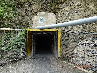
La Pita is an emerald mine located in the western belt of the Colombian emerald mining area. It is owned and operated by the Colombian company, Zuliana De Esmeraldas Ltda.
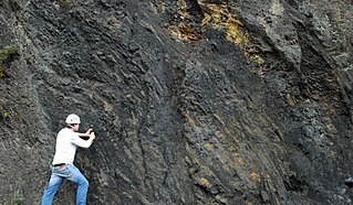
The Macanal Formation or Macanal Shale is a fossiliferous geological formation of the Altiplano Cundiboyacense and Tenza Valley in the Eastern Ranges of the Colombian Andes. The predominantly organic shale formation dates to the Early Cretaceous period; Berriasian to Valanginian epochs and has a maximum thickness of 2,935 metres (9,629 ft). The Macanal Formation contains numerous levels of fossiliferous abundances. Bivalves, ammonites and fossil flora have been found in the formation.