
Catamarca is a province of Argentina, located in the northwest of the country. The province had a population of 429,556 as per the 2022 census [INDEC], and covers an area of 102,602 km2. Its literacy rate is 95.5%. Neighbouring provinces are : Salta, Tucumán, Santiago del Estero, Córdoba, and La Rioja. To the west it borders the country of Chile.

Chocó Department is a department of the Pacific region of Colombia known for hosting the largest Afro-Colombian population in the nation, and a large population of Amerindian and mixed African-Amerindian Colombians. It is in the west of the country, and is the only Colombian department to have coastlines on both the Pacific Ocean and the Atlantic Ocean. It contains all of Colombia's border with Panama. Its capital is Quibdó.

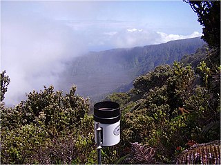
Quibdó is the capital city of Chocó Department, in the Pacific Region of Colombia, and is located on the Atrato River. The municipality of Quibdó has an area of 3,507 km² and a population of 129,237, predominantly Afro Colombian, including Zambo Colombians.
Mawsynram is a town in the East Khasi Hills district of Meghalaya state in Northeastern India, 69 kilometres from Shillong, the state capital. Mawsynram receives the highest rainfall in India. It is reportedly the wettest place on Earth, with an average annual rainfall of 11,872 millimetres (467.4 in). According to the Guinness Book of World Records, Mawsynram received 26,000 millimetres (1,000 in) of rainfall in 1985. Mawsynram received 745.2 mm of rainfall on 19 August 2015, probably the highest rainfall received by the town in recent times. On 17 June 2022, Mawsynram set a new record by receiving 1003.6 mm in a span of 24 hours which has now become its highest single day record for the month of June and for its all-time single day record, beating its former record of 944.7 mm on 7 June 1966.

Mount Waiʻaleʻale is a shield volcano and the second highest point on the island of Kauaʻi in the Hawaiian Islands. Its name literally means "rippling water" or "overflowing water".

Nóvita is a municipality and town in the Chocó Department, Colombia.

Sipí is a municipality and town in the Chocó Department, Colombia.

López de Micay is a town and municipality in the Cauca Department, Colombia. It is located on the Pacific Coast of the Cauca Department in the Naya Region on the foothills of the Colombian Western Cordillera. It is located 84 km from the departmental capital, Popayán.

The climate of the north and central parts of the U.S. state of Florida is humid subtropical. South Florida has a tropical climate. There is a defined rainy season from May through October when air-mass thundershowers that build in the heat of the day drop heavy but brief summer rainfall.

Texas' weather varies widely, from arid in the west to humid in the east. The huge expanse of Texas encompasses several regions with distinctly different climates: Northern Plains, Trans-Pecos Region, Texas Hill Country, Piney Woods, and South Texas. Generally speaking, the eastern half of the state is humid subtropical, while the western half is largely semi-arid.

Natural disasters in Colombia are the result of several different natural hazards that affect the country according to its particular geographic and geologic features. Human vulnerability, exacerbated by the lack of planning or lack of appropriate emergency management, and the fragility of the economy and infrastructure contribute to a high rate of financial, structural, and human losses.

The climate of the United States varies due to changes in latitude, and a range of geographic features, including mountains and deserts. Generally, on the mainland, the climate of the U.S. becomes warmer the farther south one travels, and drier the farther west, until one reaches the West Coast.

The climate of Argentina varies from region to region, as the vast size of the country and wide variation in altitude make for a wide range of climate types. Summers are the warmest and wettest season in most of Argentina, except for most of Patagonia, where it is the driest season. The climate is warm in the north, cool in the center, and cold in the southern parts, that experience frequent frost and snow. Because the southern parts of the country are moderated by the surrounding oceans, the cold is less intense and prolonged than areas at similar latitudes in the northern hemisphere. Spring and autumn are transition seasons that generally feature mild weather.

Rain is water droplets that have condensed from atmospheric water vapor and then fall under gravity. Rain is a major component of the water cycle and is responsible for depositing most of the fresh water on the Earth. It provides water for hydroelectric power plants, crop irrigation, and suitable conditions for many types of ecosystems.

Earth rainfall climatology Is the study of rainfall, a sub-field of meteorology. Formally, a wider study includes water falling as ice crystals, i.e. hail, sleet, snow. The aim of rainfall climatology is to measure, understand and predict rain distribution across different regions of planet Earth, a factor of air pressure, humidity, topography, cloud type and raindrop size, via direct measurement and remote sensing data acquisition. Current technologies accurately predict rainfall 3–4 days in advance using numerical weather prediction. Geostationary orbiting satellites gather IR and visual wavelength data to measure realtime localised rainfall by estimating cloud albedo, water content, and the corresponding probability of rain.

The 1960 Texas tropical storm brought severe but localized flooding to southeastern Texas in June 1960. The first tropical cyclone and first tropical storm of the 1960 Atlantic hurricane season, this system developed from an area of showers and thunderstorms in the Bay of Campeche on June 22. Initially a tropical depression, it strengthened and was estimated to have reached tropical storm status on June 23. Early on the following day, the storm peaked with winds of 60 mph (97 km/h). Later that day, it made landfall near Corpus Christi, Texas, at the same intensity. The storm weakened slowly and moved across the Central United States, before dissipating over Illinois on June 28.
The Pacific Equatorial Forest is a tropical forest ecosystem located along Ecuador's coastal mountain range at 0° latitude, primarily concentrated in northwestern Manabí. The ecosystem is most notable for its high diversity of forest types in unusually close proximity. Tropical rainforest, moist evergreen forest, premontane cloud forest, and tropical deciduous forest can all be encountered over the course of a one-day hike, and the transition from one forest type to another can occur in as little as 500 meters.

Hurricane Manuel was a catastrophic tropical cyclone that brought widespread flooding across much of Mexico in September 2013, in conjunction with Hurricane Ingrid. The fifteenth named storm and seventh hurricane of the annual hurricane season, Manuel originated from a strong area of low pressure south of Acapulco on September 13. Within favorable conditions aloft, the storm intensified into a tropical storm as it tracked northward. The following day, Manuel curved westward and strengthened to a point just shy of hurricane intensity before making its first landfall at that intensity on September 15. Due to interaction with land, the tropical storm quickly weakened, and its center dissipated over western Mexico on September 16. However, the storm's remnants continued to track northwestward into the Gulf of California, where they reorganized into a tropical cyclone the next day. Manuel regained tropical storm status on September 18 as it began to curve northeastward. Shortly thereafter, Manuel attained Category 1 hurricane intensity, before making its final landfall just west of Culiacán at peak intensity. Over land, Manuel quickly weakened due to interaction with Mexico's high terrain, and the storm dissipated early on September 20.
The Big Bog is a high-altitude bog on the island of Maui, the largest in the Hawaiian Islands. It is located on Haleakala's east rift zone, at the border between Hāna Forest Reserve and Haleakalā National Park. It is alleged to be one of the wettest places on Earth, with a reported annual rainfall of 404 inches (10,300 mm) for the period 1992-2018 according to the University of Hawaiʻi at Mānoa.


