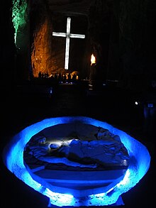
Department of Cundinamarca is one of the departments of Colombia. Its area covers 22,623 square kilometres (8,735 sq mi) and it has a population of 2,919,060 as of 2018. It was created on August 5, 1886, under the constitutional terms presented on the same year. Cundinamarca is located in the center of Colombia.

The Muisca are an Indigenous people and culture of the Altiplano Cundiboyacense, Colombia, that formed the Muisca Confederation before the Spanish conquest. The people spoke Muysccubun, a language of the Chibchan language family, also called Muysca and Mosca. They were encountered by conquistadors dispatched by the Spanish Empire in 1537 at the time of the conquest.

Zipaquirá is a municipality and city of Colombia in the department of Cundinamarca. Its neighboring municipalities are Cogua and Nemocón to the north; Tocancipá to the east; Tabio, Cajicá and Sopó to the south; and Subachoque and Pacho to the west. Its seat of municipal government is 49 kilometers from the national capital Bogotá. It is part of the Greater Bogotá Metropolitan Area, and is the capital of the Sabana Centro province. It is also the headquarters of the diocese of the same name and that includes much of the Department of Cundinamarca, extending to the centre of Bogotá, the region of Rionegro, the Ubaté Valley, and the region of Guavio.
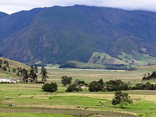
The Altiplano Cundiboyacense is a high plateau located in the Eastern Cordillera of the Colombian Andes covering parts of the departments of Cundinamarca and Boyacá. The altiplano corresponds to the ancient territory of the Muisca. The Altiplano Cundiboyacense comprises three distinctive flat regions; the Bogotá savanna, the valleys of Ubaté and Chiquinquirá, and the valleys of Duitama and Sogamoso. The average altitude of the altiplano is about 2,600 metres (8,500 ft) above sea level but ranges from roughly 2,500 metres (8,200 ft) to 4,000 metres (13,000 ft).

The history of Bogotá refers to the history of the area surrounding the Colombian capital Bogotá. The area around Bogotá was first populated by groups of indigenous people that migrated from mesoamerica. Among these groups were the Muisca that settled on the Altiplano Cundiboyacense in what is now Cundinamarca and Boyacá. With the arrival of the Spanish colonizers the area was developed into a major settlement that was founded by Gonzalo Jiménez de Quesada in 1538, and became capital of the Spanish Empire provinces and the seat of the Viceroyalty of New Granada. With independence, Bogotá became the capital of the Gran Colombia, and -subsequently- of the Republic of Colombia.

Cogua is a municipality and town of Colombia in the department of Cundinamarca. It is situated on northern part of the Bogotá savanna with the urban centre at an altitude of 2,600 metres (8,500 ft) at 50 kilometres (31 mi) from the capital Bogotá. Cogua borders Tausa in the north, Nemocón in the east, Pacho in the west and Zipaquirá in the south.

Nemocón is a municipality and town of Colombia in the Central Savanna Province, part of the department of Cundinamarca. Nemocón, famous for its salt mine, was an important village in the Muisca Confederation, the country in the central Colombian Andes before the arrival of the Spanish. The municipality is situated in the northern part of the Bogotá savanna, part of the Altiplano Cundiboyacense with its urban centre at an altitude of 2,585 metres (8,481 ft) and 65 kilometres (40 mi) from the capital Bogotá. Nemocón is the northeasternmost municipality of the Metropolitan Area of Bogotá and the Bogotá River originates close to Nemocón. The median temperature of Nemocón is 12.8 °C. The municipality borders Tausa in the north, Suesca and Gachancipá in the east, Tocancipá and Zipaquirá in the south and in the west the rivers Checua and Neusa and the municipality of Cogua.
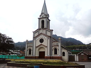
Tausa is a municipality and town of Colombia in the Ubaté Province, part of the department of Cundinamarca. Tausa is and was an important town on the Altiplano Cundiboyacense due to its salt mine. It was the third most prolific salt deposit for the original inhabitants of the area; the Muisca. Tausa's urban centre is located at an elevation of 2,950 metres (9,680 ft) and a distance of 65 kilometres (40 mi) from the capital Bogotá. The municipality borders San Cayetano, Carmen de Carupa and Sutatausa in the north, Pacho in the west, Sutatausa, Cucunubá and Suesca in the east and in the south with Nemocón and Cogua.

El Abra is the name given to an extensive archeological site, located in the valley of the same name. El Abra is situated in the east of the municipality Zipaquirá extending to the westernmost part of Tocancipá in the department of Cundinamarca, Colombia. The several hundred metres long series of rock shelters is in the north of the Bogotá savanna on the Altiplano Cundiboyacense, Eastern Ranges of the Colombian Andes at an altitude of 2,570 metres (8,430 ft). The rock shelter and cave system is one of the first evidences of human settlement in the Americas, dated at 12,400 ± 160 years BP. The site was used by the hunter-gatherers of the Late Pleistocene epoch.

The Bogotá savanna is a montane savanna, located in the southwestern part of the Altiplano Cundiboyacense in the center of Colombia. The Bogotá savanna has an extent of 4,251.6 square kilometres (1,641.6 sq mi) and an average altitude of 2,650 metres (8,690 ft). The savanna is situated in the Eastern Ranges of the Colombian Andes.

Piedras del Tunjo is an important archaeological park established on a natural rock shelter 40 kilometres (25 mi) west of Bogotá in the municipality of Facatativá.

Mineral industry of Colombia refers to the extraction of valuable minerals or other geological materials in Colombia. Colombia is well-endowed with minerals and energy resources. It has the largest coal reserves in Latin America, and is second to Brazil in hydroelectric potential. Estimates of petroleum reserves in 1995 were 3.1 billion barrels (490,000,000 m3). Colombia also possesses significant amounts of nickel and gold. Other important metals included platinum and silver, which were extracted in much smaller quantities. Colombia also produces copper, small amounts of iron ore, and bauxite. Nonmetallic mined minerals include salt, limestone, sulfur, gypsum, dolomite, barite, feldspar, clay, magnetite, mica, talcum, and marble. Colombia also produces most of the world's emeralds. Despite the variety of minerals available for exploitation, Colombia still had to import substances such as iron, copper, and aluminum to meet its industrial needs.
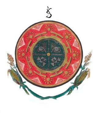
The Muisca Confederation was a loose confederation of different Muisca rulers in the central Andean highlands of what is today Colombia before the Spanish conquest of northern South America. The area, presently called Altiplano Cundiboyacense, comprised the current departments of Boyacá, Cundinamarca and minor parts of Santander.

Ana María Groot de Mahecha is a Colombian historian, archaeologist, anthropologist and associate professor at the Department of Anthropology of the Universidad Nacional de Colombia. Ana Mariá Groot speaks Spanish, English and French.

Liborio Zerda was a Colombian physician and Muisca scholar. Zerda has been important in the natural sciences of the late 19th and early 20th century in Colombia, publishing many articles about various topics, from medicine to chemical analysis, radioactivity and the popular drink chicha.

Marianne Vere Cardale de Schrimpff is a Colombian anthropologist, archaeologist, academic and writer.
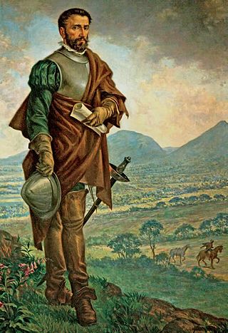
The Spanish conquest of the Muisca took place from 1537 to 1540. The Muisca were the inhabitants of the central Andean highlands of Colombia before the arrival of the Spanish conquistadors. They were organised in a loose confederation of different rulers; the psihipqua of Muyquytá, with his headquarters in Funza, the hoa of Hunza, the iraca of the sacred City of the Sun Sugamuxi, the Tundama of Tundama, and several other independent caciques. The most important rulers at the time of the conquest were psihipqua Tisquesusa, hoa Eucaneme, iraca Sugamuxi and Tundama in the northernmost portion of their territories. The Muisca were organised in small communities of circular enclosures, with a central square where the bohío of the cacique was located. They were called "Salt People" because of their extraction of salt in various locations throughout their territories, mainly in Zipaquirá, Nemocón, and Tausa. For the main part self-sufficient in their well-organised economy, the Muisca traded with the European conquistadors valuable products as gold, tumbaga, and emeralds with their neighbouring indigenous groups. In the Tenza Valley, to the east of the Altiplano Cundiboyacense where the majority of the Muisca lived, they extracted emeralds in Chivor and Somondoco. The economy of the Muisca was rooted in their agriculture with main products maize, yuca, potatoes, and various other cultivations elaborated on elevated fields. Agriculture had started around 3000 BCE on the Altiplano, following the preceramic Herrera Period and a long epoch of hunter-gatherers since the late Pleistocene. The earliest archaeological evidence of inhabitation in Colombia, and one of the oldest in South America, has been found in El Abra, dating to around 12,500 years BP.

The Cathedral of the Most Holy Trinity, St. Anthony of Padua and Our Lady of Assumption of Zipaquirá also called Zipaquirá Cathedral is a cathedral church of Catholic worship dedicated under the joint patronage of the Holy Trinity and St. Anthony of Padua. It is located on the north side of the Comuneros Square, in the historic center of the city of Zipaquirá (Cundinamarca) in the South American country of Colombia.
Checua is a preceramic open area archaeological site in Nemocón, Cundinamarca, Colombia. The site is located 7 kilometres (4.3 mi) north of the town centre. At Checua, thousands of stone and bone tools, stone flakes and human remains have been found, indicating human occupation from around 8500 to 3000 years BP.
