Ciudad Perdida

Last updated
Ciudad Perdida
YAEL PHOTOS 898.jpg
View of the central area of the city. Wooden structures once stood on the stone platforms.
Colombia location map.svg
Archaeological site icon (red).svg
Shown within Colombia
Alternative nameTeyuna, Buritaca-200
Location Magdalena Department, Colombia
Region Sierra Nevada de Santa Marta
Coordinates 11°2′16.79″N73°55′30.69″W / 11.0379972°N 73.9251917°W / 11.0379972; -73.9251917
TypeSettlement

Ciudad Perdida (Spanish for "lost city"; also known as Teyuna and Buritaca-200 [1] ) is the archaeological site of an ancient city in the Sierra Nevada de Santa Marta of Colombia, within the jurisdiction of the municipality of Santa Marta. This city is believed to have been founded about 800 AD. If so, Ciudad Perdida predates Machu Picchu by about 650 years.

Contents

Ciudad Perdida consists of a series of 169 terraces carved into the mountainside, a network of tiled roads, and several small circular plazas. The entrance can be accessed only by climbing up 1,200 stone steps through dense jungle. [2] [3]

Modern discovery

Ciudad Perdida was discovered in 1972 by Los Sepúlvedas, a group of local treasure looters.

Los Sepúlvedas were a small family of looters living in Colombia. The family often went hunting in the forests, and one day they shot a wild turkey. While retrieving the turkey, they noticed it had fallen on a series of stone steps rising up the mountainside. They climbed up the stone steps and discovered an abandoned city, which they named "Green Hell" or "Wide Set". After the murder of one of the Sepúlveda sons at the site of Ciudad Perdida, fights broke out among the looters. [4]

Soon after, gold figures and ceramic urns from Ciudad Perdida began to appear on the local black market. [3] This alerted archaeologists, and a team led by the director of the Instituto Colombiano de Antropología, reached the site in 1976. The site was reconstructed between 1976 and 1982. [5]

Although La Ciudad Perdida is an impressive site, it is not the only one of its kind. Only about 30–40% of the sites in the Sierra Nevada region have been explored. However, thanks to recent widespread lidar access, more and more of these sites are being discovered. [5] [3] [6]

Members of local tribes – notably the Kogi people – have stated that they visited the site of Ciudad Perdida regularly before it was widely reported, but had kept quiet about it. [7] [8] They call the city "Teyuna" and believe it was the heart of a network of villages inhabited by their forebears, the Tairona.

History

Boulder with carved markings, believed to be a map of Ciudad Perdida and paths connecting it to the larger area (see Lost Cities with Albert Lin, S1 E3, "El Dorado, City of Gold") YAEL PHOTOS 819.jpg
Boulder with carved markings, believed to be a map of Ciudad Perdida and paths connecting it to the larger area (see Lost Cities with Albert Lin, S1 E3, "El Dorado, City of Gold")

Built around 800 CE, [4] Ciudad Perdida was most likely the region's political and manufacturing center on the Buritaca River and may have housed 2,000–8,000 people. The site was originally inhabited by the Tairona people. According to the Kogi people, who are some of the last preserved indigenous descendants of the Tairona, the Tairona lived for thousands of years, up until the age of the Spanish conquistadors.

The Tairona people were forced to flee from La Ciudad Perdida sometime in the 16th century, [3] after years of trade and conflict.

Indigenous tribes

Indigenous peoples had established advanced communities 1,500 years before the Spanish arrived. These communities were connected by stone paths, which facilitated the exchange of food and products of gold, stone, and clay. The inhabitants took advantage of the rich variety of foods and resources available in this mountainous region near the sea. They had gardens to grow vegetables such as tomatoes and corn, and fruits such as avocado, guanabana, pineapple, and guava. Due to their close proximity to the ocean, they obtained a large variety of seafood. Indigenous children learned stories and legends from elders and learned to create fabrics to make clothes and mochilas. Children and adults admired the warriors who protected the indigenous people from the Spanish conquerors.

Although they are generally referred to as the "Tairona people", there were many groups and settlements spread across the mountains and beaches in distinct, smaller communities (polities) all trading and working together. When the SThe Tairona people, much like the Kogi people today, were not violent people. The Kogi believe in kindness and equality. The Tairona people lived to protect and serve the earth, not only for themselves but for everyone.

As the European colonizers settled in indigenous territory, they began enslaving the natives who fished and collected salt on the coast. The Tairona people in the mountains, dependent on the fish and salt farmed by the coastal Tairona people, told escaped enslaved Tairona members to return and bring the Europeans gifts of gold to appease them. The Europeans took the gold but were not appeased and became more hostile to the natives. The Tairona eventually fled in the 1500s.

Around 1970, some farmers who colonized the lower part of the Sierra Nevada, up to approximately 700 meters above sea level, learned of the possibilities of finding great treasures. In a short time, some of them organized themselves and without any archaeological preparation, they dedicated themselves to the looting of the Tayrona tombs, an illegal activity called guaquería.

The guaqueros went deeper and deeper into the Sierra until, in 1973, one of them, Julio César Sepúlveda, arrived at the lost city and began to loot it. Almost simultaneously, another guaquero, Jorge Restrepo, along with his men arrived in Teyuna and dedicated himself to looting. The two sides clashed and the two leaders died in the bloody combat. History repeated itself. After almost 500 years since the first Europeans landed in America, the mania for getting rich with the gold buried in indigenous tombs continued to kill victims. [9]

The effects of the conquistador's colonization of their villages are still seen today. As the years passed, the Europeans took more and more of the gold originally crafted by the indigenous people. Much of that gold still resides in museums across Europe, leaving the current descendant tribes of today—the Kogi, Arsarios, Arhuacos, Kankwamos, and Chimilas—without any of the gold of their ancestors.

The Kogi people live in the last pre-Columbian settlement and have more-or-less kept the ways of the Tairona people since they were forced out of their settlements by the conquistadors. Although the Kogi can provide insight into the Tairona, they are distinct from the people who lived 500 years ago. The Kogi believe that everything buried in La Ciudad Perdida contributes to the peace, harmony, and balance of the world. After teaching one of their members Spanish, they presented this case to the Colombian government and successfully reclaimed the rights to their ancestral land. Now, groups like the Global Heritage Fund continuously work to protect the historic site against, as the Kogi people would say, "younger brother's" harm.

Armed conflict

The area around Ciudad Perdida was affected by the Colombian armed conflict between the Colombian National Army, right-wing paramilitary groups, and left-wing guerrilla groups like the National Liberation Army (ELN) and Revolutionary Armed Forces of Colombia (FARC).

On 15 September 2003, the ELN kidnapped eight foreign tourists visiting Ciudad Perdida, demanding a government investigation into human rights abuses in exchange for their hostages. [10] The ELN released the last of the hostages three months later. The United Self-Defense Forces of Colombia (paramilitary right-wing groups) continued attacking aborigines and non-aborigines in the zone for a while.

The area has been free of incidents for some time, and is now deemed to be safe.[ citation needed ]

Resumed access

In 2005, tourist hikes became operational again and there have been no problems since then. The Colombian Army actively patrols the area, which is now deemed to be safe for visitors, and there have not been any more kidnappings.

Since 2009, the non-profit organization Global Heritage Fund (GHF) has been working in Ciudad Perdida to preserve and protect the historic site against climate, vegetation, neglect, looting, and unsustainable tourism. GHF's stated goals include the development and implementation of a regional management plan, documentation and conservation of the archaeological features at Ciudad Perdida, and engagement of the local indigenous communities as major stakeholders in the preservation and sustainable development of the site.
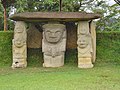
For a 4-day hike to the lost city, the cost is approximately US$440, a fixed-price arranged by the communities that inhabit the surroundings of the trail. It is a moderately difficult hike: The hike is about 44 km of walking in total and requires a good level of fitness. The hike includes several river crossings and steep climbs and descents. [11]

Related Research Articles

<span class="mw-page-title-main">Santa Marta</span> District and city in Caribbean Region, Colombia

Santa Marta, officially the Distrito Turístico, Cultural e Histórico de Santa Marta, is a port city on the coast of the Caribbean Sea in northern Colombia. It is the capital of Magdalena Department and the fourth-largest urban city of the Caribbean Region of Colombia, after Barranquilla, Cartagena, and Soledad. Founded on July 29, 1525, by the Spanish conqueror Rodrigo de Bastidas, it was one of the first Spanish settlements in Colombia, its oldest surviving city, and second oldest in South America. This city is situated on a bay by the same name and as such, it is a prime tourist destination in the Caribbean region.

<span class="mw-page-title-main">Cesar Department</span> Department of Colombia

Cesar Department or simply Cesar is a department of Colombia located in the north of the country in the Caribbean region, bordering to the north with the Department of La Guajira, to the west with the Department of Magdalena and Department of Bolivar, to the south with Department of Santander, to the east with the Department of North Santander, and further to the east with the country of Venezuela. The department capital city is Valledupar.

<span class="mw-page-title-main">Gerardo Reichel-Dolmatoff</span> Austrian anthropologist (1912–1994)

Gerardo Reichel-Dolmatoff was an Austrian anthropologist and archaeologist. He is known for his fieldwork among many different Amerindian cultures such as in the Amazonian tropical rainforests, and also among dozens of other indigenous groups in Colombia in the Caribbean Coast, as well as others living in the Pacific Coast, Llanos Orientales, and in the Andean and inter-Andean regions (Muisca) as well as in other areas of Colombia, and he also did research on campesino societies. For nearly six decades he advanced ethnographic and anthropological studies, as well as archeological research, and as a scholar was a prolific writer and public figure renowned as a staunch defender of indigenous peoples. Reichel-Dolmatoff has worked with other archaeologists and anthropologists such as Marianne Cardale de Schrimpff, Ana María Groot, Gonzalo Correal Urrego and others. He died 17 May 1994 in Colombia.

<span class="mw-page-title-main">Isthmo-Colombian Area</span> Historical cultural area in the Americas

The Isthmo-Colombian Area is defined as a cultural area encompassing those territories occupied predominantly by speakers of the Chibchan languages at the time of European contact. It includes portions of the Central American isthmus like eastern El Salvador, eastern Honduras, Caribbean Nicaragua, Costa Rica, Panama, and northern Colombia.

<span class="mw-page-title-main">Tairona</span> Former family of ethnic and linguistic groups

Tairona or Tayrona was a Pre-Columbian culture of Colombia, which consisted in a group of chiefdoms in the region of Sierra Nevada de Santa Marta in present-day Cesar, Magdalena and La Guajira Departments of Colombia, South America, which goes back at least to the 1st century AD and had significant demographic growth around the 11th century.

<span class="mw-page-title-main">Sierra Nevada de Santa Marta</span> Mountain range in northern Colombia

The Sierra Nevada de Santa Marta is an isolated mountain range in northern Colombia, separate from the Andes range that runs through the north of the country. Reaching an elevation of 5,700 m (18,700 ft) just 42 km (26 mi) from the Caribbean coast, the Sierra Nevada is the highest coastal range in the tropics, and one of the highest coastal ranges in the world, being 250 metres (820 ft) shorter than the Saint Elias Mountains in Canada. The Sierra Nevada encompasses about 17,000 km2 (6,600 sq mi) and serves as the source of 36 rivers. The range is in the Departments of Magdalena, Cesar and La Guajira.

<span class="mw-page-title-main">Indigenous peoples in Colombia</span> Ethnic groups that have inhabited Colombia before European colonization

Indigenous peoples of Colombia are the ethnic groups who have inhabited Colombia since before the Spanish colonization of Colombia, in the early 16th century.

<span class="mw-page-title-main">Arhuaco</span> Indigenous Chibchan ethnic group of northern Colombia

The Arhuaco are an indigenous people of Colombia. They are Chibchan-speaking people and descendants of the Tairona culture, concentrated in northern Colombia in the Sierra Nevada de Santa Marta.

<span class="mw-page-title-main">Kogi people</span> Indigenous Chibchan ethnic group of northern Colombia

The Kogi, or Cogui, or Kágaba, meaning "jaguar" in the Kogi language, are an indigenous group that resides in the Sierra Nevada de Santa Marta mountains in northern Colombia. Their culture has continued since the Pre-Columbian era.

<span class="mw-page-title-main">La Guajira Department</span> Department of Colombia

La Guajira is a department of Colombia. It occupies most of the Guajira Peninsula in the northeast region of the country, on the Caribbean Sea and bordering Venezuela, at the northernmost tip of South America. The capital city of the department is Riohacha.

<span class="mw-page-title-main">Dibulla, La Guajira</span> Town in Caribbean, Colombia

Dibulla is a town and municipality located in the Department of La Guajira, Colombia by the Caribbean sea and the Sierra Nevada de Santa Marta mountains on the Guajira Peninsula. It was proclaimed municipality in 1995.

<span class="mw-page-title-main">Poporo</span> Tool specifically made to assist in the chewing of coca leaves

A Poporo is a device used by indigenous cultures in present and pre-Columbian South America for storage of small amounts of lime produced from burnt and crushed sea-shells. It consists of two pieces: the receptacle, and the lid which includes a pin that is used to carry the lime to the mouth while chewing coca leaves. Since the chewing of coca is sacred for the indigenous people, the poporos are also attributed with mystical powers and social status.

<i>Tachiramantis tayrona</i> Species of frog

Tachiramantis tayrona is a species of frog in the family Strabomantidae. It is endemic to the north-western Sierra Nevada de Santa Marta, Colombia. The specific name tayrona refers to the pre-Columbian Tairona culture. Lynch and Ruíz-Carranza suggest that this species might have been a model for the gold frogs unearthed from archaeological sites in the area.

<span class="mw-page-title-main">Tourism in Colombia</span>

The contribution of travel and tourism to GDP was US$5,880.3bn in 2016. Tourism generated 556,135 jobs in 2016. Foreign tourist visits were predicted to have risen from 0.6 million in 2007 to 4 million in 2017. Responsible tourism became a peremptory need for Colombia because it minimizes negative social, economic and environmental impacts and makes positive contributions to the conservation of natural and cultural heritage.

<span class="mw-page-title-main">Spanish conquest of the Chibchan nations</span> Part of the Spanish conquest of Colombia

The Spanish conquest of the Chibchan nations refers to the conquest by the Spanish monarchy of the Chibcha language-speaking nations, mainly the Muisca and Tairona that inhabited present-day Colombia, beginning the Spanish colonization of the Americas. It is estimated that around 5 to 8 million people died as a result of Spanish Conquest, either by disease or direct conflict, this is roughly around 80-90% of the Pre-Columbian population of Colombia.

<span class="mw-page-title-main">Tayrona National Natural Park</span> Protected area in Colombias north Caribbean region

The Tayrona National Natural Park is a protected area in the Colombian northern Caribbean region and within the jurisdiction of the city of Santa Marta, 34 kilometres (21 mi) from the city centre. The park presents a biodiversity endemic to the area of the Sierra Nevada de Santa Marta mountain range, featuring a variety of climates and geography that ranges from arid sea level to 900 meters above sea level. The park covers approximately 30 square kilometres (12 sq mi) of maritime area in the Caribbean sea and approximately 150 square kilometres (58 sq mi) of land.

<span class="mw-page-title-main">Taganga</span> Fishing village and corregimiento in Magdalena, Colombia

Taganga is a traditional fishing village and corregimiento of Santa Marta, located on the Caribbean coast of Colombia at about 10 minutes or 3 kilometres (1.9 mi) north of Santa Marta. Both Santa Marta and Taganga were founded by Rodrigo de Bastidas on July 29, 1525, making them two of the oldest remaining colonial settlements in present-day Colombia.

<span class="mw-page-title-main">Hernán Pérez de Quesada</span> Spanish conquistador

Hernán Pérez de Quesada, sometimes spelled as Quezada, was a Spanish conquistador. Second in command of the army of his elder brother, Gonzalo Jiménez de Quesada, Hernán was part of the first European expedition towards the inner highlands of the Colombian Andes. The harsh journey, taking almost a year and many deaths, led through the modern departments Magdalena, Cesar, Santander, Boyacá, Cundinamarca and Huila of present-day Colombia between 1536 and 1539 and, without him, Meta, Caquetá and Putumayo of Colombia and northern Peru and Ecuador between 1540 and 1542.

<span class="mw-page-title-main">Battle of Tocarema</span>

The Battle of Tocarema was fought between an alliance of the troops of Spanish conquistador Gonzalo Jiménez de Quesada and zipa of the Muisca Sagipa of the southern Muisca Confederation and the indigenous Panche. The battle took place on the afternoon of August 19 and the morning of August 20, 1538 in the vereda Tocarema of Cachipay, Cundinamarca, Colombia and resulted in a victory for the Spanish and Muisca, when captains Juan de Céspedes and Juan de Sanct Martín commanded two flanks of the conquistadors.

<span class="mw-page-title-main">Pre-Columbian cultures of Colombia</span>

The pre-Columbian cultures of Colombia refers to the ancient cultures and civilizations that inhabited Colombia before the Spanish Conquest in the 16th century.

References

  1. Mayorga Hernández, María Isabel (2022). Teyuna: La Ciudad Perdida Tairona: Dibujos y levantamientos como aporte gráfico a su estudio (PDF). Proceedings of the XIX Congreso Internacional de Expresión Gráfica Arquitectónica (in Spanish). Cartagena, Colombia: Escuela de Arquitectura y Urbanismo, Universidad Nacional de Colombia.
  2. "Explore the Site". Global Heritage Fund. Archived from the original on 2014-09-08.
  3. 1 2 3 4 Muse, Toby (September–October 2004). "Lost City". Archaeology.
  4. 1 2 "Everything you need to know about the Lost City". 3 August 2015.
  5. 1 2 Giraldo Peláez, Santiago; Fernanda Herrera, Luisa (July 2019). Parque Arqueológico-Teyuna Ciudad Perdida: Guía para visitantes (in Spanish) (second ed.). Bogotá, Colombia: Instituto Colombiano de Antropología e Historia. ISBN   978-958-8852-76-8 . Retrieved 8 February 2024.
  6. Soto Holguín, Alvaro (2006). The Lost City of the Tayronas. Bogotá, Colombia: I/M Editores. ISBN   978-958-9343-03-6.
  7. Muse, Toby (2004). "Lost City". Archaeology. Vol. 57, no. 5. pp. 18–23.
  8. Campo, Andrés Ricardo Restrepo; Turbay, Sandra (2015). "The silence of the Kogi in front of tourists". Annals of Tourism Research. 52: 44–59. doi:10.1016/j.annals.2015.02.014. (Abstract only)
  9. "Teyuna, the lost city of the Tayrona • Neperos". Neperos.com.
  10. "Ciudad Perdida Kidnappings". La Ciudad Perdida. Archived from the original on 2012-11-30. Retrieved 2014-09-08.
  11. "Lost city trek facts". kagumuadventures.com. (Hiking Information)