Atabapo River

Last updated
Atabapo River
Rio Atabapo.jpg
Location
Countries
Physical characteristics
Length280 km (170 mi)
Basin size13,000 km2 (5,000 sq mi)
Discharge 
  average883 m3/s (31,200 cu ft/s)

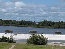
Atabapo River is a river of Venezuela and Colombia. It forms the international boundary between the two countries for much of its length. It is part of the Orinoco River basin.

See also

Related Research Articles

Venezuela Country in South America

Venezuela, officially the Bolivarian Republic of Venezuela, is a country on the northern coast of South America, consisting of a continental landmass and many islands and islets in the Caribbean Sea. It has a territorial extension of 916,445 km2, and the population of Venezuela was estimated at 28 million in 2019. The capital and largest urban agglomeration is the city of Caracas.

Caracas Capital and largest city of Venezuela

Caracas, officially Santiago de León de Caracas, abbreviated as CCS, is the capital and largest city of Venezuela, and the center of the Metropolitan Region of Caracas. Caracas is located along the Guaire River in the northern part of the country, within the Caracas Valley of the Venezuelan coastal mountain range. The valley is close to the Caribbean Sea, separated from the coast by a steep 2,200-meter-high (7,200 ft) mountain range, Cerro El Ávila; to the south there are more hills and mountains. The Metropolitan Region of Caracas has an estimated population of almost 5 million inhabitants.

Orinoco River in Venezuela and Colombia

The Orinoco is one of the longest rivers in South America at 2,250 kilometres (1,400 mi). Its drainage basin, sometimes known as the Orinoquia, covers 989,000 km2 (382,000 sq mi), with 76.3 percent of it in Venezuela and the remainder in Colombia. It is the fourth largest river in the world by discharge volume of water. The Orinoco River and its tributaries are the major transportation system for eastern and interior Venezuela and the Llanos of Colombia. The environment and wildlife in the Orinoco's basin are extremely diverse.

Bolívar (state) State of Venezuela

Bolívar is one of the 23 states into which Venezuela is divided. The state capital city is Ciudad Bolívar, but the largest city is Ciudad Guayana. Bolívar State covers a total surface area of 242,801 km2 (93,746 sq mi) and as of the 2011 census, had a population of 1,410,964. The state contains Angel Falls.

Ciudad Guayana Place in Venezuela

Ciudad Guayana is a city in Bolívar State, Venezuela. It stretches 40 kilometers along the south bank of the Orinoco river, at the point where it is joined by its main tributary, the Caroní river. The Caroni crosses the city south-north and divides it on its two main halves: the old town of San Félix in the east, and the new town of Puerto Ordaz in the west. The city was officially founded in 1961 by the unification of this two former settlements, but the history of San Félix goes back to its foundation in 1724. Within the city limits are located the site of Cachamay Falls and Llovizna Falls. There are three bridges across the Caroni and the second crossing over the Orinoco, the Orinoquia Bridge, was inaugurated in the city in 2006. With approximately one million people, it is Venezuela's fastest-growing city due to its important iron, steel, aluminium and hydroelectric industries. Ciudad Guayana is one of Venezuela's five most important ports, since most goods produced in the industry-rich Bolívar state are shipped through it, as ocean-going vessels can sail to it from the Atlantic Ocean up the Orinoco river.

Arawakan languages Language family of indigenous peoples in South America

Arawakan, also known as Maipurean, is a language family that developed among ancient indigenous peoples in South America. Branches migrated to Central America and the Greater Antilles in the Caribbean and the Atlantic, including what is now the Bahamas. Almost all present-day South American countries are known to have been home to speakers of Arawakan languages, the exceptions being Ecuador, Uruguay, and Chile. Maipurean may be related to other language families in a hypothetical Macro-Arawakan stock.

Táchira River

The Táchira River is a river located in Táchira and it divides the border that exists between Venezuela and Colombia in that western state.

Catatumbo River River in Venezuela

The Catatumbo River is a river rising in northern Colombia, flowing into Lake Maracaibo in Venezuela. The Catatumbo River is approximately 340 kilometres (210 mi) long. It forms a part of the international boundary between the two countries.

Guayana Esequiba Disputed territory in South America

Guayana Esequiba, sometimes also called Esequibo or Essequibo, is a disputed territory of 159,500 km2 (61,600 sq mi) west of the Essequibo River that is administered and controlled by Guyana but claimed by Venezuela. The boundary dispute was inherited from the colonial powers and has been complicated by the independence of Guyana from the United Kingdom in 1966.

Violaceous jay Species of bird

The violaceous jay is a species of bird in the family Corvidae, the crows and their allies.

River tyrannulet Species of bird

The river tyrannulet is a species of bird in the family Tyrannidae, the tyrant flycatchers. It is found in Peru, Venezuela and Brazil; also river extensions into Ecuador, Colombia-(border) and Bolivia.

Manuel Carlos Piar Guayana Airport

Manuel Carlos Piar Guayana International Airport, is an airport in the city of Ciudad Guayana, Venezuela. Ciudad Guayana is divided into two main population centres, San Félix and Puerto Ordaz, where the airport is located and hence its IATA code of PZO. The city sits at the confluence of the Orinoco and Caroni Rivers, and is the main access point for the natural attractions in south-east Venezuela, mainly Canaima National Park and Gran Sabana.

Guyana Country in South America

Guyana, officially the Co‑operative Republic of Guyana, is a country on the northern mainland of South America and the capital city is Georgetown. Guyana is bordered by the Atlantic Ocean to the north, Brazil to the south and southwest, Venezuela to the west, and Suriname to the east. With 215,000 square kilometres (83,000 sq mi), Guyana is the third-smallest sovereign state by area in mainland South America after Uruguay and Suriname; it is also the second-least populous sovereign state in South America after Suriname.

Liga Paralela de Béisbol is a baseball league competition held in Venezuela during the winter. Its relationship to the Venezuelan Professional Baseball League is similar to that of the AA and AAA Minor League Baseball leagues to Major League Baseball in the U.S.A. After players finish the league competition, they often join the MLB. It gives some of the younger Venezuelan players an opportunity to play in their home country during the winter.

Wenamu River

Wenamu River is a river in South America. It forms a portion of the international boundary between Venezuela and Guyana. It is part of the Essequibo River basin.

Amacuro River

The Amacuro River is a river in South America. It forms part of the northern section of the international boundary between Venezuela and Guyana. It is part of the Orinoco River basin.

The Portuguesa River is a river of Venezuela. It is part of the Orinoco River basin, and is a tributary of the Apure River.

The El Limón River is a river in Zulia in northwestern Venezuela. It flows into the Caribbean Sea. Tributaries include the Socuy River and Guasare River.

Mount Venamo is a mountain in South America that forms part of the international boundary between Guyana and Venezuela. The mountain is 1,890 metres (6,200 ft) high and is the westernmost point in Guyana. The mountain is named after the Venamo River, which flows nearby. It is often wrongly synonymized with Waukauyengtipu, a different tabletop mountain within the territory of Guyana, situated approximately 25km southeast of Mount Venamo.

Otomákoan languages

Otomaco and Taparita are two long-extinct languages of the Venezuelan Llanos.

References