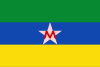
Boyacá is one of the thirty-two departments of Colombia, and the remnant of Boyacá State, one of the original nine states of the "United States of Colombia".

Puerto Boyacá is a Colombian river-port town and municipality by the Magdalena River in the Boyacá Department, where is also considered a Special Handling Zone due to its port status. Its main industries are oil exploration and processing. In the 1980s and early 1990s, Puerto Boyacá was affected intensively by the Colombian Armed Conflict.

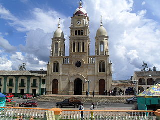
Muzo is a town and municipality in the Western Boyacá Province, part of the department of Boyacá, Colombia. It is widely known as the world capital of emeralds for the mines containing the world's highest quality gems of this type. Muzo is situated at a distance of 178 kilometres (111 mi) from the departmental capital Tunja and 118 kilometres (73 mi) from the capital of the Western Boyacá Province, Chiquinquirá. The urban centre is at an altitude of 815 metres (2,674 ft) above sea level. Muzo borders Otanche and San Pablo de Borbur in the north, Maripí and Coper in the east, Quípama in the west and the department of Cundinamarca in the south.

Boyacá is a town and municipality in the Márquez Province, part of the department of Boyacá, Colombia. It is located approximately 15 kilometres (9.3 mi) from the city of Tunja, the capital of the department. Boyacá limits Tunja and Soracá in the north, Jenesano in the south, Nuevo Colón and Ramiriquí in the west and Ventaquemada in the east.

The Lache were an indigenous, agrarian people in the highlands of what is now central Colombia's northern Boyacá and Santander departments, primarily in Gutiérrez Province and García Rovira Province. They were part of the Cocuy Confederation and spoke Chibcha, trading predominantly with other Chibcha speakers, such as the Muisca, Guane, Pijao and Chitarero. Trade included salt and textiles, as well as food stuffs. The Lache farmed maize, potatoes, quinoa and cotton, among other crops.
Ventaquemada is a town and municipality in the Central Boyacá Province, part of the Colombian department of Boyacá. Ventaquemada is located at a distance of 98 kilometres (61 mi) from the capital Bogotá and 29 kilometres (18 mi) from the departmental capital Tunja. The urban centre is situated at an altitude of 2,630 metres (8,630 ft) on the Altiplano Cundiboyacense in the Eastern Ranges of the Colombian Andes. Ventaquemada borders Tunja and Samacá in the north, Boyacá, Boyacá, Jenesano and Nuevo Colón in the east, Turmequé and Villapinzón in the south and Guachetá, Lenguazaque and Villapinzón in the west.

La Uvita is a town and municipality in the Northern Boyacá Province, part of the Colombian Department of Boyacá. The urban centre is located at an altitude of 2,700 metres (8,900 ft) in the Eastern Ranges of the Colombian Andes. La Uvita borders San Mateo in the north, El Cocuy and Chita in the east, Chita and Jericó in the south and Boavita in the west.
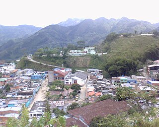
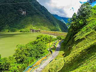
Quípama is a town and municipality in the Colombian Department of Boyacá, part of the subregion of the Western Boyacá Province.

Chivor is a town and municipality in the Eastern Boyacá Province, part of the Colombian department of Boyacá. The mean temperature of the village in the Tenza Valley is 18 °C (64 °F) and Chivor is located at 215 kilometres (134 mi) from the department capital Tunja. Chivor is world-famous for its emeralds.

Guateque is a town and municipality in the Colombian Department of Boyacá, part of the subregion of the Eastern Boyacá Province. Guateque's urban center is located at an altitude of 1,815 metres (5,955 ft) on the Altiplano Cundiboyacense at distances of 125 kilometres (78 mi) from the department capital Tunja and 112 kilometres (70 mi) from Bogotá, capital of Colombia. It borders the municipalities of La Capilla, Tenza, Sutatenza, Somondoco of Boyacá and Tibiritá and Manta of Cundinamarca.

The Paja Formation is an Early Cretaceous geologic formation of central Colombia. The formation extends across the northern part of the Altiplano Cundiboyacense, the Western Colombian emerald belt and surrounding areas of the Eastern Ranges of the Colombian Andes. In the subsurface, the formation is found in the Middle Magdalena Valley to the west. The Paja Formation stretches across four departments, from north to south the southernmost Bolívar Department, in Santander, Boyacá and the northern part of Cundinamarca. Well known fossiliferous outcrops of the formation occur near Villa de Leyva, also written as Villa de Leiva, and neighboring Sáchica.

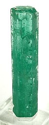
Emeralds are green precious gemstones that are mined in various geological settings. They are minerals in the beryl group of silicates. For more than 4,000 years, emeralds have been among the most valuable of all jewels on Earth. Colombia, located on the continent of South America, is the country that mines and produces the most emeralds for the global market. It is estimated that Colombia accounts for 70-90% of the world's emerald market. While commercial grade emeralds are quite plentiful, fine and extra fine quality emeralds are extremely rare. Colombian emeralds over 50 carat can cost much more than diamonds of the same size.

The Santa Rosa de Viterbo Meteorite was found in 1810, in the Tocavita Hill, near the town that holds the same name in the north central area of Boyacá, Colombia.

Miguel Triana Ruiz de Cote was a Colombian engineer and Muisca scholar. He is best known for his 1922 publication La Civilización Chibcha; "The Muisca civilisation". Triana wrote a number of books about the Muisca and their culture. Miguel Triana especially contributed to the knowledge of the religion, society and the creation of rock art throughout the Muisca Confederation. Triana was the first Colombian investigator relating the Muisca culture with the pictographs. He described hundreds of rock paintings and carvings in his book El jeroglífico Chibcha.

The Muzo people were a Cariban-speaking indigenous group who inhabited the western slopes of the eastern Colombian Andes. They were a highly war-like tribe who frequently clashed with their neighbouring indigenous groups, especially the Muisca. It is said they performed cannibalism on their conquered neighbours.
The Tenza Valley is an intermontane valley in the Eastern Ranges of the Colombian Andes. The valley stretches over the southeastern part of the department of Boyacá and the northeastern part of Cundinamarca. It is located east of the Altiplano Cundiboyacense and in the time before the Spanish conquest of the Muisca, as the Altiplano was inhabited by the Muisca in the higher altitudes and the Tegua in the lower areas to the east.
Luis Lanchero, also known as Luis Lancheros was a Spanish conquistador and the founder of the town of Muzo, Boyacá, the most important emerald settlement in Colombia. Muzo was founded after twenty years of unsuccessful attempts to subjugate the Muzo to Spanish rule. Lanchero arrived in the New World in 1533 and died impoverished in Tunja in 1562.

The Las Pavas, also called La Pava, is a Colombian emerald mining area that is neighboring Colombia's largest emerald mine, Puerto Arturo. It is located 200 kilometres (120 mi) northwest of the capital Bogotá in the western emerald belt of Muzo, and about 235 kilometres (146 mi) west of Chivor, which is in the eastern emerald belt. The mining area spans the municipalities Quípama and Muzo.
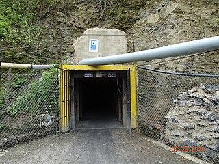
La Pita is an emerald mine located in the western belt of the Colombian emerald mining area. It is owned and operated by the Colombian company, Zuliana De Esmeraldas Ltda.

The Suárez River, originally Saravita, is a river in the Eastern Ranges of the Colombian Andes. The river originates in Lake Fúquene on the border of Cundinamarca and Boyacá and its mouth is the confluence with the Chicamocha River, forming the Sogamoso River in Santander. It is part of the Magdalena Basin flowing towards the Caribbean Sea.