
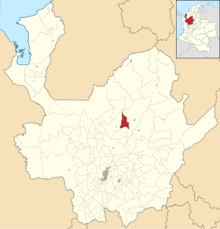
Angostura is a town and municipality in Antioquia Department, Colombia. It is part of the subregion of Northern Antioquia. The population was 10,500 at the 2018 census.

Santa Fe de Antioquia is a municipality in the Antioquia Department, Colombia. The city is located approximately 58 kilometres (36 mi) north of Medellín, the department capital. The population was 23,216 at the 2018 census.
Betania is a town and municipality in the Colombian department of Antioquia. It is part of the subregion of Southwestern Antioquia, with a population comprising 9,286 people, according to the 2015 census. It is located 33 mi/53 km SW of Medellín. The main industries include coffee, sugarcane, cacao, and livestock.
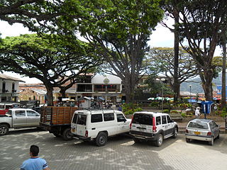
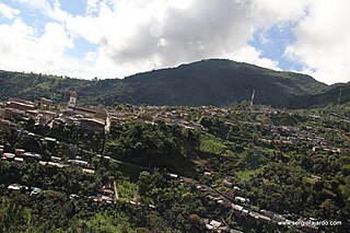
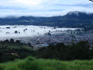
Campamento is a town and municipality in the Colombian department of Antioquia. Part of the subregion of Northern Antioquia, it lies at an altitude of 1,700 m above sea level. It is a little town, in the middle of the Andes.It borders on the north with the municipalities of Yarumal and Anorí, on the east with Anorí, on the south with the municipality of Angostura, and on the west with Yarumal.
Don Matías is a municipality in Antioquia Department, Colombia. Part of the subregion of Northern Antioquia. Bordered to the north by the municipality of Santa Rosa de Osos, to the east by the municipalities of Santa Rosa de Osos and Santo Domingo, to the south by the municipality of Barbosa, and to the west by the municipality of San Pedro de los Milagros.

Ebéjico is a town and municipality in the West of Antioquia Department, Colombia.
Fredonia is a town and municipality in the Colombian department of Antioquia. It is part of the sub-region of Southwestern Antioquia. According to the 2018 census, the population comprises 18,790 people.

Guatapé is a town and municipality in the Department of Antioquia, Colombia. It is a part of the subregion of Eastern Antioquia and is located 79 kilometres (49 mi) from Medellín, the capital of the department. Guatapé is bordered on the north by Alejandría, San Rafael to the east, and Granada and El Peñol to the south. This town is the gathering place for Las Vegas, referring to the small farms of the area.
Ituango is a town and municipality in the Colombian department of Antioquia. P\It is part of the subregion of Northern Antioquia. The population was 23,784 at the 2018 census.

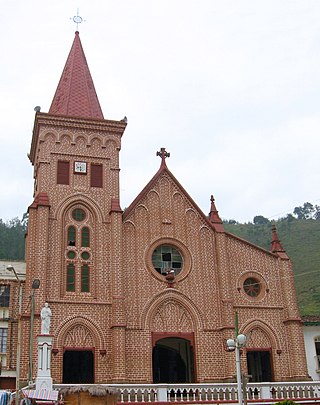
Jericó is a town, municipality and Catholic bishopric in the Colombian department of Antioquia. It is part of the subregion of Southwestern Antioquia. The distance reference from Medellín city, the capital of the department, is 104 km. It lies 1,910 m above sea level.
Montebello is a town and municipality in Antioquia Department, Colombia. Located at an elevation of 2,350 m above sea level, it is part of the sub-region of Southwestern Antioquia.
Támesis is a town and municipality in the Colombian department of Antioquia. Part of the subregion of Southwestern Antioquia. Located at an elevation of 1,638 m above sea level, it was established in 1858. The local economy is based on agriculture.

Venecia is a town and municipality in Antioquia Department, Colombia. According to the 2018 census, the population comprised 10,280 people.

Yondó is a town and municipality in Antioquia Department, Colombia. It is part of the Magdalena Medio Antioquia sub-region.

Peque is a municipality in the Colombian department of Antioquia. The population was 7,155 at the 2018 census.

Rionegro is a city and municipality in Antioquia Department, Colombia, located in the subregion of Eastern Antioquia. The official name of the city is "Ciudad Santiago de Arma de Rionegro". Rio Negro means "Black River" in Spanish, as the city received its name after a river that looks black because of the shadows cast by trees. The river traverses the city and it is the most prominent geographical feature of the municipality. Rionegro is also sometimes called the Cuna de la democracia as it was one of the most important cities during the era of the Colombia's struggle for independence and the 1863 constitution was written in the city.

San Rafael is a town and municipality in Antioquia Department, Colombia. Part of the subregion of Eastern Antioquia.
Olaya is a town and municipality located in the western region of the Department of Antioquia in the Republic of Colombia. It borders to the north with the municipality of Liborina, to the east with the municipalities of Belmira and Sopetrán and to the South with Sopetrán and by the West with the municipality of Santa Fe de Antioquia. It lies at an altitude of 500 m above sea level.

Líbano is a town and municipality in the Tolima department of Colombia. The population of the municipality was estimated at 36,231 as of 2020. Along with Honda, Líbano is the seat of the Roman Catholic Diocese of Líbano–Honda.
La Ceja del Tambo, known as La Ceja, is a town and municipality in the Antioquia Department of Colombia. It is part of the subregion of Eastern Antioquia. La Ceja borders the Rionegro and Carmen de Viboral municipalities to the north, La Unión to the east, and Montebello and Retiro to the west. It is located approximately 41 kilometers from Medellín, the department capital.


