Urrao

Last updated • 1 min readFrom Wikipedia, The Free Encyclopedia
Urrao, Antioquia
Municipality & Town
9285 parque-principal-rafael-uribe-uribe 1024x600(1).jpg
Panorámica de Urrao.
Flag of Urrao.svg
Colombia - Antioquia - Urrao.svg
Location of the municipality of Urrao, Antioquia in the Antioquia Department of Colombia
Colombia location map.svg
Red pog.svg
Urrao, Antioquia
Location in Colombia
Coordinates: 6°19′0.7″N76°8′4.19″W / 6.316861°N 76.1344972°W / 6.316861; -76.1344972
CountryFlag of Colombia.svg  Colombia
Department Flag of Antioquia Department.svg Antioquia Department
Subregion Southwestern
Founded June 12 of 1781
Area
   Municipality & Town2,556 km2 (987 sq mi)
Elevation
1,830 m (6,004 ft)
Population
 (2015)
   Municipality & Town44,648
   Urban
17,401
  Metro density17.47/km2 (45.2/sq mi)
Demonym(s) Urraeño, -a
Time zone UTC-5 (Colombia Standard Time)
Website http://www.urrao-antioquia.gov.co

Urrao is a town and municipality of Colombia, located in the subregion southwest of the department of Antioquia. Limited by the north with the municipalities of Frontino and Abriaquí, in the east with the municipalities of Abriaquí, Caicedo, Anzá, Betulia and Salgar, and in the south and west with Vigía del Fuerte and the department of Chocó. It is the second largest municipality in the department. As of 2015, the population comprised 44,648 people. Professional cyclist Rigoberto Urán was born and raised here. [1]


Climate

The climate is warm and temperate in Urrao. There is significant rainfall throughout the year in Urrao. Even the driest month still has a lot of rainfall. According to Köppen and Geiger, this climate is classified as Cfb. The average temperature in Urrao is 15.7 °C | 60.3 °F. About 7573 mm | 298.1 inch of precipitation falls annually.

Climate data for Urrao, elevation 1,850 m (6,070 ft), (1981–2010)
MonthJanFebMarAprMayJunJulAugSepOctNovDecYear
Mean daily maximum °C (°F)22.7
(72.9)
23.0
(73.4)
23.0
(73.4)
22.7
(72.9)
22.5
(72.5)
22.7
(72.9)
22.9
(73.2)
23.0
(73.4)
22.5
(72.5)
21.9
(71.4)
21.7
(71.1)
22.0
(71.6)
22.5
(72.5)
Daily mean °C (°F)17.3
(63.1)
17.4
(63.3)
17.6
(63.7)
17.6
(63.7)
17.6
(63.7)
17.6
(63.7)
17.5
(63.5)
17.5
(63.5)
17.2
(63.0)
17.0
(62.6)
17.1
(62.8)
17.2
(63.0)
17.4
(63.3)
Mean daily minimum °C (°F)12.9
(55.2)
13.3
(55.9)
13.4
(56.1)
13.9
(57.0)
14.1
(57.4)
13.8
(56.8)
13.4
(56.1)
13.3
(55.9)
13.4
(56.1)
13.3
(55.9)
13.5
(56.3)
13.4
(56.1)
13.5
(56.3)
Average precipitation mm (inches)119.0
(4.69)
113.2
(4.46)
133.8
(5.27)
199.4
(7.85)
249.7
(9.83)
182.5
(7.19)
171.9
(6.77)
170.6
(6.72)
223.6
(8.80)
295.8
(11.65)
251.7
(9.91)
162.8
(6.41)
2,273.9
(89.52)
Average precipitation days (≥ 1.0 mm)131214192218171821242217217
Average relative humidity (%)88888888888888878989898988
Mean monthly sunshine hours 179.8158.1158.1126.0136.4159.0176.7170.5132.0127.1132.0155.01,810.7
Mean daily sunshine hours 5.85.65.14.24.45.35.75.54.44.14.45.05.0
Source: Instituto de Hidrologia Meteorologia y Estudios Ambientales [2]
Climate data for Urrao (Honda La), elevation 1,850 m (6,070 ft), (1981–2010)
MonthJanFebMarAprMayJunJulAugSepOctNovDecYear
Mean daily maximum °C (°F)21.6
(70.9)
21.8
(71.2)
21.6
(70.9)
21.6
(70.9)
21.9
(71.4)
21.7
(71.1)
21.7
(71.1)
21.9
(71.4)
21.4
(70.5)
21.2
(70.2)
21.0
(69.8)
21.0
(69.8)
21.6
(70.9)
Daily mean °C (°F)16.6
(61.9)
16.7
(62.1)
16.9
(62.4)
17.0
(62.6)
17.1
(62.8)
16.9
(62.4)
16.8
(62.2)
16.8
(62.2)
16.6
(61.9)
16.5
(61.7)
16.7
(62.1)
16.5
(61.7)
16.8
(62.2)
Mean daily minimum °C (°F)12.1
(53.8)
12.5
(54.5)
12.8
(55.0)
13.1
(55.6)
12.9
(55.2)
12.6
(54.7)
12.7
(54.9)
12.7
(54.9)
12.6
(54.7)
12.6
(54.7)
12.7
(54.9)
12.3
(54.1)
12.7
(54.9)
Average precipitation mm (inches)63.5
(2.50)
74.3
(2.93)
94.8
(3.73)
151.8
(5.98)
182.5
(7.19)
160.4
(6.31)
158.9
(6.26)
134.9
(5.31)
208.5
(8.21)
207.2
(8.16)
184.5
(7.26)
109.2
(4.30)
1,698.1
(66.85)
Average precipitation days (≥ 1.0 mm)161519222421212023232319241
Average relative humidity (%)91919191919191919292919291
Mean monthly sunshine hours 164.3141.2124.0108.0117.8117.0139.5145.7114.0117.8120.0139.51,548.8
Mean daily sunshine hours 5.35.04.03.63.83.94.54.73.83.84.04.54.2
Source: Instituto de Hidrologia Meteorologia y Estudios Ambientales [2]

Related Research Articles

<span class="mw-page-title-main">Abriaquí</span> Municipality and town in Antioquia Department, Colombia

Abriaquí is a town and municipality in Antioquia Department, Colombia. Its population was 4,200 in 2002.

<span class="mw-page-title-main">Arboletes</span> Municipality and town in Antioquia Department, Colombia

Arboletes is a town and municipality in the subregion of Urabá in Antioquia Department, Colombia.

<span class="mw-page-title-main">Apartadó</span> Municipality in Antioquia Department, Colombia

Apartadó is a town and municipality in the Antioquia Department, Colombia. It is part of the Urabá sub-region.

<span class="mw-page-title-main">Caldas, Antioquia</span> Municipality and town in Antioquia Department, Colombia

Caldas is a town and municipality in Antioquia Department, Colombia. Caldas is part of The Metropolitan Area of the Aburrá Valley. It is the seat of the Roman Catholic Diocese of Caldas. The population was estimated to be 83,423 in 2020.

<span class="mw-page-title-main">Cañasgordas</span> Municipality and town in Antioquia Department, Colombia

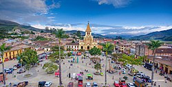
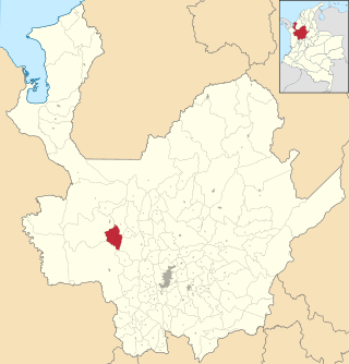
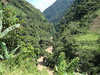
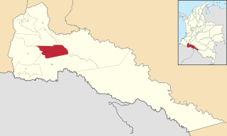
Cañasgordas is a town and municipality in Antioquia Department, Colombia. The population was 13,595 at the 2018 census.

<span class="mw-page-title-main">Carepa</span> Municipality and town in Antioquia Department, Colombia

Carepa is a town and municipality in Antioquia Department, Colombia. Carepa is part of the Urabá Antioquia sub-region.

<span class="mw-page-title-main">Chigorodó</span> Municipality and town in Antioquia Department, Colombia

Chigorodó is a town and municipality in Antioquia Department, Colombia. It is part of the Urabá Antioquia sub-region.

<span class="mw-page-title-main">Dabeiba</span> Municipality and town in Antioquia Department, Colombia

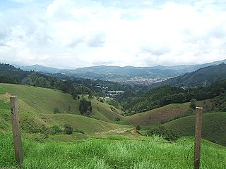
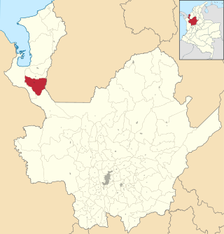
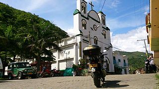
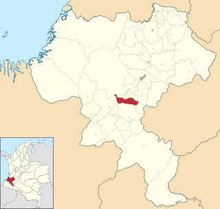
Dabeiba is a town and municipality in the Colombian department of Antioquia. The population was 22,717 at the 2018 census. The Battle of Dabeiba took place there in October 2000.

<span class="mw-page-title-main">Mutatá</span> Municipality and town in Antioquia Department, Colombia

Mutatá is a municipality in the Colombian department of Antioquia. It is part of the Urabá Antioquia sub-region.

<span class="mw-page-title-main">Uramita</span> Municipality and town in Antioquia Department, Colombia

Uramita is a town and municipality in Antioquia Department, Colombia.

<span class="mw-page-title-main">Necoclí</span> Municipality and town in Antioquia Department, Colombia

Necoclí is a town and municipality in Antioquia Department, Colombia. Located on the eastern shore of the Gulf of Urabá, it is part of the Urabá Antioquia sub-region. The population is predominantly Afro-Colombian.

<span class="mw-page-title-main">San Juan de Urabá</span> Municipality and town in Antioquia Department, Colombia

San Juan de Urabá is a town and municipality in the Colombian department of Antioquia. It is part of the Urabá Antioquia sub-region.

<span class="mw-page-title-main">San Pedro de Urabá</span> Municipality and town in Antioquia Department, Colombia

San Pedro de Urabá is a municipality in Antioquia Department, Colombia. It is part of the Urabá Antioquia sub-region.

<span class="mw-page-title-main">Tame, Arauca</span> Municipality and town in Arauca Department, Colombia

Tame is a town and municipality in the Arauca Department, Colombia. The municipality has a total area of around 5,419 square kilometres or 2,090 square miles.

<span class="mw-page-title-main">Tadó</span> Municipality and town in Chocó Department, Colombia

Tadó is a municipality and town in the Chocó Department, Colombia.

<span class="mw-page-title-main">Puerto Asís</span> Municipality and city in Putumayo Department, Colombia

Puerto Asís is a Colombian municipality and city in Putumayo Department. It is located on the west bank of the Putumayo River, downstream from the mouth of the Guamués River, 75 km (47 mi) south of (Cardinal) Mocoa. Bordering Ecuador, Puerto Asís municipality is the most populous municipality of the department, with a population of 67,211.

<span class="mw-page-title-main">Puerto Caicedo</span> Municipality and town in Putumayo Department, Colombia

Puerto Caicedo is a town and municipality located in the Putumayo Department, Republic of Colombia.

<span class="mw-page-title-main">Restrepo, Meta</span> Municipality and town in Meta Department, Colombia

Restrepo is a town and municipality in the Meta Department, Colombia.

<span class="mw-page-title-main">La Sierra, Cauca</span> Municipality and town in Cauca Department, Colombia

La Sierra is a town and municipality in the Cauca Department, Colombia.

The Urrao Fault is a sinistral oblique strike-slip fault in the department of Antioquia in northwestern Colombia. The fault has a total length of 30.5 kilometres (19.0 mi) and runs along an average north to south strike of 003.6 ± 1 in the Western Ranges of the Colombian Andes.

References

  1. "¿Qué sería de Rigo sin Urrao?". Señal Colombia. Radio Televisión Nacional de Colombia. 26 June 2018. Retrieved 15 September 2020.
  2. 1 2 "Promedios Climatológicos 1981–2010" (in Spanish). Instituto de Hidrologia Meteorologia y Estudios Ambientales. Archived from the original on 15 August 2016. Retrieved 3 June 2024.

6°18′56″N76°08′03″W / 6.31556°N 76.13417°W / 6.31556; -76.13417