Angostura is a town and municipality in Antioquia Department, Colombia. It is part of the subregion of Northern Antioquia. The population was 10,500 at the 2018 census.

Santa Fe de Antioquia is a municipality in the Antioquia Department, Colombia. The city is located approximately 58 kilometres (36 mi) north of Medellín, the department capital. The population was 23,216 at the 2018 census.
Entrerrios is a municipality in the Colombian subregion of Northern Antioquia, in the department of Antioquia. The population was 8,820 at the 2018 census. The population, according to the 2002 census, was 8,305 inhabitants.
Gómez Plata is a town and municipality in the Colombian department of Antioquia. It is part of the subregion of Northern Antioquia. The population was 8,235 at the 2018 census.

Jericó is a town, municipality and Catholic bishopric in the Colombian department of Antioquia. It is part of the subregion of Southwestern Antioquia. The distance reference from Medellín city, the capital of the department, is 104 km. It lies 1,910 m above sea level.

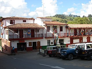
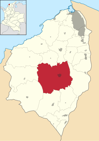
Titiribí is a town and municipality in the Colombian department of Antioquia. Located at an elevation of 1,550 m above sea level, it is part of the sub-region of Southwestern Antioquia.

Peque is a municipality in the Colombian department of Antioquia. The population was 7,155 at the 2018 census.
Sabanalarga is a municipality in the Atlántico Department, Colombia. Founded in 1620 by Lucas Dionisio Tesillo y Diego and Marceliano de Jesús Almanza. It became a municipality in 1680.

San Rafael is a town and municipality in Antioquia Department, Colombia. Part of the subregion of Eastern Antioquia.
Buenavista is a municipality in the south-central part of the department of Quindío, Colombia. It's known and named for the spectacular view over the department. The township is located 33 kilometres (21 mi) south of the departmental capital Armenia.

Momil is a town and municipality located in the Córdoba Department, northern Colombia.
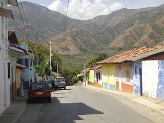
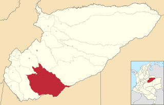
Olaya is a town and municipality located in the western region of the Department of Antioquia in the Republic of Colombia. It borders to the north with the municipality of Liborina, to the east with the municipalities of Belmira and Sopetrán and to the South with Sopetrán and by the West with the municipality of Santa Fe de Antioquia. It lies at an altitude of 500 m above sea level.

Molagavita is a town and municipality in the Santander Department in northeastern Colombia.

Istmina is a municipality and town in the Chocó Department, Colombia. The town of Istmina was founded in 1834 by Juan Nepomuceno Mosquera, initially with the name of San Pablo. The name was changed in 1903 to Istmina, a contraction of isthmus and minas (mines), two characteristics of the area. The municipality covers 1,880 square kilometres (726 sq mi), with an average elevation of 79 metres (259 ft), and an average temperature of 26.7 °C (80 °F). Istmina is located 75 km (47 mi) from the departmental capital, Quibdó.
Maní is a town and municipality in the Department of Casanare, Colombia.
Belalcázar is a town and municipality in the Colombian Department of Caldas.

Suaza is a town and municipality in the Huila Department, Colombia.
El Doncello is a town and municipality in Caquetá Department, Colombia with a population, according to a 2018 census, of 17,775. There is evidence that it was first settled in the 1930s, but most large-scale official building occurred from the 1950s onwards. The immigrant families that first settled El Doncello came from various neighbouring regions and were mainly avoiding the monopolization of land in the country's centre; the colonization was more or less spontaneous, as there was no institution overseeing the process.

Otívar is a municipality located at 267.80 metres above sea level in the Province of Granada, Spain. According to the 2004 census (INE), the village has a population of 1,113 inhabitants.

Vera de Moncayo is a municipality located in the province of Zaragoza, Aragon, Spain. According to the 2004 census (INE), the municipality has a population of 432 inhabitants.